


22 km | 29 km-effort
![Trail On foot Herdecke - [H3] Hengsteysee und Teufelskanzel - Photo](https://media.geolcdn.com/t/1900/400/48a0ef8e-3704-4b57-a4cf-02a57ebc2595.jpeg&format=pjpeg&maxdim=2)

Tous les sentiers balisés d’Europe GUIDE+


FREE GPS app for hiking
 SityTrail
IGN / Geographical institutes
SityTrail World
The world is yours!
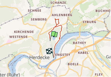
Trail On foot of 6.7 km to be discovered at North Rhine-Westphalia, Ennepe-Ruhr-Kreis, Herdecke. This trail is proposed by SityTrail - itinéraires balisés pédestres.
Trail created by Sauerländischer Gebirgsverein.
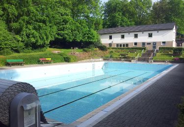
![Trail On foot Herdecke - [H3] Hengsteysee und Teufelskanzel - Photo 1](https://media.geolcdn.com/t/2048/auto/8a0d787b-4be0-467e-9877-bf6a0c60645f.jpeg&format=jpg&maxdim=0 "Trail On foot Herdecke - [H3] Hengsteysee und Teufelskanzel - Photo 1")
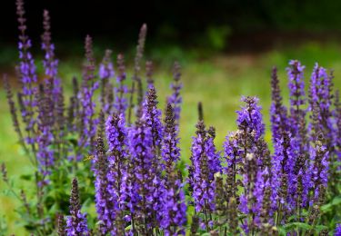
![Trail On foot Herdecke - [H3] Hengsteysee und Teufelskanzel - Photo 2](https://media.geolcdn.com/t/2048/auto/bcd8121d-7bb5-4049-b30d-fc358d77719f.jpeg&format=jpg&maxdim=0 "Trail On foot Herdecke - [H3] Hengsteysee und Teufelskanzel - Photo 2")
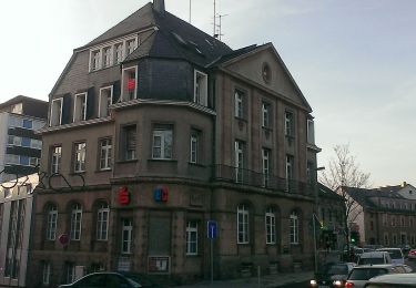
![Trail On foot Herdecke - [H3] Hengsteysee und Teufelskanzel - Photo 3](https://media.geolcdn.com/t/2048/auto/91eb9446-02ed-4efd-b82d-3faecebc62d1.jpeg&format=jpg&maxdim=0 "Trail On foot Herdecke - [H3] Hengsteysee und Teufelskanzel - Photo 3")
![Trail On foot Herdecke - [H3] Hengsteysee und Teufelskanzel - Photo 4](https://media.geolcdn.com/t/2048/auto/5fcc13e6-5296-484b-8932-4b69e3b8edeb.jpeg&format=jpg&maxdim=0 "Trail On foot Herdecke - [H3] Hengsteysee und Teufelskanzel - Photo 4")
![Trail On foot Herdecke - [H3] Hengsteysee und Teufelskanzel - Photo 5](https://media.geolcdn.com/t/2048/auto/48a0ef8e-3704-4b57-a4cf-02a57ebc2595.jpeg&format=jpg&maxdim=0 "Trail On foot Herdecke - [H3] Hengsteysee und Teufelskanzel - Photo 5")
![Trail On foot Herdecke - [H3] Hengsteysee und Teufelskanzel - Photo 6](https://media.geolcdn.com/t/2048/auto/045d8a22-2d89-4581-a35b-5dae3fb33bb0.jpeg&format=jpg&maxdim=0 "Trail On foot Herdecke - [H3] Hengsteysee und Teufelskanzel - Photo 6")
![Trail On foot Herdecke - [H3] Hengsteysee und Teufelskanzel - Photo 7](https://media.geolcdn.com/t/2048/auto/352005cc-4cfc-4dc8-b967-9aba66bc098f.jpeg&format=jpg&maxdim=0 "Trail On foot Herdecke - [H3] Hengsteysee und Teufelskanzel - Photo 7")
![Trail On foot Herdecke - [H3] Hengsteysee und Teufelskanzel - Photo 8](https://media.geolcdn.com/t/2048/auto/bde0a4aa-a736-4bbe-84a5-8478ec84ea1a.jpeg&format=jpg&maxdim=0 "Trail On foot Herdecke - [H3] Hengsteysee und Teufelskanzel - Photo 8")
![Trail On foot Herdecke - [H3] Hengsteysee und Teufelskanzel - Photo 9](https://media.geolcdn.com/t/2048/auto/83b42b6f-65df-46bd-b645-0ca766859632.jpeg&format=jpg&maxdim=0 "Trail On foot Herdecke - [H3] Hengsteysee und Teufelskanzel - Photo 9")
![Trail On foot Herdecke - [H3] Hengsteysee und Teufelskanzel - Photo 10](https://media.geolcdn.com/t/2048/auto/91ec9509-e6bc-402f-92cc-e6be28bcc355.jpeg&format=jpg&maxdim=0 "Trail On foot Herdecke - [H3] Hengsteysee und Teufelskanzel - Photo 10")
![Trail On foot Herdecke - [H6] Waldgebiete - Photo](https://media.geolcdn.com/t/375/260/fc184e54-a300-4080-bfb1-ee5af7544b8a.jpeg&format=jpg&maxdim=2)
On foot
![Trail On foot Herdecke - [H5] Westende - Kirchende - Ostende - Photo](https://media.geolcdn.com/t/375/260/a4190d68-4b9d-4b0c-86e3-91419be4a223.jpeg&format=jpg&maxdim=2)
On foot
![Trail On foot Herdecke - [H2] Ruhrtal zum Hickenstein - Photo](https://media.geolcdn.com/t/375/260/47dfa9a4-572d-4f34-b111-ae10e112c377.jpeg&format=jpg&maxdim=2)
On foot
![Trail On foot Herdecke - [H1] Viadukt und Nacken - Photo](https://media.geolcdn.com/t/375/260/0816fcff-a194-4a3a-b211-f59c276124fc.jpeg&format=jpg&maxdim=2)
On foot
On foot
On foot
On foot
On foot
On foot