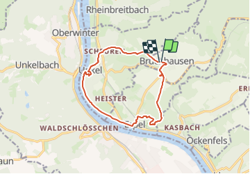
![](/images/other/stat-length.png)
![Trail On foot Bruchhausen - Rotbäckchen Rundwanderweg - Photo](https://media.geolcdn.com/t/1900/400/1dd5c4a7-c3a6-459c-9cef-b7e5315b6005.jpeg&format=pjpeg&maxdim=2)
Rotbäckchen Rundwanderweg
SityTrail - itinéraires balisés pédestres
Tous les sentiers balisés d’Europe GUIDE+
![Length](/images/other/stat-length.png)
![Max alt](https://static1.geolcdn.com/siteimages/upload/files/1508320355ic_sort_altitude_max_24dp.png)
![Uphill gradient](https://static1.geolcdn.com/siteimages/upload/files/1508320355ic_sort_den_pos_24dp.png)
![Km-Effort](/images/other/stat-length.png)
![Min alt](https://static1.geolcdn.com/siteimages/upload/files/1508320355ic_sort_altitude_min_24dp.png)
![Downhill gradient](https://static1.geolcdn.com/siteimages/upload/files/1508320355ic_sort_den_neg_24dp.png)
![Boucle](https://static1.geolcdn.com/siteimages/upload/files/16400158638029165_repeat_loop_refresh_sync_direction_icon.png)
![On foot](https://static1.geolcdn.com/sitytour/trail-icons/100.png)
3h11
Difficulty : Easy
![Scan this QR Code to open this trail in the SityTrail application](https://capi.geolives.com/qq0zvz2zws4bq2lad0pu/sitytour/trails/3101544/qr.png?size=200)
FREE GPS app for hiking
About
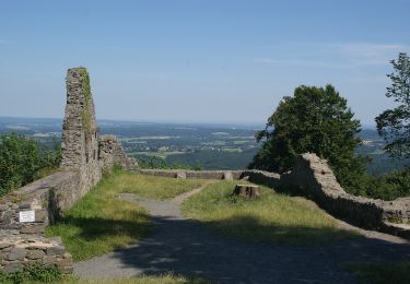
Trail On foot of 11.1 km to be discovered at Rhineland-Palatinate, Landkreis Neuwied, Bruchhausen. This trail is proposed by SityTrail - itinéraires balisés pédestres.
Description
Trail created by Touristik & Gewerbe Unkel e.V..
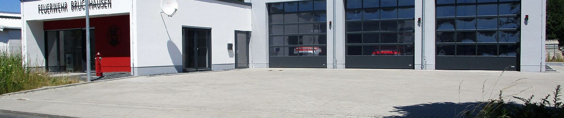
Ausschilderung spärlich
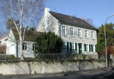
Symbol: Kindergesicht und Illustration "Unkel am Rhein" auf weißem Untergrund
Positioning
Comments
Trails nearby
![Trail On foot Remagen - Apollinaris-Schleife (Rheinburgenweg Rundtour) - Photo](https://media.geolcdn.com/t/375/260/afe28d54-8362-474d-8d66-b77f50c689dd.jpeg&format=jpg&maxdim=2)
![On foot On foot](https://static1.geolcdn.com/sitytour/trail-icons/100.png)
On foot
![](/images/other/stat-length.png)
![](https://static1.geolcdn.com/siteimages/upload/files/16400158638029165_repeat_loop_refresh_sync_direction_icon.png)
![Trail On foot Remagen - [4] Oberwinter Rundwanderweg - Photo](https://media.geolcdn.com/t/375/260/e27ef9e9-090e-4d77-ab64-ebc2130b65b2.jpeg&format=jpg&maxdim=2)
![On foot On foot](https://static1.geolcdn.com/sitytour/trail-icons/100.png)
On foot
![](/images/other/stat-length.png)
![](https://static1.geolcdn.com/siteimages/upload/files/16400158638029165_repeat_loop_refresh_sync_direction_icon.png)
![Trail On foot Remagen - [5] Oberwinter Rundwanderweg - Photo](https://media.geolcdn.com/t/375/260/f5d36974-2dd7-4709-98b7-1c99706d0ead.jpeg&format=jpg&maxdim=2)
![On foot On foot](https://static1.geolcdn.com/sitytour/trail-icons/100.png)
On foot
![](/images/other/stat-length.png)
![](https://static1.geolcdn.com/siteimages/upload/files/16400158638029165_repeat_loop_refresh_sync_direction_icon.png)
![Trail On foot Remagen - Oberwinter Rundweg 2 - Photo](https://media.geolcdn.com/t/375/260/778735ff-4094-4e3b-aa07-2d8b179e4649.jpeg&format=jpg&maxdim=2)
![On foot On foot](https://static1.geolcdn.com/sitytour/trail-icons/100.png)
On foot
![](/images/other/stat-length.png)
![](https://static1.geolcdn.com/siteimages/upload/files/16400158638029165_repeat_loop_refresh_sync_direction_icon.png)
![Trail On foot Remagen - [1] Oberwinter Wanderweg (Oberwinter - Rolandseck) - Photo](https://media.geolcdn.com/t/375/260/25784967-1970-4af5-8d60-8f5ed7fdcfe9.jpeg&format=jpg&maxdim=2)
![On foot On foot](https://static1.geolcdn.com/sitytour/trail-icons/100.png)
On foot
![](/images/other/stat-length.png)
![](https://static1.geolcdn.com/siteimages/upload/files/16400158638029165_repeat_loop_refresh_sync_direction_icon.png)
![Trail On foot Wachtberg - Verbindungsweg - Photo](https://media.geolcdn.com/t/375/260/8a894d8e-564e-4043-b18c-669126bb6c29.jpeg&format=jpg&maxdim=2)
![On foot On foot](https://static1.geolcdn.com/sitytour/trail-icons/100.png)
On foot
![](/images/other/stat-length.png)
![](https://static1.geolcdn.com/siteimages/upload/files/16400158638029165_repeat_loop_refresh_sync_direction_icon.png)
![Trail On foot Bad Honnef - Rheinsteig-Zuweg Bad Honnef (Nord) - Photo](https://media.geolcdn.com/t/375/260/e60109cf-63fe-45d6-8fb4-6ccf1e16ec85.jpeg&format=jpg&maxdim=2)
![On foot On foot](https://static1.geolcdn.com/sitytour/trail-icons/100.png)
On foot
![](/images/other/stat-length.png)
![](https://static1.geolcdn.com/siteimages/upload/files/16400158638029165_repeat_loop_refresh_sync_direction_icon.png)
![Trail On foot Vettelschoß - Rheinsteig-Zuweg Kalenborn - Photo](https://media.geolcdn.com/t/375/260/c07369c5-ba12-49ff-983d-a7ba9bba008e.jpeg&format=jpg&maxdim=2)
![On foot On foot](https://static1.geolcdn.com/sitytour/trail-icons/100.png)
On foot
![](/images/other/stat-length.png)
![](https://static1.geolcdn.com/siteimages/upload/files/16400158638029165_repeat_loop_refresh_sync_direction_icon.png)
![Trail On foot Bad Neuenahr-Ahrweiler - Rundweg A2 Gimmingen - Photo](https://media.geolcdn.com/t/375/260/fc23cae3-4d12-45b0-899f-2f205d4ce91d.jpeg&format=jpg&maxdim=2)
![On foot On foot](https://static1.geolcdn.com/sitytour/trail-icons/100.png)
On foot
![](/images/other/stat-length.png)
![](https://static1.geolcdn.com/siteimages/upload/files/16400158638029165_repeat_loop_refresh_sync_direction_icon.png)