Trail On foot Eltville am Rhein - Gutenbergweg - Photo

Tous les sentiers balisés d’Europe PRO

© OpenStreetMap contributors
Length
Length
24 km
Max alt
Max alt
270 m
Uphill gradient
Uphill gradient
425 m
Km-Effort
Km-Effort  
30 km
Min alt
Min alt
78 m
Downhill gradient
Downhill gradient
421 m
Boucle
Boucle
Yes
Signpost
Signpost
Creation date :
2022-02-11 20:09:25.603
Updated on :
2022-02-11 20:09:25.603

(0 Reviews)

On foot
On foot
6h46
Difficulty : Medium

Scan this QR Code to open this trail in the SityTrail application

FREE GPS app for hiking

Logo SityTrail SityTrail

IGN / Geographical institutes

Download SityTrail from the App Store Download SityTrail from Google Play

Logo SityTrail SityTrail World

The world is yours!

Download SityTrail from the App Store Download SityTrail from Google Play Download SityTrail on Huawei AppGallery

About

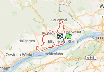
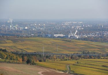
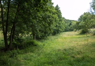
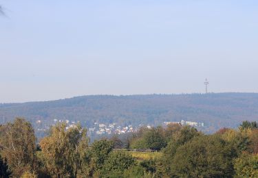
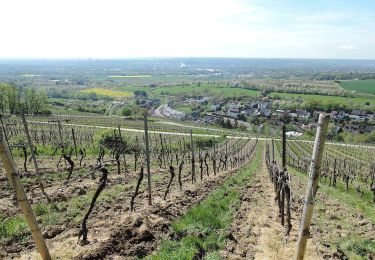
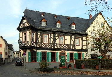
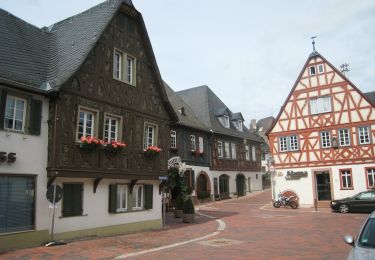
Trail On foot of 24 km to be discovered at Hesse, Rheingau-Taunus-Kreis, Eltville am Rhein. This trail is proposed by SityTrail - itinéraires balisés pédestres.

Description

Trail created by Stadt Eltville.

Symbol: Grünes, aufgeschlagenes Buch mit großem, weißen G auf der linken Seite, schwarz unterschrieben mit "Gutenbergweg" auf weißem Grund

Photos

Positioning

Country:
Germany
Region :
Hesse
Department/Province :
Rheingau-Taunus-Kreis
Municipality :
Eltville am Rhein
Location:
Eltville
Start:(UTM)
437171 ; 5541788 (32U) N.

Trails nearby

Trail On foot Ingelheim am Rhein - Kaiserpfalzweg - Photo
On foot
PRO

On foot

Easy
Ingelheim am Rhein, Rhineland-Palatinate, Landkreis Mainz-Bingen, Germany
7.9 km | 9.6 km-effort
2h 11min
Yes
Trail On foot Eltville am Rhein - Rheinsteig-Zuweg Eltville - Photo
On foot
PRO

On foot

Easy
Eltville am Rhein, Hesse, Rheingau-Taunus-Kreis, Germany
3.2 km | 3.6 km-effort
48min
No
Trail On foot Kiedrich - Kiedrich 7: - Photo
On foot
PRO

On foot

Easy
Kiedrich, Hesse, Rheingau-Taunus-Kreis, Germany
5.8 km | 7.7 km-effort
1h 45min
No
Trail On foot Eltville am Rhein - Rheinsteig-Zuweg Niederwalluf (West) - Photo
On foot
PRO

On foot

Easy
Eltville am Rhein, Hesse, Rheingau-Taunus-Kreis, Germany
5.8 km | 8.2 km-effort
1h 51min
No
Trail On foot Eltville am Rhein - Rheinsteig Rundtour: Rauenthaler Spange - Photo
On foot
PRO

On foot

Easy
Eltville am Rhein, Hesse, Rheingau-Taunus-Kreis, Germany
7.5 km | 9.8 km-effort
2h 13min
No
Trail On foot Unknown - Rheinsteig-Zuweg Dotzheim - Photo
On foot
PRO

On foot

Easy
Unknown, Hesse, Wiesbaden, Germany
3.1 km | 4.1 km-effort
55min
No
Trail On foot Eltville am Rhein - Wanderweg 2 Pfeile - Photo
On foot
PRO

On foot

Easy
Eltville am Rhein, Hesse, Rheingau-Taunus-Kreis, Germany
3.9 km | 5.1 km-effort
1h 9min
Yes
Trail On foot Eltville am Rhein - Parkplatz
On foot
PRO

On foot

Easy
Eltville am Rhein, Hesse, Rheingau-Taunus-Kreis, Germany
5.5 km | 8.2 km-effort
1h 51min
Yes
Trail On foot Eltville am Rhein - Weinwanderweg Hattenheim - Photo
On foot
PRO

On foot

Easy
Eltville am Rhein, Hesse, Rheingau-Taunus-Kreis, Germany
8.6 km | 11.6 km-effort
2h 38min
Yes


Close
My subscriptions