![](/images/other/stat-length.png)
![Trail On foot Nettetal - NS-wandeling Krickenbecker Seen - Photo](https://media.geolcdn.com/t/1900/400/ext.pjpeg?maxdim=2&url=https%3A%2F%2Fstatic1.geolcdn.com%2Fsiteimages%2Fupload%2Ffiles%2F1545311037marcheuse_200dpi.jpg)
NS-wandeling Krickenbecker Seen
SityTrail - itinéraires balisés pédestres
Tous les sentiers balisés d’Europe GUIDE+
![Length](/images/other/stat-length.png)
![Max alt](https://static1.geolcdn.com/siteimages/upload/files/1508320355ic_sort_altitude_max_24dp.png)
![Uphill gradient](https://static1.geolcdn.com/siteimages/upload/files/1508320355ic_sort_den_pos_24dp.png)
![Km-Effort](/images/other/stat-length.png)
![Min alt](https://static1.geolcdn.com/siteimages/upload/files/1508320355ic_sort_altitude_min_24dp.png)
![Downhill gradient](https://static1.geolcdn.com/siteimages/upload/files/1508320355ic_sort_den_neg_24dp.png)
![Boucle](https://static1.geolcdn.com/siteimages/upload/files/16400158638029165_repeat_loop_refresh_sync_direction_icon.png)
![On foot](https://static1.geolcdn.com/sitytour/trail-icons/100.png)
4h05
Difficulty : Easy
![Scan this QR Code to open this trail in the SityTrail application](https://capi.geolives.com/qq0zvz2zws4bq2lad0pu/sitytour/trails/3100925/qr.png?size=200)
FREE GPS app for hiking
About
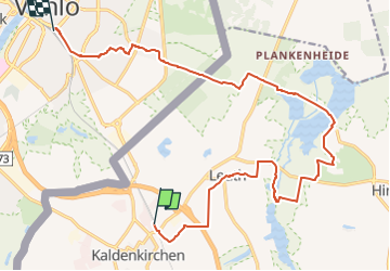
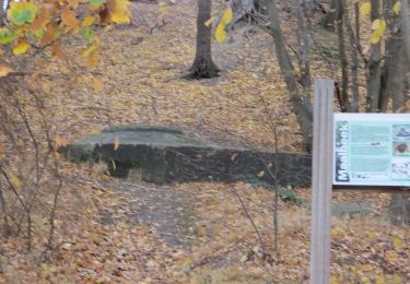
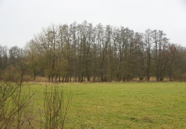
Trail On foot of 16.5 km to be discovered at North Rhine-Westphalia, Kreis Viersen, Nettetal. This trail is proposed by SityTrail - itinéraires balisés pédestres.
Description
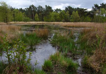
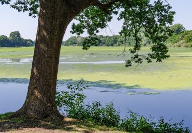
Een dagje Duitsland? Zo geregeld. Vanaf het eerste station over de grens, Kaldenkirchen, is het maar een paar kilometer lopen naar dit natuurgebied.
Website: https://www.ns.nl/dagje-uit/wandelen/krickenbecker-seen.html
Positioning
Comments
Trails nearby
![Trail On foot Brüggen - Rundweg A4 Sonsbeckweg - Photo](https://media.geolcdn.com/t/375/260/05620fe7-d3cf-4593-b74e-dea700a7b00d.jpeg&format=jpg&maxdim=2)
![On foot On foot](https://static1.geolcdn.com/sitytour/trail-icons/100.png)
On foot
![](/images/other/stat-length.png)
![](https://static1.geolcdn.com/siteimages/upload/files/16400158638029165_repeat_loop_refresh_sync_direction_icon.png)
![Trail On foot Brüggen - Rundweg](https://media.geolcdn.com/t/375/260/6f33c76c-2cd2-42e3-9451-2656da970113.jpeg&format=jpg&maxdim=2)
![On foot On foot](https://static1.geolcdn.com/sitytour/trail-icons/100.png)
On foot
![](/images/other/stat-length.png)
![](https://static1.geolcdn.com/siteimages/upload/files/16400158638029165_repeat_loop_refresh_sync_direction_icon.png)
![Trail On foot Nettetal - Rundweg A1 Sternbuschweg - Photo](https://media.geolcdn.com/t/375/260/6f33c76c-2cd2-42e3-9451-2656da970113.jpeg&format=jpg&maxdim=2)
![On foot On foot](https://static1.geolcdn.com/sitytour/trail-icons/100.png)
On foot
![](/images/other/stat-length.png)
![](https://static1.geolcdn.com/siteimages/upload/files/16400158638029165_repeat_loop_refresh_sync_direction_icon.png)
![Trail On foot Nettetal - Nette Seen - Photo](https://media.geolcdn.com/t/375/260/ea2eb3e7-66dd-44e1-98dd-53565fe20900.jpeg&format=jpg&maxdim=2)
![On foot On foot](https://static1.geolcdn.com/sitytour/trail-icons/100.png)
On foot
![](/images/other/stat-length.png)
![](https://static1.geolcdn.com/siteimages/upload/files/16400158638029165_repeat_loop_refresh_sync_direction_icon.png)
![Trail On foot Nettetal - Galgenvenn - Photo](https://media.geolcdn.com/t/375/260/54e3301f-8fda-4f6c-8189-439bbec75137.jpeg&format=jpg&maxdim=2)
![On foot On foot](https://static1.geolcdn.com/sitytour/trail-icons/100.png)
On foot
![](/images/other/stat-length.png)
![](https://static1.geolcdn.com/siteimages/upload/files/16400158638029165_repeat_loop_refresh_sync_direction_icon.png)
![Trail On foot Nettetal - Rundweg A3 Nettebruchsee - Photo](https://media.geolcdn.com/t/375/260/c158fa26-ad60-4c7f-9111-bcebf91c860c.jpeg&format=jpg&maxdim=2)
![On foot On foot](https://static1.geolcdn.com/sitytour/trail-icons/100.png)
On foot
![](/images/other/stat-length.png)
![](https://static1.geolcdn.com/siteimages/upload/files/16400158638029165_repeat_loop_refresh_sync_direction_icon.png)
![Trail On foot Nettetal - Rundweg A2 Windmühlenbruch - Photo](https://media.geolcdn.com/t/375/260/ea2eb3e7-66dd-44e1-98dd-53565fe20900.jpeg&format=jpg&maxdim=2)
![On foot On foot](https://static1.geolcdn.com/sitytour/trail-icons/100.png)
On foot
![](/images/other/stat-length.png)
![](https://static1.geolcdn.com/siteimages/upload/files/16400158638029165_repeat_loop_refresh_sync_direction_icon.png)
![Trail On foot Nettetal - Rundweg A3 Krickenbecker Seen - Photo](https://media.geolcdn.com/t/375/260/49c6bc84-b21c-4779-b59b-685bc2bf9f18.jpeg&format=jpg&maxdim=2)
![On foot On foot](https://static1.geolcdn.com/sitytour/trail-icons/100.png)
On foot
![](/images/other/stat-length.png)
![](https://static1.geolcdn.com/siteimages/upload/files/16400158638029165_repeat_loop_refresh_sync_direction_icon.png)
![Trail Car Venlo - trein spotten langs de rijn - Photo](https://media.geolcdn.com/t/375/260/db980175-98f0-406d-8f9d-756ee412204a.jpg&format=jpg&maxdim=2)
![Car Car](https://static1.geolcdn.com/sitytour/trail-icons/401.png)
Car
![](/images/other/stat-length.png)
![](https://static1.geolcdn.com/siteimages/upload/files/16400158638029165_repeat_loop_refresh_sync_direction_icon.png)