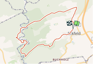
![](/images/other/stat-length.png)
![Trail On foot Eckfeld - Urpferdweg 51 - Photo](https://media.geolcdn.com/t/1900/400/ext.pjpeg?maxdim=2&url=https%3A%2F%2Fstatic1.geolcdn.com%2Fsiteimages%2Fupload%2Ffiles%2F1545311037marcheuse_200dpi.jpg)
Urpferdweg 51
SityTrail - itinéraires balisés pédestres
Tous les sentiers balisés d’Europe GUIDE+
![Length](/images/other/stat-length.png)
![Max alt](https://static1.geolcdn.com/siteimages/upload/files/1508320355ic_sort_altitude_max_24dp.png)
![Uphill gradient](https://static1.geolcdn.com/siteimages/upload/files/1508320355ic_sort_den_pos_24dp.png)
![Km-Effort](/images/other/stat-length.png)
![Min alt](https://static1.geolcdn.com/siteimages/upload/files/1508320355ic_sort_altitude_min_24dp.png)
![Downhill gradient](https://static1.geolcdn.com/siteimages/upload/files/1508320355ic_sort_den_neg_24dp.png)
![Boucle](https://static1.geolcdn.com/siteimages/upload/files/16400158638029165_repeat_loop_refresh_sync_direction_icon.png)
![On foot](https://static1.geolcdn.com/sitytour/trail-icons/100.png)
2h51
Difficulty : Easy
![Scan this QR Code to open this trail in the SityTrail application](https://capi.geolives.com/qq0zvz2zws4bq2lad0pu/sitytour/trails/3100895/qr.png?size=200)
FREE GPS app for hiking
About
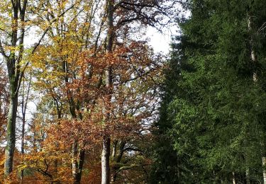
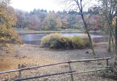
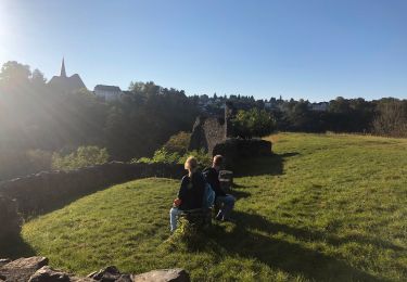
Trail On foot of 9.5 km to be discovered at Rhineland-Palatinate, Landkreis Bernkastel-Wittlich, Eckfeld. This trail is proposed by SityTrail - itinéraires balisés pédestres.
Description
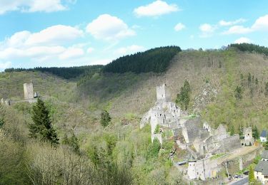
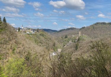
Eckfeld bietet eine große Auswahl an Wanderwegen; ist direkt angeschlossen an die überregionalen Wanderwege Eifelsteig Lieserpfad Über die Gemarkung Eckfeld führen auch die folgenden Wanderwege: Vulkanweg Karl-Kaufmann-Weg Karl-Carstens-Weg Rhein-Maas-Weg Eckfeld – Wenzelsteig – Eckfeld – 7,7 km Rundweg, überwiegend durch Wald und einen kurzen, gesicherten Steig ins Liesertal. Mehr Informationen finden Sie bei outdooractive.com. Eckfeld - Manderscheider Rittersteig – Eckfeld – 9.3 km Rundweg zu den Manderscheider Burgen und zum Aussichtspunkt „Belvedere“. Mehr Informationen finden Sie bei outdooractive.com. Urpferdweg 51 – 9,8 km Rundweg entlang des Achtergrabens zum Liesertal, vorbei an mehreren Hütten zur Grabungsstelle "Eckfelder Trockenmaar", entlang des Pellenbaches zurück nach Eckfeld. Mehr Informationen finden Sie bei outdooractive.com. Holzmaarweg 53 – 12,5 km Rundweg zum Holzmaar über Lenzenhaus und Buchholz zurück nach Eckfeld. Mehr Informationen finden Sie bei outdooractive.com. Buchholzweg 52 – 4,6 km Rundweg über "Morgenfelderhof" und "Lindenhof" nach Buchholz und wieder zurück nach Eckfeld. Mehr Informationen finden Sie bei outdooractive.com. Keltenweg – 12,9 km Rundweg ab Keltenhütte am Sportplatz Eckfeld durch den Staatsforst "Hillscheid", über "Lieserpfad" und "Eifelsteig" bis zur "Urpferdbrücke", Ausgrabungsstätte "Eckfelder Trockenmaar", entlang des "Pellenbachs", überwiegend durch Mischwald zurück nach Eckfeld. Mehr Informationen finden Sie bei outdooractive.com. Määrchen-Naturwaldpfad Der Määrchen-Naturwaldpfad ist ein Wanderweg speziell für Kinder. Hier wird spielerisch das Ökosystem Wald an verschiedenen Wegen im Wald erklärt. Mehr Informationen bei www.määrchen-naturwaldpfad.de
Website: https://eckfeld.de/lokale-wanderwege/
Positioning
Comments
Trails nearby
![Trail On foot Üdersdorf - HeimatSpur Wasser- und Felsenweg - Photo](https://media.geolcdn.com/t/375/260/2a06d58d-a40a-4c3b-9920-9399a98721d8.jpeg&format=jpg&maxdim=2)
![On foot On foot](https://static1.geolcdn.com/sitytour/trail-icons/100.png)
On foot
![](/images/other/stat-length.png)
![](https://static1.geolcdn.com/siteimages/upload/files/16400158638029165_repeat_loop_refresh_sync_direction_icon.png)
![Trail On foot Manderscheid - Manderscheider Burgensteig - Photo](https://media.geolcdn.com/t/375/260/5ac3e765-3be1-4695-9264-ed214577260b.jpeg&format=jpg&maxdim=2)
![On foot On foot](https://static1.geolcdn.com/sitytour/trail-icons/100.png)
On foot
![](/images/other/stat-length.png)
![](https://static1.geolcdn.com/siteimages/upload/files/16400158638029165_repeat_loop_refresh_sync_direction_icon.png)
![Trail Walking Manderscheid - Manderscheid et Mosenberg (Eifel) - Photo](https://media.geolcdn.com/t/375/260/587ebeaa-2ed8-485d-84ac-4ea3053d181c.jpeg&format=jpg&maxdim=2)
![Walking Walking](https://static1.geolcdn.com/sitytour/trail-icons/101.png)
Walking
![](/images/other/stat-length.png)
![](https://static1.geolcdn.com/siteimages/upload/files/16400158638029165_repeat_loop_refresh_sync_direction_icon.png)
![Trail Walking Gillenfeld - Gillenfeld - Photo](https://media.geolcdn.com/t/375/260/e6116093-965e-4e2e-be53-a362624c7b28.jpg&format=jpg&maxdim=2)
![Walking Walking](https://static1.geolcdn.com/sitytour/trail-icons/101.png)
Walking
![](/images/other/stat-length.png)
![](https://static1.geolcdn.com/siteimages/upload/files/16400158638029165_repeat_loop_refresh_sync_direction_icon.png)
![Trail Walking Manderscheid - Manderscheid Niederburg - Oberburg - Photo](https://media.geolcdn.com/t/375/260/403961bb-50e8-4f09-a395-f53096d745e4.jpg&format=jpg&maxdim=2)
![Walking Walking](https://static1.geolcdn.com/sitytour/trail-icons/101.png)
Walking
![](/images/other/stat-length.png)
![](https://static1.geolcdn.com/siteimages/upload/files/16400158638029165_repeat_loop_refresh_sync_direction_icon.png)
![Walking Walking](https://static1.geolcdn.com/sitytour/trail-icons/101.png)
Walking
![](/images/other/stat-length.png)
![](https://static1.geolcdn.com/siteimages/upload/files/16400158638029165_repeat_loop_refresh_sync_direction_icon.png)
![Trail Walking Manderscheid - 29 juin boucle-manderscheid-1 - Photo](https://media.geolcdn.com/t/375/260/ext.jpg?maxdim=2&url=https%3A%2F%2Fstatic1.geolcdn.com%2Fsiteimages%2Fupload%2Ffiles%2F1553511878bg_sport_marche.png)
![Walking Walking](https://static1.geolcdn.com/sitytour/trail-icons/101.png)
Walking
![](/images/other/stat-length.png)
![](https://static1.geolcdn.com/siteimages/upload/files/16400158638029165_repeat_loop_refresh_sync_direction_icon.png)
![Trail Walking Gillenfeld - Gillenfeld 02 - Photo](https://media.geolcdn.com/t/375/260/ext.jpg?maxdim=2&url=https%3A%2F%2Fstatic1.geolcdn.com%2Fsiteimages%2Fupload%2Ffiles%2F1553511878bg_sport_marche.png)
![Walking Walking](https://static1.geolcdn.com/sitytour/trail-icons/101.png)
Walking
![](/images/other/stat-length.png)
![](https://static1.geolcdn.com/siteimages/upload/files/16400158638029165_repeat_loop_refresh_sync_direction_icon.png)
![Trail Walking Üdersdorf - stausee udersdorf vulkaaneiffel - Photo](https://media.geolcdn.com/t/375/260/ext.jpg?maxdim=2&url=https%3A%2F%2Fstatic1.geolcdn.com%2Fsiteimages%2Fupload%2Ffiles%2F1553511878bg_sport_marche.png)
![Walking Walking](https://static1.geolcdn.com/sitytour/trail-icons/101.png)
Walking
![](/images/other/stat-length.png)
![](https://static1.geolcdn.com/siteimages/upload/files/16400158638029165_repeat_loop_refresh_sync_direction_icon.png)