


17.3 km | 23 km-effort
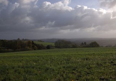
![Trail On foot Breckerfeld - [A10]Rundweg Breckerfeld (zur Glörtalsperre) - Photo](https://media.geolcdn.com/t/1900/400/497900ac-296a-4d0b-bf58-8b261fe038d7.jpeg&format=pjpeg&maxdim=2)

Tous les sentiers balisés d’Europe GUIDE+


FREE GPS app for hiking
 SityTrail
IGN / Geographical institutes
SityTrail World
The world is yours!
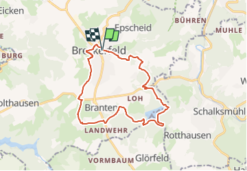
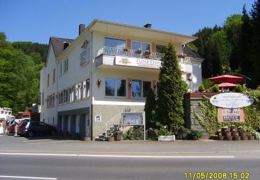
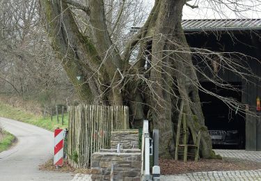
Trail On foot of 13.3 km to be discovered at North Rhine-Westphalia, Ennepe-Ruhr-Kreis, Breckerfeld. This trail is proposed by SityTrail - itinéraires balisés pédestres.
Trail created by Sauerländischer Gebirgsverein.
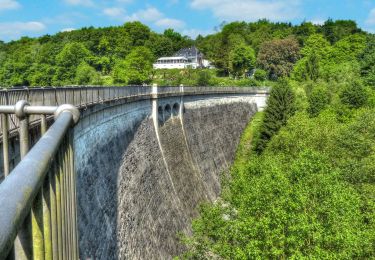
![Trail On foot Breckerfeld - [A10]Rundweg Breckerfeld (zur Glörtalsperre) - Photo 1](https://media.geolcdn.com/t/2048/auto/020c5252-0224-47b5-aa35-c59500a4abf0.jpeg&format=jpg&maxdim=0 "Trail On foot Breckerfeld - [A10]Rundweg Breckerfeld (zur Glörtalsperre) - Photo 1")
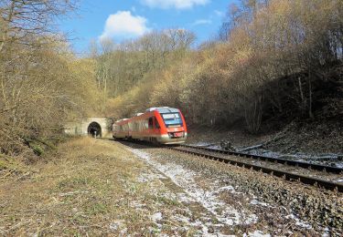
![Trail On foot Breckerfeld - [A10]Rundweg Breckerfeld (zur Glörtalsperre) - Photo 2](https://media.geolcdn.com/t/2048/auto/963ff863-602e-4834-a076-d2bcd0c24a0e.jpeg&format=jpg&maxdim=0 "Trail On foot Breckerfeld - [A10]Rundweg Breckerfeld (zur Glörtalsperre) - Photo 2")
![Trail On foot Breckerfeld - [A10]Rundweg Breckerfeld (zur Glörtalsperre) - Photo 3](https://media.geolcdn.com/t/2048/auto/ae419baa-2398-4675-b9dc-5f5d0d831e96.jpeg&format=jpg&maxdim=0 "Trail On foot Breckerfeld - [A10]Rundweg Breckerfeld (zur Glörtalsperre) - Photo 3")
![Trail On foot Breckerfeld - [A10]Rundweg Breckerfeld (zur Glörtalsperre) - Photo 4](https://media.geolcdn.com/t/2048/auto/5cf8b4f3-07a0-4f1b-91ee-1a54d06507bd.jpeg&format=jpg&maxdim=0 "Trail On foot Breckerfeld - [A10]Rundweg Breckerfeld (zur Glörtalsperre) - Photo 4")
![Trail On foot Breckerfeld - [A10]Rundweg Breckerfeld (zur Glörtalsperre) - Photo 5](https://media.geolcdn.com/t/2048/auto/182b1aa7-be06-4681-8135-2349fbadf1a9.jpeg&format=jpg&maxdim=0 "Trail On foot Breckerfeld - [A10]Rundweg Breckerfeld (zur Glörtalsperre) - Photo 5")
![Trail On foot Breckerfeld - [A10]Rundweg Breckerfeld (zur Glörtalsperre) - Photo 6](https://media.geolcdn.com/t/2048/auto/497900ac-296a-4d0b-bf58-8b261fe038d7.jpeg&format=jpg&maxdim=0 "Trail On foot Breckerfeld - [A10]Rundweg Breckerfeld (zur Glörtalsperre) - Photo 6")
On foot
On foot
On foot
On foot
On foot
On foot
On foot
On foot
On foot