![](/images/other/stat-length.png)
![Trail On foot Neualbenreuth - Ringelfelsen-Weg - Photo](https://media.geolcdn.com/t/1900/400/95845725-0005-4d81-920c-73b4f09cdf34.jpeg&format=pjpeg&maxdim=2)
Ringelfelsen-Weg
SityTrail - itinéraires balisés pédestres
Tous les sentiers balisés d’Europe GUIDE+
![Length](/images/other/stat-length.png)
![Max alt](https://static1.geolcdn.com/siteimages/upload/files/1508320355ic_sort_altitude_max_24dp.png)
![Uphill gradient](https://static1.geolcdn.com/siteimages/upload/files/1508320355ic_sort_den_pos_24dp.png)
![Km-Effort](/images/other/stat-length.png)
![Min alt](https://static1.geolcdn.com/siteimages/upload/files/1508320355ic_sort_altitude_min_24dp.png)
![Downhill gradient](https://static1.geolcdn.com/siteimages/upload/files/1508320355ic_sort_den_neg_24dp.png)
![Boucle](https://static1.geolcdn.com/siteimages/upload/files/16400158638029165_repeat_loop_refresh_sync_direction_icon.png)
![On foot](https://static1.geolcdn.com/sitytour/trail-icons/100.png)
3h06
Difficulty : Easy
![Scan this QR Code to open this trail in the SityTrail application](https://capi.geolives.com/qq0zvz2zws4bq2lad0pu/sitytour/trails/3099706/qr.png?size=200)
FREE GPS app for hiking
About
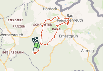
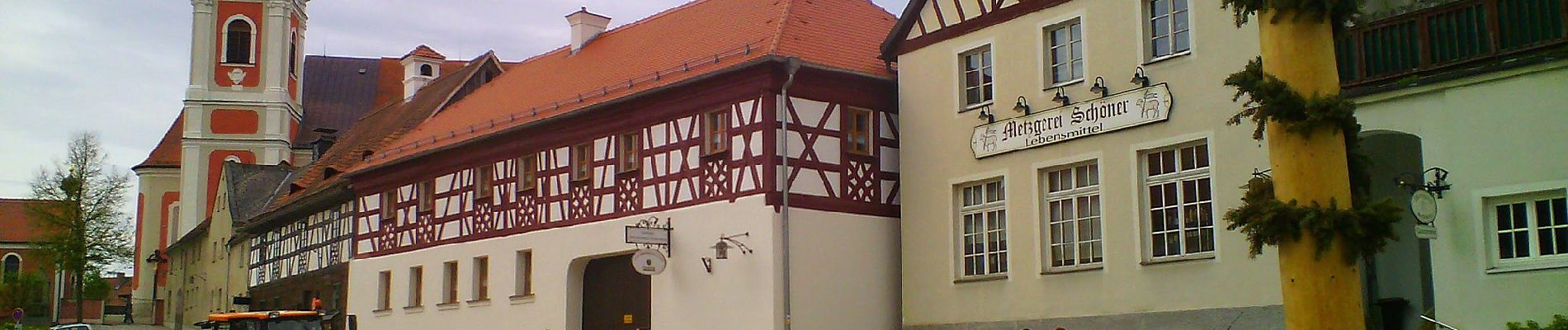
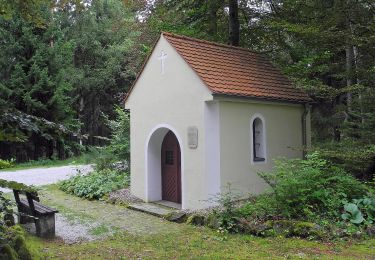
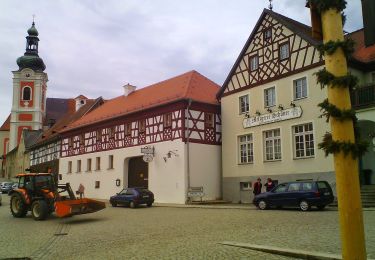
Trail On foot of 11.2 km to be discovered at Bavaria, Landkreis Tirschenreuth, Neualbenreuth. This trail is proposed by SityTrail - itinéraires balisés pédestres.
Description
Trail created by Oberpfälzer Waldverein.
Das osmc-Symbol gibt es nur mit blau in der linken unteren Ecke. Original ist blau in der linken oberen Ecke.
Symbol: Blau-Weiße Diagonale
Website: https://wandern-in-neualbenreuth.de/ringelfelsen-weg
Positioning
Comments
Trails nearby
![Trail On foot Lipová - CZ-6704 - Photo](https://media.geolcdn.com/t/375/260/8cb1f201-bee5-4835-9c64-1be594bf1fd9.jpeg&format=jpg&maxdim=2)
![On foot On foot](https://static1.geolcdn.com/sitytour/trail-icons/100.png)
On foot
![](/images/other/stat-length.png)
![](https://static1.geolcdn.com/siteimages/upload/files/16400158638029165_repeat_loop_refresh_sync_direction_icon.png)
![Trail On foot Neualbenreuth - Neualbenreuth: Auf stillen Waldpfaden zur Grenze - Photo](https://media.geolcdn.com/t/375/260/da23ae0e-15a2-4ebb-81d9-23741e0bbc84.jpeg&format=jpg&maxdim=2)
![On foot On foot](https://static1.geolcdn.com/sitytour/trail-icons/100.png)
On foot
![](/images/other/stat-length.png)
![](https://static1.geolcdn.com/siteimages/upload/files/16400158638029165_repeat_loop_refresh_sync_direction_icon.png)
![Trail On foot Neualbenreuth - Neualbenreuth: In einem Tag durch das Fraisch-Gebiet - Photo](https://media.geolcdn.com/t/375/260/03a83182-60a3-4efd-ae3e-013f5ce67585.jpeg&format=jpg&maxdim=2)
![On foot On foot](https://static1.geolcdn.com/sitytour/trail-icons/100.png)
On foot
![](/images/other/stat-length.png)
![](https://static1.geolcdn.com/siteimages/upload/files/16400158638029165_repeat_loop_refresh_sync_direction_icon.png)
![Trail On foot Neualbenreuth - Alter Herrgott Weg - Photo](https://media.geolcdn.com/t/375/260/da23ae0e-15a2-4ebb-81d9-23741e0bbc84.jpeg&format=jpg&maxdim=2)
![On foot On foot](https://static1.geolcdn.com/sitytour/trail-icons/100.png)
On foot
![](/images/other/stat-length.png)
![](https://static1.geolcdn.com/siteimages/upload/files/16400158638029165_repeat_loop_refresh_sync_direction_icon.png)
![Trail On foot Neualbenreuth - Neualbenreuth: Wanderweg Sibyllenbad Gedankental - Photo](https://media.geolcdn.com/t/375/260/95845725-0005-4d81-920c-73b4f09cdf34.jpeg&format=jpg&maxdim=2)
![On foot On foot](https://static1.geolcdn.com/sitytour/trail-icons/100.png)
On foot
![](/images/other/stat-length.png)
![](https://static1.geolcdn.com/siteimages/upload/files/16400158638029165_repeat_loop_refresh_sync_direction_icon.png)
![Trail On foot Neualbenreuth - Neualbenreuth: Auf den Spuen der Waldsassener Äbte - Photo](https://media.geolcdn.com/t/375/260/5f042772-f8e8-470c-b546-2ed4e5c1411b.jpeg&format=jpg&maxdim=2)
![On foot On foot](https://static1.geolcdn.com/sitytour/trail-icons/100.png)
On foot
![](/images/other/stat-length.png)
![](https://static1.geolcdn.com/siteimages/upload/files/16400158638029165_repeat_loop_refresh_sync_direction_icon.png)
![Trail On foot Mähring - Tirschenreuth - Alter Herrgott - Photo](https://media.geolcdn.com/t/375/260/ext.jpg?maxdim=2&url=https%3A%2F%2Fstatic1.geolcdn.com%2Fsiteimages%2Fupload%2Ffiles%2F1545311037marcheuse_200dpi.jpg)
![On foot On foot](https://static1.geolcdn.com/sitytour/trail-icons/100.png)
On foot
![](/images/other/stat-length.png)
![](https://static1.geolcdn.com/siteimages/upload/files/16400158638029165_repeat_loop_refresh_sync_direction_icon.png)
![Trail On foot Neualbenreuth - Neualbenreuth - Egerer Wald - Photo](https://media.geolcdn.com/t/375/260/ext.jpg?maxdim=2&url=https%3A%2F%2Fstatic1.geolcdn.com%2Fsiteimages%2Fupload%2Ffiles%2F1545311037marcheuse_200dpi.jpg)
![On foot On foot](https://static1.geolcdn.com/sitytour/trail-icons/100.png)
On foot
![](/images/other/stat-length.png)
![](https://static1.geolcdn.com/siteimages/upload/files/16400158638029165_repeat_loop_refresh_sync_direction_icon.png)
![Trail On foot Neualbenreuth - Tischenreuth - Egerer Wald - Photo](https://media.geolcdn.com/t/375/260/ext.jpg?maxdim=2&url=https%3A%2F%2Fstatic1.geolcdn.com%2Fsiteimages%2Fupload%2Ffiles%2F1545311037marcheuse_200dpi.jpg)
![On foot On foot](https://static1.geolcdn.com/sitytour/trail-icons/100.png)
On foot
![](/images/other/stat-length.png)
![](https://static1.geolcdn.com/siteimages/upload/files/16400158638029165_repeat_loop_refresh_sync_direction_icon.png)