Trail On foot Auetal - HO12 - Süntelturm-Route - Photo

HO12 - Süntelturm-Route

Tous les sentiers balisés d’Europe PRO

© OpenStreetMap contributors
Length
Length
7.8 km
Max alt
Max alt
445 m
Uphill gradient
Uphill gradient
279 m
Km-Effort
Km-Effort  
11.5 km
Min alt
Min alt
200 m
Downhill gradient
Downhill gradient
281 m
Boucle
Boucle
Yes
Signpost
Signpost
Creation date :
2022-02-11 18:12:50.841
Updated on :
2022-02-11 18:12:50.841

(0 Reviews)

On foot
On foot
2h36
Difficulty : Easy

Scan this QR Code to open this trail in the SityTrail application

FREE GPS app for hiking

Logo SityTrail SityTrail

IGN / Geographical institutes

Download SityTrail from the App Store Download SityTrail from Google Play

Logo SityTrail SityTrail World

The world is yours!

Download SityTrail from the App Store Download SityTrail from Google Play Download SityTrail on Huawei AppGallery

About

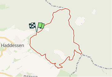
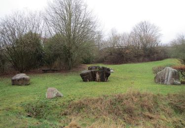
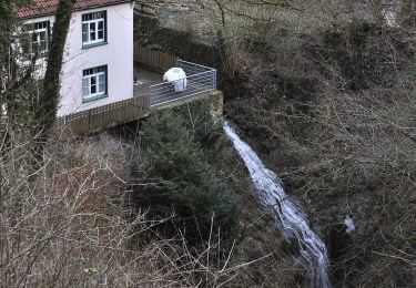
Trail On foot of 7.8 km to be discovered at Lower Saxony, Landkreis Schaumburg, Auetal. This trail is proposed by SityTrail - itinéraires balisés pédestres.

Photos

Positioning

Country:
Germany
Region :
Lower Saxony
Department/Province :
Landkreis Schaumburg
Municipality :
Auetal
Location:
Unknown
Start:(UTM)
524749 ; 5780580 (32U) N.

Trails nearby

Trail On foot Auetal - HO6 - Blutbach-Route - Photo
On foot
PRO

On foot

Easy
Auetal, Lower Saxony, Landkreis Schaumburg, Germany
3.3 km | 3.9 km-effort
53min
Yes
Trail On foot Auetal - HO9 - Roter Stein Route - Photo
On foot
PRO

On foot

Easy
Auetal, Lower Saxony, Landkreis Schaumburg, Germany
8.9 km | 12.7 km-effort
2h 53min
Yes
Trail On foot Auetal - HO10 - Westerberg-Route - Photo
On foot
PRO

On foot

Easy
Auetal, Lower Saxony, Landkreis Schaumburg, Germany
4.2 km | 6.1 km-effort
1h 22min
Yes
Trail On foot Auetal - HO8 - Kreuzstein-Route - Photo
On foot
PRO

On foot

Easy
Auetal, Lower Saxony, Landkreis Schaumburg, Germany
7.4 km | 10.4 km-effort
2h 21min
Yes
Trail On foot Auetal - HO7 - Hohenstein Route - Photo
On foot
PRO

On foot

Easy
Auetal, Lower Saxony, Landkreis Schaumburg, Germany
12.2 km | 15.8 km-effort
3h 35min
Yes
Trail On foot Auetal - HM7 Rundweg Märzenbecher - Photo
On foot
PRO

On foot

Easy
Auetal, Lower Saxony, Landkreis Schaumburg, Germany
3.9 km | 5 km-effort
1h 7min
Yes
Trail On foot Auetal - HM8 Rundweg Wehl - Photo
On foot
PRO

On foot

Easy
Auetal, Lower Saxony, Landkreis Schaumburg, Germany
3.9 km | 5.8 km-effort
1h 19min
No
Trail On foot Auetal - HO5 - Langenfeld Route - Photo
On foot
PRO

On foot

Easy
Auetal, Lower Saxony, Landkreis Schaumburg, Germany
3.2 km | 4 km-effort
54min
Yes
Trail On foot Auetal - HO11 - Katzennase-Route - Photo
On foot
PRO

On foot

Easy
Auetal, Lower Saxony, Landkreis Schaumburg, Germany
4.5 km | 5.8 km-effort
1h 18min
No


Close
My subscriptions