![](/images/other/stat-length.png)
![Trail On foot Gevelsberg - [A2] Rundwanderweg Silschede - Photo](https://media.geolcdn.com/t/1900/400/e8511c04-2680-4359-a7af-e8f515133e2a.jpeg&format=pjpeg&maxdim=2)
[A2] Rundwanderweg Silschede
SityTrail - itinéraires balisés pédestres
Tous les sentiers balisés d’Europe GUIDE+
![Length](/images/other/stat-length.png)
Length
7.1 km
![Max alt](https://static1.geolcdn.com/siteimages/upload/files/1508320355ic_sort_altitude_max_24dp.png)
Max alt
268 m
![Uphill gradient](https://static1.geolcdn.com/siteimages/upload/files/1508320355ic_sort_den_pos_24dp.png)
Uphill gradient
142 m
![Km-Effort](/images/other/stat-length.png)
Km-Effort
9 km
![Min alt](https://static1.geolcdn.com/siteimages/upload/files/1508320355ic_sort_altitude_min_24dp.png)
Min alt
193 m
![Downhill gradient](https://static1.geolcdn.com/siteimages/upload/files/1508320355ic_sort_den_neg_24dp.png)
Downhill gradient
137 m
![Boucle](https://static1.geolcdn.com/siteimages/upload/files/16400158638029165_repeat_loop_refresh_sync_direction_icon.png)
Boucle
Yes
Signpost
Creation date :
2022-02-11 18:03:36.12
Updated on :
2022-02-11 18:03:36.12
![On foot](https://static1.geolcdn.com/sitytour/trail-icons/100.png)
2h02
Difficulty : Easy
![Scan this QR Code to open this trail in the SityTrail application](https://capi.geolives.com/qq0zvz2zws4bq2lad0pu/sitytour/trails/3098970/qr.png?size=200)
FREE GPS app for hiking
About
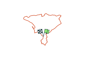
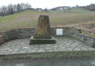
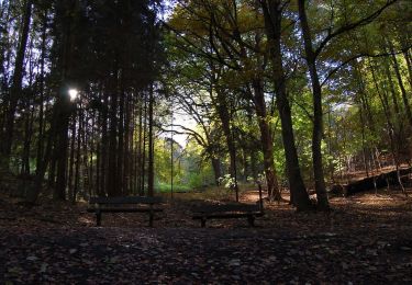
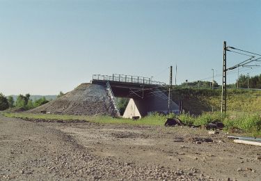
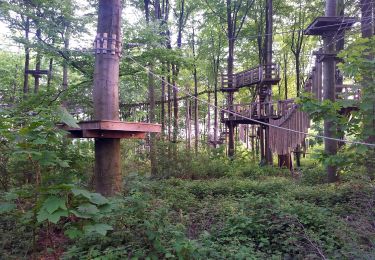
Trail On foot of 7.1 km to be discovered at North Rhine-Westphalia, Ennepe-Ruhr-Kreis, Gevelsberg. This trail is proposed by SityTrail - itinéraires balisés pédestres.
Description
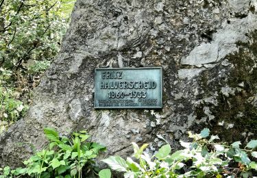
Trail created by Sauerländischer Gebirgsverein.
Symbol: weißer Text A2 auf schwarzem Grund
Positioning
Country:
Germany
Region :
North Rhine-Westphalia
Department/Province :
Ennepe-Ruhr-Kreis
Municipality :
Gevelsberg
Location:
Unknown
Start:(Dec)
Start:(UTM)
383741 ; 5690175 (32U) N.
Comments
Trails nearby
![Trail On foot Gevelsberg - Gevelsberg A2 - Photo](https://media.geolcdn.com/t/375/260/21da2367-fb27-4e94-9be3-4f8ac0f58149.jpeg&format=jpg&maxdim=2)
![On foot On foot](https://static1.geolcdn.com/sitytour/trail-icons/100.png)
Gevelsberg A2
On foot
Easy
Gevelsberg,
North Rhine-Westphalia,
Ennepe-Ruhr-Kreis,
Germany
![](/images/other/stat-length.png)
5.4 km | 7.5 km-effort
1h 42min
![](https://static1.geolcdn.com/siteimages/upload/files/16400158638029165_repeat_loop_refresh_sync_direction_icon.png)
Yes
![Trail On foot Gevelsberg - [A3] historischer Rundwanderweg Silschede - Photo](https://media.geolcdn.com/t/375/260/e8511c04-2680-4359-a7af-e8f515133e2a.jpeg&format=jpg&maxdim=2)
![On foot On foot](https://static1.geolcdn.com/sitytour/trail-icons/100.png)
[A3] historischer Rundwanderweg Silschede
On foot
Easy
Gevelsberg,
North Rhine-Westphalia,
Ennepe-Ruhr-Kreis,
Germany
![](/images/other/stat-length.png)
4 km | 5.3 km-effort
1h 12min
![](https://static1.geolcdn.com/siteimages/upload/files/16400158638029165_repeat_loop_refresh_sync_direction_icon.png)
Yes
![Trail On foot Ennepetal - Voerde Rundweg A7 - Photo](https://media.geolcdn.com/t/375/260/06f812dd-828f-4932-abc8-6edb7058f4bf.jpeg&format=jpg&maxdim=2)
![On foot On foot](https://static1.geolcdn.com/sitytour/trail-icons/100.png)
Voerde Rundweg A7
On foot
Easy
Ennepetal,
North Rhine-Westphalia,
Ennepe-Ruhr-Kreis,
Germany
![](/images/other/stat-length.png)
5.2 km | 6.8 km-effort
1h 33min
![](https://static1.geolcdn.com/siteimages/upload/files/16400158638029165_repeat_loop_refresh_sync_direction_icon.png)
No
![Trail On foot Wetter (Ruhr) - Auf den Spuren Gustav Vorstehers - Photo](https://media.geolcdn.com/t/375/260/6650b932-7f62-41ca-99e0-7a8de169d7d3.jpeg&format=jpg&maxdim=2)
![On foot On foot](https://static1.geolcdn.com/sitytour/trail-icons/100.png)
Auf den Spuren Gustav Vorstehers
On foot
Easy
Wetter (Ruhr),
North Rhine-Westphalia,
Ennepe-Ruhr-Kreis,
Germany
![](/images/other/stat-length.png)
3.6 km | 4.6 km-effort
1h 2min
![](https://static1.geolcdn.com/siteimages/upload/files/16400158638029165_repeat_loop_refresh_sync_direction_icon.png)
Yes
![Trail On foot Wetter (Ruhr) - Neuwülfingsburg-Weg - Photo](https://media.geolcdn.com/t/375/260/cf05ce53-e61e-46ff-a76b-acb933d061c0.jpeg&format=jpg&maxdim=2)
![On foot On foot](https://static1.geolcdn.com/sitytour/trail-icons/100.png)
Neuwülfingsburg-Weg
On foot
Easy
Wetter (Ruhr),
North Rhine-Westphalia,
Ennepe-Ruhr-Kreis,
Germany
![](/images/other/stat-length.png)
11.1 km | 14.4 km-effort
3h 16min
![](https://static1.geolcdn.com/siteimages/upload/files/16400158638029165_repeat_loop_refresh_sync_direction_icon.png)
No
![Trail On foot Wetter (Ruhr) - Erbstollenweg - Photo](https://media.geolcdn.com/t/375/260/b3b2b259-90e3-4aa5-8d2c-d44b2040b229.jpeg&format=jpg&maxdim=2)
![On foot On foot](https://static1.geolcdn.com/sitytour/trail-icons/100.png)
Erbstollenweg
On foot
Easy
Wetter (Ruhr),
North Rhine-Westphalia,
Ennepe-Ruhr-Kreis,
Germany
![](/images/other/stat-length.png)
8.8 km | 12.3 km-effort
2h 48min
![](https://static1.geolcdn.com/siteimages/upload/files/16400158638029165_repeat_loop_refresh_sync_direction_icon.png)
No
![Trail On foot Wetter (Ruhr) - Freiherr-vom-und-zum-Stein-Weg - Photo](https://media.geolcdn.com/t/375/260/7fdd3340-a2bd-426d-9833-60094cb79580.jpeg&format=jpg&maxdim=2)
![On foot On foot](https://static1.geolcdn.com/sitytour/trail-icons/100.png)
Freiherr-vom-und-zum-Stein-Weg
On foot
Easy
Wetter (Ruhr),
North Rhine-Westphalia,
Ennepe-Ruhr-Kreis,
Germany
![](/images/other/stat-length.png)
4.4 km | 5.7 km-effort
1h 18min
![](https://static1.geolcdn.com/siteimages/upload/files/16400158638029165_repeat_loop_refresh_sync_direction_icon.png)
Yes
![Trail On foot Wetter (Ruhr) - [A3] Rundwanderweg Grundschöttel - Photo](https://media.geolcdn.com/t/375/260/cf05ce53-e61e-46ff-a76b-acb933d061c0.jpeg&format=jpg&maxdim=2)
![On foot On foot](https://static1.geolcdn.com/sitytour/trail-icons/100.png)
[A3] Rundwanderweg Grundschöttel
On foot
Easy
Wetter (Ruhr),
North Rhine-Westphalia,
Ennepe-Ruhr-Kreis,
Germany
![](/images/other/stat-length.png)
6.1 km | 8.4 km-effort
1h 55min
![](https://static1.geolcdn.com/siteimages/upload/files/16400158638029165_repeat_loop_refresh_sync_direction_icon.png)
Yes
![Trail On foot Wetter (Ruhr) - Harkortberg Rundweg A1 - Photo](https://media.geolcdn.com/t/375/260/726cb39b-5cbe-4b68-b43e-a3bcd858a524.jpeg&format=jpg&maxdim=2)
![On foot On foot](https://static1.geolcdn.com/sitytour/trail-icons/100.png)
Harkortberg Rundweg A1
On foot
Easy
Wetter (Ruhr),
North Rhine-Westphalia,
Ennepe-Ruhr-Kreis,
Germany
![](/images/other/stat-length.png)
3.2 km | 4.2 km-effort
57min
![](https://static1.geolcdn.com/siteimages/upload/files/16400158638029165_repeat_loop_refresh_sync_direction_icon.png)
No