![](/images/other/stat-length.png)
![Trail On foot Mandelbachtal - Heckendalheimer Höhen- und Klammenweg - Photo](https://media.geolcdn.com/t/1900/400/fc1842e4-9ed2-4f92-8d37-7cc75582c21d.jpeg&format=pjpeg&maxdim=2)
Heckendalheimer Höhen- und Klammenweg
SityTrail - itinéraires balisés pédestres
Tous les sentiers balisés d’Europe GUIDE+
![Length](/images/other/stat-length.png)
![Max alt](https://static1.geolcdn.com/siteimages/upload/files/1508320355ic_sort_altitude_max_24dp.png)
![Uphill gradient](https://static1.geolcdn.com/siteimages/upload/files/1508320355ic_sort_den_pos_24dp.png)
![Km-Effort](/images/other/stat-length.png)
![Min alt](https://static1.geolcdn.com/siteimages/upload/files/1508320355ic_sort_altitude_min_24dp.png)
![Downhill gradient](https://static1.geolcdn.com/siteimages/upload/files/1508320355ic_sort_den_neg_24dp.png)
![Boucle](https://static1.geolcdn.com/siteimages/upload/files/16400158638029165_repeat_loop_refresh_sync_direction_icon.png)
![On foot](https://static1.geolcdn.com/sitytour/trail-icons/100.png)
2h36
Difficulty : Easy
![Scan this QR Code to open this trail in the SityTrail application](https://capi.geolives.com/qq0zvz2zws4bq2lad0pu/sitytour/trails/3098749/qr.png?size=200)
FREE GPS app for hiking
About
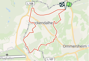
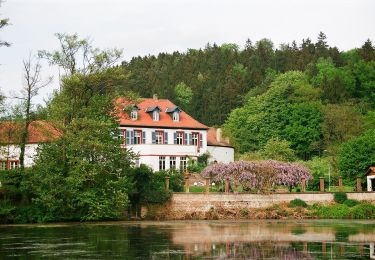
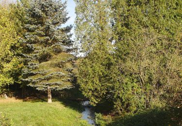
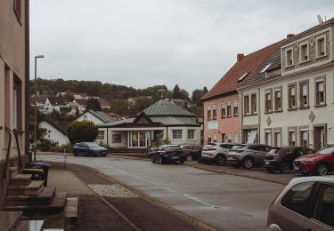
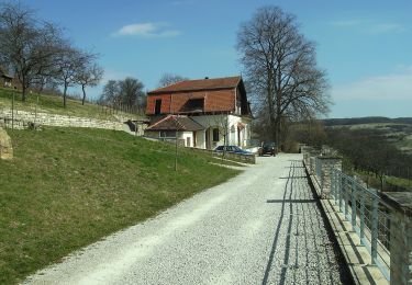
Trail On foot of 9.2 km to be discovered at Saarland, Saarpfalz-Kreis, Mandelbachtal. This trail is proposed by SityTrail - itinéraires balisés pédestres.
Description
Trail created by Heimat- und Kulturverein Heckendalheim.
2020-04-04: Die Route wurde mit einer Umleitung versehen. Ob die dauerhaft ist oder nur vorübergehend, ist unklar.
Symbol: runde Dorfansicht mit blauer Aufschrift "Rund um Dalem"
Positioning
Comments
Trails nearby
![Trail On foot Saarbrücken - Ensheimer Brunnenweg - Photo](https://media.geolcdn.com/t/375/260/86f5362b-0683-46dd-ac92-1c1dfdd922ac.jpeg&format=jpg&maxdim=2)
![On foot On foot](https://static1.geolcdn.com/sitytour/trail-icons/100.png)
On foot
![](/images/other/stat-length.png)
![](https://static1.geolcdn.com/siteimages/upload/files/16400158638029165_repeat_loop_refresh_sync_direction_icon.png)
![Trail On foot Kirkel - Wildschwein-Rundwanderweg - Photo](https://media.geolcdn.com/t/375/260/90a7ee08-7bdb-4bfc-95ac-b4d770481c04.jpeg&format=jpg&maxdim=2)
![On foot On foot](https://static1.geolcdn.com/sitytour/trail-icons/100.png)
On foot
![](/images/other/stat-length.png)
![](https://static1.geolcdn.com/siteimages/upload/files/16400158638029165_repeat_loop_refresh_sync_direction_icon.png)
![Trail On foot Blieskastel - Niederwürzbacher-Weiher-Tour - Photo](https://media.geolcdn.com/t/375/260/96afa618-fe7e-42d5-b76b-9a6decb0e3bf.jpeg&format=jpg&maxdim=2)
![On foot On foot](https://static1.geolcdn.com/sitytour/trail-icons/100.png)
On foot
![](/images/other/stat-length.png)
![](https://static1.geolcdn.com/siteimages/upload/files/16400158638029165_repeat_loop_refresh_sync_direction_icon.png)
![Trail On foot Saarbrücken - DE-▲ - Photo](https://media.geolcdn.com/t/375/260/961b44f9-9c9b-444f-b8ac-1109f3ff9e8b.jpeg&format=jpg&maxdim=2)
![On foot On foot](https://static1.geolcdn.com/sitytour/trail-icons/100.png)
On foot
![](/images/other/stat-length.png)
![](https://static1.geolcdn.com/siteimages/upload/files/16400158638029165_repeat_loop_refresh_sync_direction_icon.png)
![Trail On foot Saarbrücken - Ensheimer Brunnenweg mit Mühlenschleife - Photo](https://media.geolcdn.com/t/375/260/86f5362b-0683-46dd-ac92-1c1dfdd922ac.jpeg&format=jpg&maxdim=2)
![On foot On foot](https://static1.geolcdn.com/sitytour/trail-icons/100.png)
On foot
![](/images/other/stat-length.png)
![](https://static1.geolcdn.com/siteimages/upload/files/16400158638029165_repeat_loop_refresh_sync_direction_icon.png)
![Trail On foot Sankt Ingbert - Schnepfe-Rundwanderweg - Photo](https://media.geolcdn.com/t/375/260/2be6ffdc-1ad3-4d8c-b098-19063d1242bb.jpeg&format=jpg&maxdim=2)
![On foot On foot](https://static1.geolcdn.com/sitytour/trail-icons/100.png)
On foot
![](/images/other/stat-length.png)
![](https://static1.geolcdn.com/siteimages/upload/files/16400158638029165_repeat_loop_refresh_sync_direction_icon.png)
![Trail On foot Sankt Ingbert - Schmetterling-Rundwanderweg Oberwürzbach - Photo](https://media.geolcdn.com/t/375/260/00567d36-9f17-43cb-8ff8-f2e5a3a18248.jpeg&format=jpg&maxdim=2)
![On foot On foot](https://static1.geolcdn.com/sitytour/trail-icons/100.png)
On foot
![](/images/other/stat-length.png)
![](https://static1.geolcdn.com/siteimages/upload/files/16400158638029165_repeat_loop_refresh_sync_direction_icon.png)
![Trail On foot Mandelbachtal - Kneipp-Rundweg Ormesheim - Photo](https://media.geolcdn.com/t/375/260/dbac5f73-b780-4acf-abd6-0160ebb89fb9.jpeg&format=jpg&maxdim=2)
![On foot On foot](https://static1.geolcdn.com/sitytour/trail-icons/100.png)
On foot
![](/images/other/stat-length.png)
![](https://static1.geolcdn.com/siteimages/upload/files/16400158638029165_repeat_loop_refresh_sync_direction_icon.png)
![Trail On foot Mandelbachtal - Natura Trails Ormesheim - Photo](https://media.geolcdn.com/t/375/260/bc813a3b-33fb-42c1-9ccc-0aa867764c45.jpeg&format=jpg&maxdim=2)
![On foot On foot](https://static1.geolcdn.com/sitytour/trail-icons/100.png)
On foot
![](/images/other/stat-length.png)
![](https://static1.geolcdn.com/siteimages/upload/files/16400158638029165_repeat_loop_refresh_sync_direction_icon.png)