![](/images/other/stat-length.png)
![Trail On foot Echternacherbrück - Felsenweg 1 - Photo](https://media.geolcdn.com/t/1900/400/2e9ebe84-c1e3-4839-8a8a-11176ceb2a5c.jpeg&format=pjpeg&maxdim=2)
Felsenweg 1
SityTrail - itinéraires balisés pédestres
Tous les sentiers balisés d’Europe GUIDE+
![Length](/images/other/stat-length.png)
Length
14 km
![Max alt](https://static1.geolcdn.com/siteimages/upload/files/1508320355ic_sort_altitude_max_24dp.png)
Max alt
342 m
![Uphill gradient](https://static1.geolcdn.com/siteimages/upload/files/1508320355ic_sort_den_pos_24dp.png)
Uphill gradient
500 m
![Km-Effort](/images/other/stat-length.png)
Km-Effort
20 km
![Min alt](https://static1.geolcdn.com/siteimages/upload/files/1508320355ic_sort_altitude_min_24dp.png)
Min alt
162 m
![Downhill gradient](https://static1.geolcdn.com/siteimages/upload/files/1508320355ic_sort_den_neg_24dp.png)
Downhill gradient
338 m
![Boucle](https://static1.geolcdn.com/siteimages/upload/files/16400158638029165_repeat_loop_refresh_sync_direction_icon.png)
Boucle
No
Signpost
Creation date :
2022-02-11 17:52:28.955
Updated on :
2022-02-11 17:52:28.955
![On foot](https://static1.geolcdn.com/sitytour/trail-icons/100.png)
4h33
Difficulty : Medium
![Scan this QR Code to open this trail in the SityTrail application](https://capi.geolives.com/qq0zvz2zws4bq2lad0pu/sitytour/trails/3098679/qr.png?size=200)
FREE GPS app for hiking
About
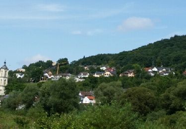
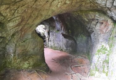
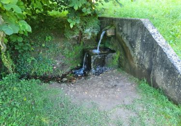
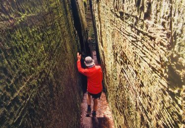
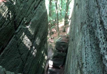
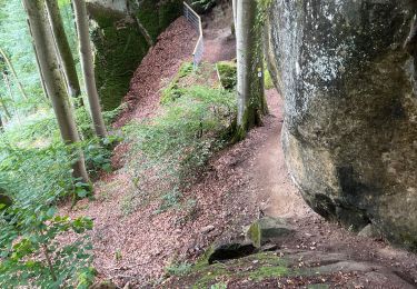
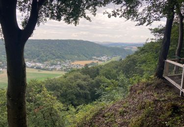
Trail On foot of 14 km to be discovered at Rhineland-Palatinate, Eifelkreis Bitburg-Prüm, Echternacherbrück. This trail is proposed by SityTrail - itinéraires balisés pédestres.
Description
Symbol: Grünes stilisiertes Blatt auf weißem Grund
Positioning
Country:
Germany
Region :
Rhineland-Palatinate
Department/Province :
Eifelkreis Bitburg-Prüm
Municipality :
Echternacherbrück
Location:
Unknown
Start:(Dec)
Start:(UTM)
314903 ; 5521035 (32U) N.
Comments
Trails nearby
![Trail Walking Berdorf - MÜLLERTHAL (Bollendorf-Pont) - Photo](https://media.geolcdn.com/t/375/260/ext.jpg?maxdim=2&url=https%3A%2F%2Fservices.sitytrail.com%2FGeolivesWS%2FDownloadMedia.ashx%3FTrailID%3D816349%26Media%3Dfix__20170824131142.jpg)
![Walking Walking](https://static1.geolcdn.com/sitytour/trail-icons/101.png)
MÜLLERTHAL (Bollendorf-Pont)
Walking
Easy
(1)
Berdorf,
Unknown,
Canton Echternach,
Luxembourg
![](/images/other/stat-length.png)
10.5 km | 14.3 km-effort
3h 10min
![](https://static1.geolcdn.com/siteimages/upload/files/16400158638029165_repeat_loop_refresh_sync_direction_icon.png)
Yes
![Trail Walking Ernzen - DeLux Wanderpark Felsenweg1, Weilerbach-Houllay - Photo](https://media.geolcdn.com/t/375/260/ext.jpg?maxdim=2&url=https%3A%2F%2Fstatic1.geolcdn.com%2Fsiteimages%2Fupload%2Ffiles%2F1553511878bg_sport_marche.png)
![Walking Walking](https://static1.geolcdn.com/sitytour/trail-icons/101.png)
DeLux Wanderpark Felsenweg1, Weilerbach-Houllay
Walking
Very easy
(1)
Ernzen,
Rhineland-Palatinate,
Eifelkreis Bitburg-Prüm,
Germany
![](/images/other/stat-length.png)
20 km | 28 km-effort
5h 51min
![](https://static1.geolcdn.com/siteimages/upload/files/16400158638029165_repeat_loop_refresh_sync_direction_icon.png)
Yes
![Trail Walking Echternach - mullerthal moitié E1 - Photo](https://media.geolcdn.com/t/375/260/d1c68b99-ac30-490b-aea5-f05902ad3f3d.jpg&format=jpg&maxdim=2)
![Walking Walking](https://static1.geolcdn.com/sitytour/trail-icons/101.png)
mullerthal moitié E1
Walking
Medium
Echternach,
Unknown,
Canton Echternach,
Luxembourg
![](/images/other/stat-length.png)
6.3 km | 9.2 km-effort
2h 1min
![](https://static1.geolcdn.com/siteimages/upload/files/16400158638029165_repeat_loop_refresh_sync_direction_icon.png)
No
![Trail Walking Echternach - echternacht tour du lac villa romaine - Photo](https://media.geolcdn.com/t/375/260/702d825c-b429-41af-92ee-f2a109afde03.jpg&format=jpg&maxdim=2)
![Walking Walking](https://static1.geolcdn.com/sitytour/trail-icons/101.png)
echternacht tour du lac villa romaine
Walking
Very easy
Echternach,
Unknown,
Canton Echternach,
Luxembourg
![](/images/other/stat-length.png)
3.4 km | 3.8 km-effort
58min
![](https://static1.geolcdn.com/siteimages/upload/files/16400158638029165_repeat_loop_refresh_sync_direction_icon.png)
No
![Trail Walking Echternach - Itinérant Luxembourg Jour 4 Echternach-Beaufort - Photo](https://media.geolcdn.com/t/375/260/5d9fc501-8c8f-498e-90ca-83c630d1efb6.jpg&format=jpg&maxdim=2)
![Walking Walking](https://static1.geolcdn.com/sitytour/trail-icons/101.png)
Itinérant Luxembourg Jour 4 Echternach-Beaufort
Walking
Very difficult
Echternach,
Unknown,
Canton Echternach,
Luxembourg
![](/images/other/stat-length.png)
25 km | 34 km-effort
6h 39min
![](https://static1.geolcdn.com/siteimages/upload/files/16400158638029165_repeat_loop_refresh_sync_direction_icon.png)
No
![Trail Walking Echternach - Muller 2 - Photo](https://media.geolcdn.com/t/375/260/ac224f96-35e7-4fbc-a1ed-e43957f71bb4.jpg&format=jpg&maxdim=2)
![Walking Walking](https://static1.geolcdn.com/sitytour/trail-icons/101.png)
Muller 2
Walking
Difficult
Echternach,
Unknown,
Canton Echternach,
Luxembourg
![](/images/other/stat-length.png)
27 km | 36 km-effort
8h 24min
![](https://static1.geolcdn.com/siteimages/upload/files/16400158638029165_repeat_loop_refresh_sync_direction_icon.png)
No
![Trail On foot Echternach - Autopédestre Echternach 1 - Photo](https://media.geolcdn.com/t/375/260/a550e4c7-2c25-4f51-ad06-3a0e3c253839.jpeg&format=jpg&maxdim=2)
![On foot On foot](https://static1.geolcdn.com/sitytour/trail-icons/100.png)
Autopédestre Echternach 1
On foot
Easy
Echternach,
Unknown,
Canton Echternach,
Luxembourg
![](/images/other/stat-length.png)
11 km | 16.1 km-effort
3h 39min
![](https://static1.geolcdn.com/siteimages/upload/files/16400158638029165_repeat_loop_refresh_sync_direction_icon.png)
Yes
![Trail Walking Ernzen - Balade Ernzen Allemagne - Photo](https://media.geolcdn.com/t/375/260/efe60b51-604b-4195-ab83-3dfa9e55ea7a.jpg&format=jpg&maxdim=2)
![Walking Walking](https://static1.geolcdn.com/sitytour/trail-icons/101.png)
Balade Ernzen Allemagne
Walking
Medium
Ernzen,
Rhineland-Palatinate,
Eifelkreis Bitburg-Prüm,
Germany
![](/images/other/stat-length.png)
18.7 km | 24 km-effort
4h 53min
![](https://static1.geolcdn.com/siteimages/upload/files/16400158638029165_repeat_loop_refresh_sync_direction_icon.png)
Yes
![Trail Walking Echternach - Trek Rchternacht 2 - Photo](https://media.geolcdn.com/t/375/260/cf25e5ab-1b14-4279-816b-979176d81947.jpg&format=jpg&maxdim=2)
![Walking Walking](https://static1.geolcdn.com/sitytour/trail-icons/101.png)
Trek Rchternacht 2
Walking
Difficult
Echternach,
Unknown,
Canton Echternach,
Luxembourg
![](/images/other/stat-length.png)
10.1 km | 13.8 km-effort
5h 34min
![](https://static1.geolcdn.com/siteimages/upload/files/16400158638029165_repeat_loop_refresh_sync_direction_icon.png)
Yes