![](/images/other/stat-length.png)
![Trail On foot Waldfischbach-Burgalben - Wandern in Clausen C5 - Photo](https://media.geolcdn.com/t/1900/400/65aba17d-e65f-41ac-9aaa-2c06d98c4adb.jpeg&format=pjpeg&maxdim=2)
Wandern in Clausen C5
SityTrail - itinéraires balisés pédestres
Tous les sentiers balisés d’Europe GUIDE+
![Length](/images/other/stat-length.png)
Length
8.1 km
![Max alt](https://static1.geolcdn.com/siteimages/upload/files/1508320355ic_sort_altitude_max_24dp.png)
Max alt
411 m
![Uphill gradient](https://static1.geolcdn.com/siteimages/upload/files/1508320355ic_sort_den_pos_24dp.png)
Uphill gradient
267 m
![Km-Effort](/images/other/stat-length.png)
Km-Effort
11.7 km
![Min alt](https://static1.geolcdn.com/siteimages/upload/files/1508320355ic_sort_altitude_min_24dp.png)
Min alt
260 m
![Downhill gradient](https://static1.geolcdn.com/siteimages/upload/files/1508320355ic_sort_den_neg_24dp.png)
Downhill gradient
270 m
![Boucle](https://static1.geolcdn.com/siteimages/upload/files/16400158638029165_repeat_loop_refresh_sync_direction_icon.png)
Boucle
Yes
Signpost
Creation date :
2022-02-11 17:40:11.686
Updated on :
2022-02-11 17:40:11.686
![On foot](https://static1.geolcdn.com/sitytour/trail-icons/100.png)
2h39
Difficulty : Easy
![Scan this QR Code to open this trail in the SityTrail application](https://capi.geolives.com/qq0zvz2zws4bq2lad0pu/sitytour/trails/3098333/qr.png?size=200)
FREE GPS app for hiking
About
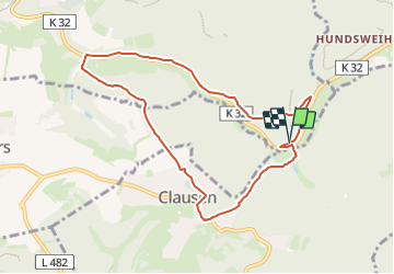
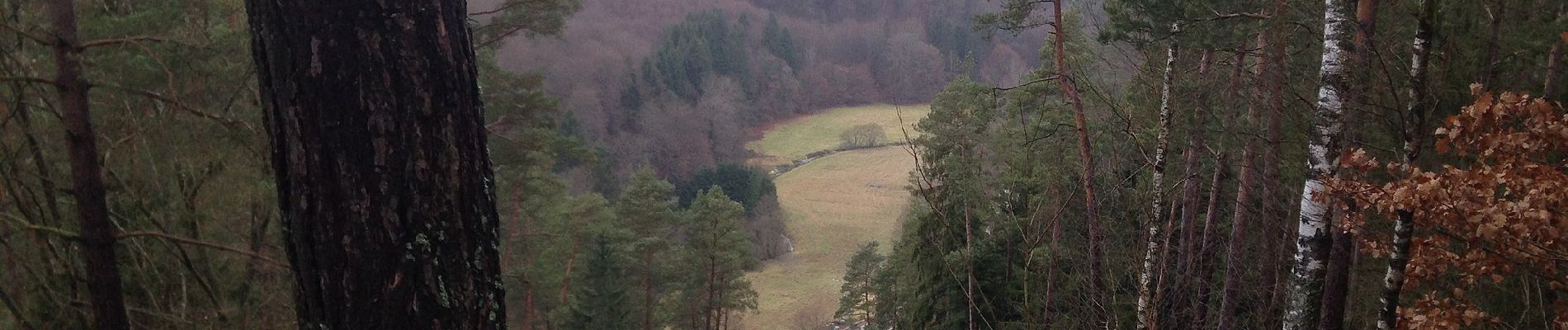
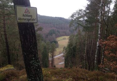
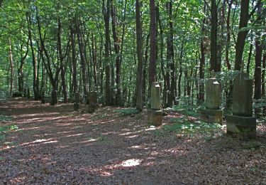
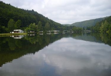
Trail On foot of 8.1 km to be discovered at Rhineland-Palatinate, Südwestpfalz, Waldfischbach-Burgalben. This trail is proposed by SityTrail - itinéraires balisés pédestres.
Description
Trail created by Kultur und Verkehrsverein Clausen.
Symbol: Blaues Oval Text Weis C5
Website: http://www.wandern-clausen.de
Positioning
Country:
Germany
Region :
Rhineland-Palatinate
Department/Province :
Südwestpfalz
Municipality :
Waldfischbach-Burgalben
Location:
Unknown
Start:(Dec)
Start:(UTM)
404853 ; 5457856 (32U) N.
Comments
Trails nearby
![Trail On foot Clausen - Wandern in Clausen C8 Rund um Clausen - Photo](https://media.geolcdn.com/t/375/260/65aba17d-e65f-41ac-9aaa-2c06d98c4adb.jpeg&format=jpg&maxdim=2)
![On foot On foot](https://static1.geolcdn.com/sitytour/trail-icons/100.png)
Wandern in Clausen C8 Rund um Clausen
On foot
Medium
Clausen,
Rhineland-Palatinate,
Südwestpfalz,
Germany
![](/images/other/stat-length.png)
18 km | 24 km-effort
5h 33min
![](https://static1.geolcdn.com/siteimages/upload/files/16400158638029165_repeat_loop_refresh_sync_direction_icon.png)
Yes
![Trail On foot Clausen - Wandern in Clausen C6 - Photo](https://media.geolcdn.com/t/375/260/0114e7e1-ac63-435d-8266-9a3926b8b6e0.jpeg&format=jpg&maxdim=2)
![On foot On foot](https://static1.geolcdn.com/sitytour/trail-icons/100.png)
Wandern in Clausen C6
On foot
Easy
Clausen,
Rhineland-Palatinate,
Südwestpfalz,
Germany
![](/images/other/stat-length.png)
3.9 km | 5.2 km-effort
1h 11min
![](https://static1.geolcdn.com/siteimages/upload/files/16400158638029165_repeat_loop_refresh_sync_direction_icon.png)
Yes
![Trail On foot Clausen - Wandern in Clausen C3 Kuhfelsen - Photo](https://media.geolcdn.com/t/375/260/bb27679f-cb33-40dc-8652-0d4b63c8d586.jpeg&format=jpg&maxdim=2)
![On foot On foot](https://static1.geolcdn.com/sitytour/trail-icons/100.png)
Wandern in Clausen C3 Kuhfelsen
On foot
Easy
Clausen,
Rhineland-Palatinate,
Südwestpfalz,
Germany
![](/images/other/stat-length.png)
5.7 km | 7.7 km-effort
1h 44min
![](https://static1.geolcdn.com/siteimages/upload/files/16400158638029165_repeat_loop_refresh_sync_direction_icon.png)
Yes
![Trail On foot Clausen - Wandern in Clausen C4 - Photo](https://media.geolcdn.com/t/375/260/65aba17d-e65f-41ac-9aaa-2c06d98c4adb.jpeg&format=jpg&maxdim=2)
![On foot On foot](https://static1.geolcdn.com/sitytour/trail-icons/100.png)
Wandern in Clausen C4
On foot
Easy
Clausen,
Rhineland-Palatinate,
Südwestpfalz,
Germany
![](/images/other/stat-length.png)
6.3 km | 8.5 km-effort
1h 55min
![](https://static1.geolcdn.com/siteimages/upload/files/16400158638029165_repeat_loop_refresh_sync_direction_icon.png)
Yes
![Trail On foot Heltersberg - Holzlandweg - Photo](https://media.geolcdn.com/t/375/260/65aba17d-e65f-41ac-9aaa-2c06d98c4adb.jpeg&format=jpg&maxdim=2)
![On foot On foot](https://static1.geolcdn.com/sitytour/trail-icons/100.png)
Holzlandweg
On foot
Very difficult
Heltersberg,
Rhineland-Palatinate,
Südwestpfalz,
Germany
![](/images/other/stat-length.png)
37 km | 51 km-effort
11h 35min
![](https://static1.geolcdn.com/siteimages/upload/files/16400158638029165_repeat_loop_refresh_sync_direction_icon.png)
Yes
![Trail On foot Münchweiler an der Rodalb - Münchweiler Höhenwanderweg - Photo](https://media.geolcdn.com/t/375/260/bbd39193-5a66-4d9f-be64-d7d175ff56e8.jpeg&format=jpg&maxdim=2)
![On foot On foot](https://static1.geolcdn.com/sitytour/trail-icons/100.png)
Münchweiler Höhenwanderweg
On foot
Medium
Münchweiler an der Rodalb,
Rhineland-Palatinate,
Südwestpfalz,
Germany
![](/images/other/stat-length.png)
15.7 km | 22 km-effort
4h 59min
![](https://static1.geolcdn.com/siteimages/upload/files/16400158638029165_repeat_loop_refresh_sync_direction_icon.png)
Yes
![Trail On foot Rodalben - Rodalber Felsenwanderweg - Photo](https://media.geolcdn.com/t/375/260/f67160cf-1ac1-4a42-9deb-59a07de4f53a.jpeg&format=jpg&maxdim=2)
![On foot On foot](https://static1.geolcdn.com/sitytour/trail-icons/100.png)
Rodalber Felsenwanderweg
On foot
Difficult
Rodalben,
Rhineland-Palatinate,
Südwestpfalz,
Germany
![](/images/other/stat-length.png)
23 km | 32 km-effort
7h 14min
![](https://static1.geolcdn.com/siteimages/upload/files/16400158638029165_repeat_loop_refresh_sync_direction_icon.png)
No
![Trail On foot Clausen - Wandern in Clausen C12 - Photo](https://media.geolcdn.com/t/375/260/47b4cd41-8db4-43d5-818b-08f79c724e87.jpeg&format=jpg&maxdim=2)
![On foot On foot](https://static1.geolcdn.com/sitytour/trail-icons/100.png)
Wandern in Clausen C12
On foot
Easy
Clausen,
Rhineland-Palatinate,
Südwestpfalz,
Germany
![](/images/other/stat-length.png)
5.5 km | 7.8 km-effort
1h 46min
![](https://static1.geolcdn.com/siteimages/upload/files/16400158638029165_repeat_loop_refresh_sync_direction_icon.png)
Yes
![Trail On foot Clausen - Wandern in Clausen C9 - Photo](https://media.geolcdn.com/t/375/260/47b4cd41-8db4-43d5-818b-08f79c724e87.jpeg&format=jpg&maxdim=2)
![On foot On foot](https://static1.geolcdn.com/sitytour/trail-icons/100.png)
Wandern in Clausen C9
On foot
Easy
Clausen,
Rhineland-Palatinate,
Südwestpfalz,
Germany
![](/images/other/stat-length.png)
7.4 km | 10.2 km-effort
2h 19min
![](https://static1.geolcdn.com/siteimages/upload/files/16400158638029165_repeat_loop_refresh_sync_direction_icon.png)
Yes