


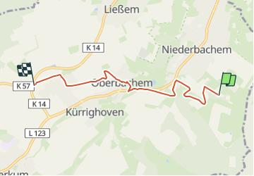

4.3 km | 5.5 km-effort

Tous les sentiers balisés d’Europe GUIDE+


FREE GPS app for hiking
 SityTrail
IGN / Geographical institutes
SityTrail World
The world is yours!
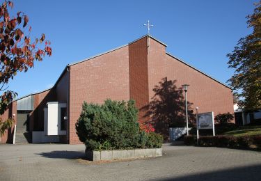
Trail On foot of 4.8 km to be discovered at North Rhine-Westphalia, Rhein-Sieg-Kreis, Wachtberg. This trail is proposed by SityTrail - itinéraires balisés pédestres.
Trail created by Naturpark Rheinland.
ersetzt durch Verbindungswege 10 und 11
Symbol: Schwarzes V in schwarzem Quadrat auf weißem Grund, Text Wachtberg Verbindungsweg


![Trail On foot Unknown - [A12] Marienforst Rundwanderweg - Photo](https://media.geolcdn.com/t/375/260/09c3dfe3-391b-4308-a292-e2e47a5c25e6.jpeg&format=jpg&maxdim=2)
On foot
![Trail On foot Königswinter - [B] Beethoven Wanderweg - Photo](https://media.geolcdn.com/t/375/260/a0531be5-8927-4495-bf61-2ab0d601589a.jpeg&format=jpg&maxdim=2)
On foot

On foot
![Trail On foot Remagen - [4] Oberwinter Rundwanderweg - Photo](https://media.geolcdn.com/t/375/260/e27ef9e9-090e-4d77-ab64-ebc2130b65b2.jpeg&format=jpg&maxdim=2)
On foot
![Trail On foot Remagen - [5] Oberwinter Rundwanderweg - Photo](https://media.geolcdn.com/t/375/260/f5d36974-2dd7-4709-98b7-1c99706d0ead.jpeg&format=jpg&maxdim=2)
On foot
On foot
![Trail On foot Remagen - [1] Oberwinter Wanderweg (Oberwinter - Rolandseck) - Photo](https://media.geolcdn.com/t/375/260/25784967-1970-4af5-8d60-8f5ed7fdcfe9.jpeg&format=jpg&maxdim=2)
On foot
On foot
On foot