![](/images/other/stat-length.png)
![Trail On foot Altenkunstadt - Wanderweg Spiesberg - Photo](https://media.geolcdn.com/t/1900/400/3f262a0c-9ff0-4e67-b429-67add5e69d6e.jpeg&format=pjpeg&maxdim=2)
Wanderweg Spiesberg
SityTrail - itinéraires balisés pédestres
Tous les sentiers balisés d’Europe GUIDE+
![Length](/images/other/stat-length.png)
![Max alt](https://static1.geolcdn.com/siteimages/upload/files/1508320355ic_sort_altitude_max_24dp.png)
![Uphill gradient](https://static1.geolcdn.com/siteimages/upload/files/1508320355ic_sort_den_pos_24dp.png)
![Km-Effort](/images/other/stat-length.png)
![Min alt](https://static1.geolcdn.com/siteimages/upload/files/1508320355ic_sort_altitude_min_24dp.png)
![Downhill gradient](https://static1.geolcdn.com/siteimages/upload/files/1508320355ic_sort_den_neg_24dp.png)
![Boucle](https://static1.geolcdn.com/siteimages/upload/files/16400158638029165_repeat_loop_refresh_sync_direction_icon.png)
![On foot](https://static1.geolcdn.com/sitytour/trail-icons/100.png)
1h40
Difficulty : Easy
![Scan this QR Code to open this trail in the SityTrail application](https://capi.geolives.com/qq0zvz2zws4bq2lad0pu/sitytour/trails/3098249/qr.png?size=200)
FREE GPS app for hiking
About
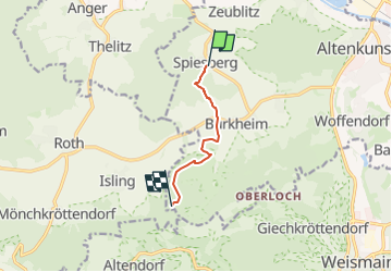
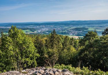
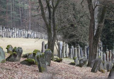
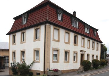
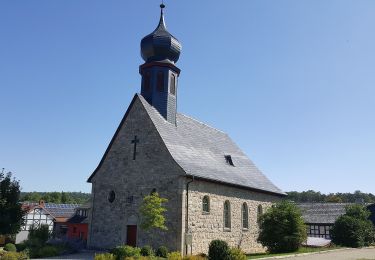
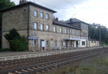
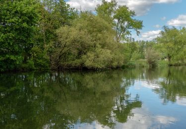
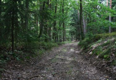
Trail On foot of 4.7 km to be discovered at Bavaria, Landkreis Lichtenfels, Altenkunstadt. This trail is proposed by SityTrail - itinéraires balisés pédestres.
Description
Trail created by Landkreis Lichtenfels.
Derzeit existieren zwei Markierungen: rote 4 auf weißem Grund (alte Wegzeichen) und weiße 4 zwischen zwei Punkten auf rotem Grund (auf den Tafeln und Karten). Künftig soll es wieder einheitlich angeglichen werden: rote 4 auf weißem Grund.
Symbol: Rote 4 auf weißem Hintergrund
Positioning
Comments
Trails nearby
![Trail On foot Weismain - Kordigast Berglauf - Photo](https://media.geolcdn.com/t/375/260/10e893e5-cfed-43ab-93f5-81b7d4660065.jpeg&format=jpg&maxdim=2)
![On foot On foot](https://static1.geolcdn.com/sitytour/trail-icons/100.png)
On foot
![](/images/other/stat-length.png)
![](https://static1.geolcdn.com/siteimages/upload/files/16400158638029165_repeat_loop_refresh_sync_direction_icon.png)
![Trail On foot Weismain - Adolf-Kolping-Gedächtnisweg - Photo](https://media.geolcdn.com/t/375/260/15c09da7-69f4-4b42-be9a-9900731faa43.jpeg&format=jpg&maxdim=2)
![On foot On foot](https://static1.geolcdn.com/sitytour/trail-icons/100.png)
On foot
![](/images/other/stat-length.png)
![](https://static1.geolcdn.com/siteimages/upload/files/16400158638029165_repeat_loop_refresh_sync_direction_icon.png)
![Trail On foot Burgkunstadt - Räuberpfad - Photo](https://media.geolcdn.com/t/375/260/220640e8-8155-4f3d-ba73-c9277146149e.jpeg&format=jpg&maxdim=2)
![On foot On foot](https://static1.geolcdn.com/sitytour/trail-icons/100.png)
On foot
![](/images/other/stat-length.png)
![](https://static1.geolcdn.com/siteimages/upload/files/16400158638029165_repeat_loop_refresh_sync_direction_icon.png)
![Trail On foot Burgkunstadt - Felsensteig - Photo](https://media.geolcdn.com/t/375/260/220640e8-8155-4f3d-ba73-c9277146149e.jpeg&format=jpg&maxdim=2)
![On foot On foot](https://static1.geolcdn.com/sitytour/trail-icons/100.png)
On foot
![](/images/other/stat-length.png)
![](https://static1.geolcdn.com/siteimages/upload/files/16400158638029165_repeat_loop_refresh_sync_direction_icon.png)
![Trail On foot Marktzeuln - Marktzeulner Bergleitenrunde - Photo](https://media.geolcdn.com/t/375/260/5b8039ae-2f57-4278-af8e-9bba7c5db977.jpeg&format=jpg&maxdim=2)
![On foot On foot](https://static1.geolcdn.com/sitytour/trail-icons/100.png)
On foot
![](/images/other/stat-length.png)
![](https://static1.geolcdn.com/siteimages/upload/files/16400158638029165_repeat_loop_refresh_sync_direction_icon.png)
![Trail On foot Hochstadt a.Main - Süd-Ost Querweg - Photo](https://media.geolcdn.com/t/375/260/db17a374-cd30-4a0a-b987-c317bde72313.jpeg&format=jpg&maxdim=2)
![On foot On foot](https://static1.geolcdn.com/sitytour/trail-icons/100.png)
On foot
![](/images/other/stat-length.png)
![](https://static1.geolcdn.com/siteimages/upload/files/16400158638029165_repeat_loop_refresh_sync_direction_icon.png)
![Trail On foot Redwitz a.d.Rodach - Hochstadter Rundweg - Photo](https://media.geolcdn.com/t/375/260/90c1ed2d-a47d-41b7-b9c7-edf3f904247f.jpeg&format=jpg&maxdim=2)
![On foot On foot](https://static1.geolcdn.com/sitytour/trail-icons/100.png)
On foot
![](/images/other/stat-length.png)
![](https://static1.geolcdn.com/siteimages/upload/files/16400158638029165_repeat_loop_refresh_sync_direction_icon.png)
![Trail On foot Burgkunstadt - Strössendorfer Weg/Main-Aussichts-Weg - Photo](https://media.geolcdn.com/t/375/260/552c2082-f543-4232-8006-80ce36b57228.jpeg&format=jpg&maxdim=2)
![On foot On foot](https://static1.geolcdn.com/sitytour/trail-icons/100.png)
On foot
![](/images/other/stat-length.png)
![](https://static1.geolcdn.com/siteimages/upload/files/16400158638029165_repeat_loop_refresh_sync_direction_icon.png)
![Trail On foot Altenkunstadt - Kulmitzberg-Rundweg - Photo](https://media.geolcdn.com/t/375/260/9eb56614-7042-49d3-86be-959e2881b4fc.jpeg&format=jpg&maxdim=2)
![On foot On foot](https://static1.geolcdn.com/sitytour/trail-icons/100.png)
On foot
![](/images/other/stat-length.png)
![](https://static1.geolcdn.com/siteimages/upload/files/16400158638029165_repeat_loop_refresh_sync_direction_icon.png)