![](/images/other/stat-length.png)
![Trail On foot Wissembourg - Grenzland Tour Schweigen-Rechtenbach - Photo](https://media.geolcdn.com/t/1900/400/bd736793-f493-4f0d-8fb5-8a1c3d8aadfb.jpeg&format=pjpeg&maxdim=2)
Grenzland Tour Schweigen-Rechtenbach
SityTrail - itinéraires balisés pédestres
Tous les sentiers balisés d’Europe GUIDE+
![Length](/images/other/stat-length.png)
Length
11.3 km
![Max alt](https://static1.geolcdn.com/siteimages/upload/files/1508320355ic_sort_altitude_max_24dp.png)
Max alt
404 m
![Uphill gradient](https://static1.geolcdn.com/siteimages/upload/files/1508320355ic_sort_den_pos_24dp.png)
Uphill gradient
311 m
![Km-Effort](/images/other/stat-length.png)
Km-Effort
15.5 km
![Min alt](https://static1.geolcdn.com/siteimages/upload/files/1508320355ic_sort_altitude_min_24dp.png)
Min alt
213 m
![Downhill gradient](https://static1.geolcdn.com/siteimages/upload/files/1508320355ic_sort_den_neg_24dp.png)
Downhill gradient
309 m
![Boucle](https://static1.geolcdn.com/siteimages/upload/files/16400158638029165_repeat_loop_refresh_sync_direction_icon.png)
Boucle
Yes
Signpost
Creation date :
2022-02-11 17:18:56.326
Updated on :
2022-03-02 08:29:44.89
![On foot](https://static1.geolcdn.com/sitytour/trail-icons/100.png)
3h30
Difficulty : Easy
![Scan this QR Code to open this trail in the SityTrail application](https://capi.geolives.com/qq0zvz2zws4bq2lad0pu/sitytour/trails/3097691/qr.png?size=200)
FREE GPS app for hiking
About
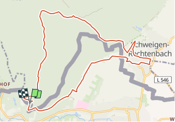
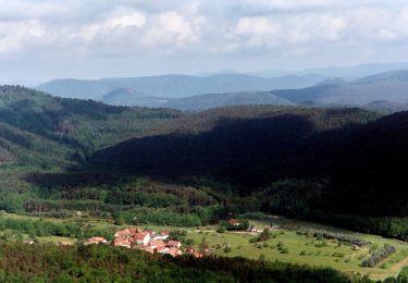
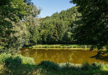
Trail On foot of 11.3 km to be discovered at Grand Est, Bas-Rhin, Wissembourg. This trail is proposed by SityTrail - itinéraires balisés pédestres.
Description
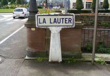
Die Markierung im Gelände stimmt nicht mit dem gpx Track im Internet überein
Symbol: 2 violette Fahnen auf weißem Grund
Positioning
Country:
France
Region :
Grand Est
Department/Province :
Bas-Rhin
Municipality :
Wissembourg
Location:
Unknown
Start:(Dec)
Start:(UTM)
420609 ; 5432659 (32U) N.
Comments
Trails nearby
![Trail On foot Cleebourg - Disque jaune - Photo](https://media.geolcdn.com/t/375/260/e4476995-5782-472a-90f8-979658e5121c.jpeg&format=jpg&maxdim=2)
![On foot On foot](https://static1.geolcdn.com/sitytour/trail-icons/100.png)
![Trail On foot Wissembourg - Rotes Kreuz - Photo](https://media.geolcdn.com/t/375/260/68ad6046-667d-4bda-b0a1-354cff9d940f.jpeg&format=jpg&maxdim=2)
![On foot On foot](https://static1.geolcdn.com/sitytour/trail-icons/100.png)
Rotes Kreuz
On foot
Easy
Wissembourg,
Grand Est,
Bas-Rhin,
France
![](/images/other/stat-length.png)
6.5 km | 9.6 km-effort
2h 11min
![](https://static1.geolcdn.com/siteimages/upload/files/16400158638029165_repeat_loop_refresh_sync_direction_icon.png)
No
![Trail On foot Wissembourg - Disque vert - Photo](https://media.geolcdn.com/t/375/260/99623353-36c3-423c-a751-656a0e168277.jpeg&format=jpg&maxdim=2)
![On foot On foot](https://static1.geolcdn.com/sitytour/trail-icons/100.png)
Disque vert
On foot
Easy
Wissembourg,
Grand Est,
Bas-Rhin,
France
![](/images/other/stat-length.png)
8.9 km | 12.9 km-effort
2h 56min
![](https://static1.geolcdn.com/siteimages/upload/files/16400158638029165_repeat_loop_refresh_sync_direction_icon.png)
No
![Trail On foot Wissembourg - Anneau rouge - Photo](https://media.geolcdn.com/t/375/260/55a6a0a6-0f10-4437-aabb-c766882fbdd8.jpeg&format=jpg&maxdim=2)
![On foot On foot](https://static1.geolcdn.com/sitytour/trail-icons/100.png)
Anneau rouge
On foot
Easy
Wissembourg,
Grand Est,
Bas-Rhin,
France
![](/images/other/stat-length.png)
7.4 km | 9.6 km-effort
2h 11min
![](https://static1.geolcdn.com/siteimages/upload/files/16400158638029165_repeat_loop_refresh_sync_direction_icon.png)
Yes
![Trail On foot Wissembourg - Anneau vert - Photo](https://media.geolcdn.com/t/375/260/899751ba-5eaf-46ca-aeea-7f1e26b78d37.jpeg&format=jpg&maxdim=2)
![On foot On foot](https://static1.geolcdn.com/sitytour/trail-icons/100.png)
Anneau vert
On foot
Easy
Wissembourg,
Grand Est,
Bas-Rhin,
France
![](/images/other/stat-length.png)
13.5 km | 18.3 km-effort
4h 9min
![](https://static1.geolcdn.com/siteimages/upload/files/16400158638029165_repeat_loop_refresh_sync_direction_icon.png)
Yes
![Trail On foot Bobenthal - Hasenkopf-Runde - Photo](https://media.geolcdn.com/t/375/260/d8f83b19-46fe-4f0b-af1d-c304a05750ef.jpeg&format=jpg&maxdim=2)
![On foot On foot](https://static1.geolcdn.com/sitytour/trail-icons/100.png)
Hasenkopf-Runde
On foot
Easy
Bobenthal,
Rhineland-Palatinate,
Südwestpfalz,
Germany
![](/images/other/stat-length.png)
7.9 km | 10.9 km-effort
2h 28min
![](https://static1.geolcdn.com/siteimages/upload/files/16400158638029165_repeat_loop_refresh_sync_direction_icon.png)
No
![Trail On foot Bobenthal - Hirzeck-Gipfel-Steig - Photo](https://media.geolcdn.com/t/375/260/fff086e2-3060-4491-a9c2-5e848399b322.jpeg&format=jpg&maxdim=2)
![On foot On foot](https://static1.geolcdn.com/sitytour/trail-icons/100.png)
Hirzeck-Gipfel-Steig
On foot
Easy
Bobenthal,
Rhineland-Palatinate,
Südwestpfalz,
Germany
![](/images/other/stat-length.png)
14.1 km | 19.3 km-effort
4h 22min
![](https://static1.geolcdn.com/siteimages/upload/files/16400158638029165_repeat_loop_refresh_sync_direction_icon.png)
Yes
![Trail On foot Dörrenbach - Weg der Aussichten, Dörrenbach - Photo](https://media.geolcdn.com/t/375/260/ef1a6a3b-6757-4ea4-a794-b6e50608a517.jpeg&format=jpg&maxdim=2)
![On foot On foot](https://static1.geolcdn.com/sitytour/trail-icons/100.png)
Weg der Aussichten, Dörrenbach
On foot
Easy
Dörrenbach,
Rhineland-Palatinate,
Landkreis Südliche Weinstraße,
Germany
![](/images/other/stat-length.png)
5.3 km | 7.9 km-effort
1h 47min
![](https://static1.geolcdn.com/siteimages/upload/files/16400158638029165_repeat_loop_refresh_sync_direction_icon.png)
No
![Trail On foot Schweigen-Rechtenbach - Rund ums Steinbühl Schweigen-Rechtenbach - Photo](https://media.geolcdn.com/t/375/260/918f5ff8-7ace-428c-9e42-3f204543353a.jpeg&format=jpg&maxdim=2)
![On foot On foot](https://static1.geolcdn.com/sitytour/trail-icons/100.png)
Rund ums Steinbühl Schweigen-Rechtenbach
On foot
Easy
Schweigen-Rechtenbach,
Rhineland-Palatinate,
Landkreis Südliche Weinstraße,
Germany
![](/images/other/stat-length.png)
7.8 km | 11.1 km-effort
2h 31min
![](https://static1.geolcdn.com/siteimages/upload/files/16400158638029165_repeat_loop_refresh_sync_direction_icon.png)
No