![](/images/other/stat-length.png)
![Trail On foot Marloffstein - Berg & Talpfad - Photo](https://media.geolcdn.com/t/1900/400/0d4ced9c-0240-4646-a9bb-3ad2a492dab7.jpeg&format=pjpeg&maxdim=2)
Berg & Talpfad
SityTrail - itinéraires balisés pédestres
Tous les sentiers balisés d’Europe GUIDE+
![Length](/images/other/stat-length.png)
Length
17.4 km
![Max alt](https://static1.geolcdn.com/siteimages/upload/files/1508320355ic_sort_altitude_max_24dp.png)
Max alt
392 m
![Uphill gradient](https://static1.geolcdn.com/siteimages/upload/files/1508320355ic_sort_den_pos_24dp.png)
Uphill gradient
295 m
![Km-Effort](/images/other/stat-length.png)
Km-Effort
21 km
![Min alt](https://static1.geolcdn.com/siteimages/upload/files/1508320355ic_sort_altitude_min_24dp.png)
Min alt
281 m
![Downhill gradient](https://static1.geolcdn.com/siteimages/upload/files/1508320355ic_sort_den_neg_24dp.png)
Downhill gradient
281 m
![Boucle](https://static1.geolcdn.com/siteimages/upload/files/16400158638029165_repeat_loop_refresh_sync_direction_icon.png)
Boucle
Yes
Signpost
Creation date :
2022-02-11 17:09:12.483
Updated on :
2022-02-11 17:09:12.483
![On foot](https://static1.geolcdn.com/sitytour/trail-icons/100.png)
4h50
Difficulty : Medium
![Scan this QR Code to open this trail in the SityTrail application](https://capi.geolives.com/qq0zvz2zws4bq2lad0pu/sitytour/trails/3097402/qr.png?size=200)
FREE GPS app for hiking
About
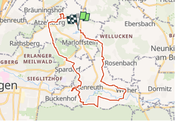
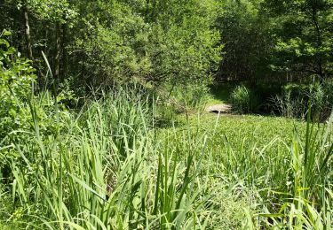
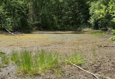
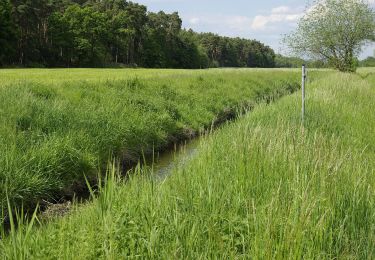
Trail On foot of 17.4 km to be discovered at Bavaria, Landkreis Erlangen-Höchstadt, Marloffstein. This trail is proposed by SityTrail - itinéraires balisés pédestres.
Description
Name steht so auf den Schildern.
Symbol: Vier bunte Kreise auf weißem Hintergrund (Logo VG Uttenreuth)
Positioning
Country:
Germany
Region :
Bavaria
Department/Province :
Landkreis Erlangen-Höchstadt
Municipality :
Marloffstein
Location:
Unknown
Start:(Dec)
Start:(UTM)
649007 ; 5498889 (32U) N.
Comments
Trails nearby
![Trail On foot - Erlangen-Steudach - Photo](https://media.geolcdn.com/t/375/260/326b0b59-d310-4208-b907-9fdb0ba2140b.jpeg&format=jpg&maxdim=2)
![On foot On foot](https://static1.geolcdn.com/sitytour/trail-icons/100.png)
![Trail On foot Baiersdorf - Meerrettichweg - Photo](https://media.geolcdn.com/t/375/260/92896cfd-f5cd-48c4-b2fd-c760b6de8ffd.jpeg&format=jpg&maxdim=2)
![On foot On foot](https://static1.geolcdn.com/sitytour/trail-icons/100.png)
Meerrettichweg
On foot
Easy
Baiersdorf,
Bavaria,
Landkreis Erlangen-Höchstadt,
Germany
![](/images/other/stat-length.png)
9.5 km | 10.8 km-effort
2h 27min
![](https://static1.geolcdn.com/siteimages/upload/files/16400158638029165_repeat_loop_refresh_sync_direction_icon.png)
No
![Trail On foot Bubenreuth - Hochwasserweg - Photo](https://media.geolcdn.com/t/375/260/0d4ced9c-0240-4646-a9bb-3ad2a492dab7.jpeg&format=jpg&maxdim=2)
![On foot On foot](https://static1.geolcdn.com/sitytour/trail-icons/100.png)
Hochwasserweg
On foot
Easy
Bubenreuth,
Bavaria,
Landkreis Erlangen-Höchstadt,
Germany
![](/images/other/stat-length.png)
7.6 km | 9.7 km-effort
2h 11min
![](https://static1.geolcdn.com/siteimages/upload/files/16400158638029165_repeat_loop_refresh_sync_direction_icon.png)
Yes
![Trail On foot Buckenhofer Forst - Kreuzeiche Trail - Photo](https://media.geolcdn.com/t/375/260/b4b6bb74-7819-4b5c-9ec1-7ba33dbaf327.jpeg&format=jpg&maxdim=2)
![On foot On foot](https://static1.geolcdn.com/sitytour/trail-icons/100.png)
Kreuzeiche Trail
On foot
Easy
Buckenhofer Forst,
Bavaria,
Landkreis Erlangen-Höchstadt,
Germany
![](/images/other/stat-length.png)
5.3 km | 5.9 km-effort
1h 20min
![](https://static1.geolcdn.com/siteimages/upload/files/16400158638029165_repeat_loop_refresh_sync_direction_icon.png)
Yes
![Trail On foot Buckenhofer Forst - Hirschlecke Trail - Photo](https://media.geolcdn.com/t/375/260/b4b6bb74-7819-4b5c-9ec1-7ba33dbaf327.jpeg&format=jpg&maxdim=2)
![On foot On foot](https://static1.geolcdn.com/sitytour/trail-icons/100.png)
Hirschlecke Trail
On foot
Easy
Buckenhofer Forst,
Bavaria,
Landkreis Erlangen-Höchstadt,
Germany
![](/images/other/stat-length.png)
5.3 km | 5.8 km-effort
1h 19min
![](https://static1.geolcdn.com/siteimages/upload/files/16400158638029165_repeat_loop_refresh_sync_direction_icon.png)
Yes
![Trail On foot - Zigeunereck Trail - Photo](https://media.geolcdn.com/t/375/260/2d289e07-5fb0-4f85-a06b-129887d0ae8b.jpeg&format=jpg&maxdim=2)
![On foot On foot](https://static1.geolcdn.com/sitytour/trail-icons/100.png)
![Trail On foot Möhrendorf - Wanderweg Südlicher Möhrendorfer Rundweg - Photo](https://media.geolcdn.com/t/375/260/ea22ba3f-a9ef-4aa3-9503-4a65b8526407.jpeg&format=jpg&maxdim=2)
![On foot On foot](https://static1.geolcdn.com/sitytour/trail-icons/100.png)
Wanderweg Südlicher Möhrendorfer Rundweg
On foot
Easy
Möhrendorf,
Bavaria,
Landkreis Erlangen-Höchstadt,
Germany
![](/images/other/stat-length.png)
7.4 km | 8.2 km-effort
1h 52min
![](https://static1.geolcdn.com/siteimages/upload/files/16400158638029165_repeat_loop_refresh_sync_direction_icon.png)
Yes
![Trail On foot Möhrendorf - Wanderweg Nördlicher Möhrendorfer Rundweg - Photo](https://media.geolcdn.com/t/375/260/e180760a-0888-4e24-92e4-d287ef34491e.jpeg&format=jpg&maxdim=2)
![On foot On foot](https://static1.geolcdn.com/sitytour/trail-icons/100.png)
Wanderweg Nördlicher Möhrendorfer Rundweg
On foot
Easy
Möhrendorf,
Bavaria,
Landkreis Erlangen-Höchstadt,
Germany
![](/images/other/stat-length.png)
8.1 km | 9.7 km-effort
2h 12min
![](https://static1.geolcdn.com/siteimages/upload/files/16400158638029165_repeat_loop_refresh_sync_direction_icon.png)
Yes
![Trail On foot - DAK-Eisert-Nordic Walking Parcour - Photo](https://media.geolcdn.com/t/375/260/83bb39d6-d712-4c37-9cdf-22ccc440f885.jpeg&format=jpg&maxdim=2)
![On foot On foot](https://static1.geolcdn.com/sitytour/trail-icons/100.png)
DAK-Eisert-Nordic Walking Parcour
On foot
Easy
,
Bavaria,
Erlangen,
Germany
![](/images/other/stat-length.png)
10.9 km | 14.1 km-effort
3h 12min
![](https://static1.geolcdn.com/siteimages/upload/files/16400158638029165_repeat_loop_refresh_sync_direction_icon.png)
Yes