


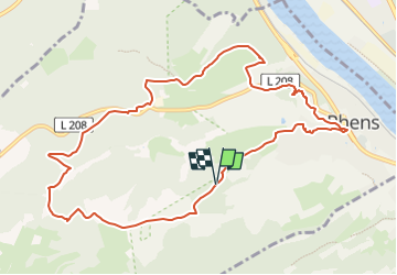

4.2 km | 6 km-effort

Tous les sentiers balisés d’Europe GUIDE+


FREE GPS app for hiking
 SityTrail
IGN / Geographical institutes
SityTrail World
The world is yours!
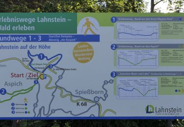
Trail On foot of 10.3 km to be discovered at Rhineland-Palatinate, Landkreis Mayen-Koblenz, Rhens. This trail is proposed by SityTrail - itinéraires balisés pédestres.
Der Traumpfad Wolfsdelle führt Sie auf historischen Supren ab Koblenz, Mayen, Bendorf zum Königsstuhl mit Ausblicken ins Rheintal, den Hunsrück und Taunus.
Website: https://www.traumpfade.info/traumpfade-rhein-mosel-eifel/rhein/wolfsdelle/


On foot
On foot
On foot
On foot
On foot

On foot
On foot
On foot
On foot