Trail On foot Hirschau - Verbindungsweg Monte - Kalvarienberg - Photo

Verbindungsweg Monte - Kalvarienberg

Tous les sentiers balisés d’Europe PRO

© OpenStreetMap contributors
Length
Length
3.4 km
Max alt
Max alt
463 m
Uphill gradient
Uphill gradient
40 m
Km-Effort
Km-Effort  
4 km
Min alt
Min alt
407 m
Downhill gradient
Downhill gradient
65 m
Boucle
Boucle
No
Signpost
Signpost
Creation date :
2022-02-11 16:25:23.889
Updated on :
2022-02-11 16:25:23.889

(0 Reviews)

On foot
On foot
54m
Difficulty : Easy

Scan this QR Code to open this trail in the SityTrail application

FREE GPS app for hiking

Logo SityTrail SityTrail

IGN / Geographical institutes

Download SityTrail from the App Store Download SityTrail from Google Play

Logo SityTrail SityTrail World

The world is yours!

Download SityTrail from the App Store Download SityTrail from Google Play Download SityTrail on Huawei AppGallery

About

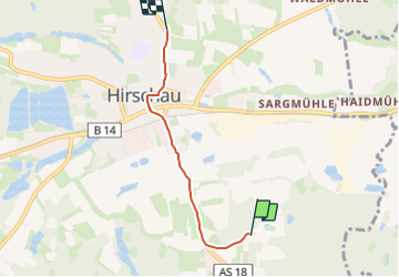
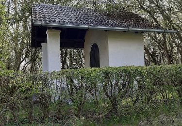
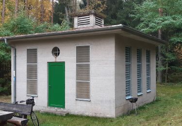
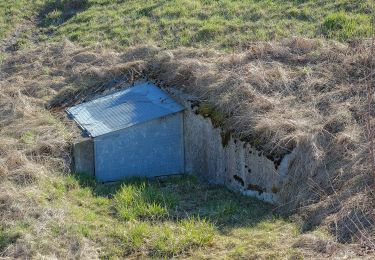
Trail On foot of 3.4 km to be discovered at Bavaria, Landkreis Amberg-Sulzbach, Hirschau. This trail is proposed by SityTrail - itinéraires balisés pédestres.

Description

Symbol: drei senkrechte Striche in der Folge "Rot-Weiß-Blau"

Photos

Positioning

Country:
Germany
Region :
Bavaria
Department/Province :
Landkreis Amberg-Sulzbach
Municipality :
Hirschau
Location:
Unknown
Start:(UTM)
714403 ; 5490637 (32U) N.

Trails nearby

Trail On foot Schnaittenbach - Bernsteinweg - Photo
On foot
PRO

On foot

Easy
Schnaittenbach, Bavaria, Landkreis Amberg-Sulzbach, Germany
10.7 km | 14.6 km-effort
3h 19min
Yes
Trail On foot Schnaittenbach - Rundwanderweg Buchberg - Photo
On foot
PRO

On foot

Easy
Schnaittenbach, Bavaria, Landkreis Amberg-Sulzbach, Germany
6.6 km | 9.1 km-effort
2h 3min
Yes
Trail On foot Hirschau - GeoPark Kaolinrevier Hirschau - Schnaittenbach - Photo
On foot
PRO

On foot

Easy
Hirschau, Bavaria, Landkreis Amberg-Sulzbach, Germany
5.1 km | 6.5 km-effort
1h 28min
No
Trail On foot Hirschau - 3_Gipfel_Weg - Photo
On foot
PRO

On foot

Easy
Hirschau, Bavaria, Landkreis Amberg-Sulzbach, Germany
12.6 km | 16.9 km-effort
3h 50min
Yes
Trail On foot Hirschau - Hirschauer Turmweg - Photo
On foot
PRO

On foot

Medium
Hirschau, Bavaria, Landkreis Amberg-Sulzbach, Germany
16.7 km | 22 km-effort
5h 0min
Yes
Trail On foot Hirschau - Buchberghüttenweg - Photo
On foot
PRO

On foot

Easy
Hirschau, Bavaria, Landkreis Amberg-Sulzbach, Germany
4.9 km | 7.3 km-effort
1h 38min
No
Trail On foot Hirschau - Rundwanderweg Hirschau - Schnaittenbach - Photo
On foot
PRO

On foot

Easy
Hirschau, Bavaria, Landkreis Amberg-Sulzbach, Germany
10.9 km | 13.5 km-effort
3h 4min
Yes
Trail On foot Hirschau - Hölzlmühlweg - Photo
On foot
PRO

On foot

Easy
Hirschau, Bavaria, Landkreis Amberg-Sulzbach, Germany
6.3 km | 8.6 km-effort
1h 57min
No
Trail On foot Schnaittenbach - Wanderroute Buchbergweg - Photo
On foot
PRO

On foot

Easy
Schnaittenbach, Bavaria, Landkreis Amberg-Sulzbach, Germany
12.6 km | 14.2 km-effort
3h 13min
No


Close
My subscriptions