Trail On foot Hatzenport - Hatzenporter Laysteig - Photo

Tous les sentiers balisés d’Europe PRO

© OpenStreetMap contributors
Length
Length
12 km
Max alt
Max alt
266 m
Uphill gradient
Uphill gradient
400 m
Km-Effort
Km-Effort  
17.3 km
Min alt
Min alt
82 m
Downhill gradient
Downhill gradient
402 m
Boucle
Boucle
Yes
Signpost
Signpost
Creation date :
2022-02-11 16:08:40.291
Updated on :
2022-02-11 16:08:40.291

(0 Reviews)

On foot
On foot
3h55
Difficulty : Easy

Scan this QR Code to open this trail in the SityTrail application

FREE GPS app for hiking

Logo SityTrail SityTrail

IGN / Geographical institutes

Download SityTrail from the App Store Download SityTrail from Google Play

Logo SityTrail SityTrail World

The world is yours!

Download SityTrail from the App Store Download SityTrail from Google Play Download SityTrail on Huawei AppGallery

About

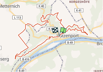
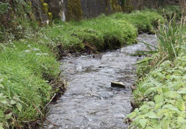
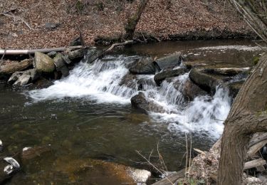
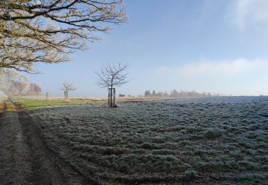
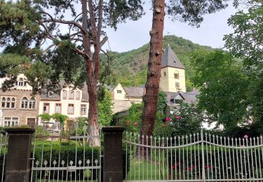
Trail On foot of 12 km to be discovered at Rhineland-Palatinate, Landkreis Mayen-Koblenz, Hatzenport. This trail is proposed by SityTrail - itinéraires balisés pédestres.

Description

Trail created by Projektbüro Traumpfade der Rhein-Mosel-Eifel-Touristik.

Symbol: Orangener Hintergrund mit weißem Weg - Traumpfade

Photos

Positioning

Country:
Germany
Region :
Rhineland-Palatinate
Department/Province :
Landkreis Mayen-Koblenz
Municipality :
Hatzenport
Location:
Unknown
Start:(UTM)
386780 ; 5565144 (32U) N.

Trails nearby

Trail On foot Löf - Traumpfädchen Löfer Rabenlaypfad - Photo
On foot
PRO

On foot

Easy
Löf, Rhineland-Palatinate, Landkreis Mayen-Koblenz, Germany
4.7 km | 6.7 km-effort
1h 30min
Yes
Trail On foot Burgen - Forellenweg - Photo
On foot
PRO

On foot

Easy
Burgen, Rhineland-Palatinate, Landkreis Mayen-Koblenz, Germany
11.5 km | 15.7 km-effort
3h 33min
Yes
Trail On foot Alken - Bergschluchtenpfad Ehrenburg - Photo
On foot
PRO

On foot

Easy
Alken, Rhineland-Palatinate, Landkreis Mayen-Koblenz, Germany
7.9 km | 10.5 km-effort
2h 23min
No
Trail On foot Oberfell - Bleidenberger Ausblicke - Photo
On foot
PRO

On foot

Easy
Oberfell, Rhineland-Palatinate, Landkreis Mayen-Koblenz, Germany
12.8 km | 19.5 km-effort
4h 25min
Yes
Trail On foot Boppard - Traumschleife Ehrbachklamm - Photo
On foot
PRO

On foot

Easy
Boppard, Rhineland-Palatinate, Rhein-Hunsrück-Kreis, Germany
8.7 km | 12.6 km-effort
2h 51min
Yes
Trail On foot Morshausen - Traumschleife Murscher Eselsche - Photo
On foot
PRO

On foot

Easy
Morshausen, Rhineland-Palatinate, Rhein-Hunsrück-Kreis, Germany
10.8 km | 15.1 km-effort
3h 25min
Yes
Trail On foot Boppard - Traumschleife Ehrbachklamm+ - Photo
On foot
PRO

On foot

Medium
Boppard, Rhineland-Palatinate, Rhein-Hunsrück-Kreis, Germany
15.4 km | 22 km-effort
4h 53min
Yes
Trail Walking Wierschem - Burg Eltz (Germany) - Photo
Walking
BruChan

Walking

Medium
Wierschem, Rhineland-Palatinate, Landkreis Mayen-Koblenz, Germany
12.5 km | 17.2 km-effort
3h 0min
Yes


Close
My subscriptions