![](/images/other/stat-length.png)
![Trail On foot Bühren - Rundwanderweg Bühren 1 - Photo](https://media.geolcdn.com/t/1900/400/eb356813-a50b-42b7-9671-04cc8b7206d8.jpeg&format=pjpeg&maxdim=2)
Rundwanderweg Bühren 1
SityTrail - itinéraires balisés pédestres
Tous les sentiers balisés d’Europe GUIDE+
![Length](/images/other/stat-length.png)
Length
12.1 km
![Max alt](https://static1.geolcdn.com/siteimages/upload/files/1508320355ic_sort_altitude_max_24dp.png)
Max alt
391 m
![Uphill gradient](https://static1.geolcdn.com/siteimages/upload/files/1508320355ic_sort_den_pos_24dp.png)
Uphill gradient
190 m
![Km-Effort](/images/other/stat-length.png)
Km-Effort
14.6 km
![Min alt](https://static1.geolcdn.com/siteimages/upload/files/1508320355ic_sort_altitude_min_24dp.png)
Min alt
279 m
![Downhill gradient](https://static1.geolcdn.com/siteimages/upload/files/1508320355ic_sort_den_neg_24dp.png)
Downhill gradient
192 m
![Boucle](https://static1.geolcdn.com/siteimages/upload/files/16400158638029165_repeat_loop_refresh_sync_direction_icon.png)
Boucle
Yes
Signpost
Creation date :
2022-02-11 16:04:13.593
Updated on :
2022-02-11 16:04:13.593
![On foot](https://static1.geolcdn.com/sitytour/trail-icons/100.png)
3h19
Difficulty : Easy
![Scan this QR Code to open this trail in the SityTrail application](https://capi.geolives.com/qq0zvz2zws4bq2lad0pu/sitytour/trails/3095699/qr.png?size=200)
FREE GPS app for hiking
About
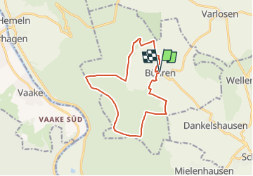
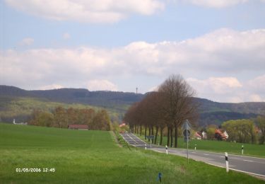
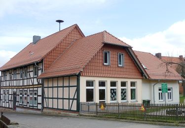
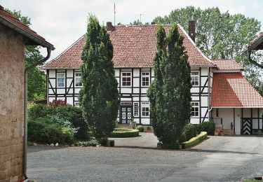
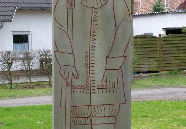
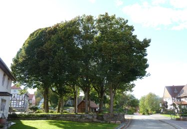
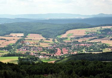
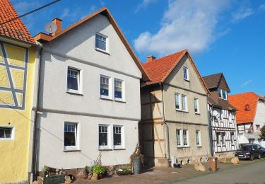
Trail On foot of 12.1 km to be discovered at Lower Saxony, Landkreis Göttingen, Bühren. This trail is proposed by SityTrail - itinéraires balisés pédestres.
Description
Trail created by Naturpark Münden.
Symbol: B1 im Kreis (gelb)
Website: http://buehren.wtulo.de/Wandern/Wandern1a.htm
Positioning
Country:
Germany
Region :
Lower Saxony
Department/Province :
Landkreis Göttingen
Municipality :
Bühren
Location:
Unknown
Start:(Dec)
Start:(UTM)
547206 ; 5703958 (32U) N.
Comments
Trails nearby
![Trail On foot Scheden - Rundwanderweg Scheden 3 - Photo](https://media.geolcdn.com/t/375/260/5262257f-e389-4fa5-81db-15efcab30e54.jpeg&format=jpg&maxdim=2)
![On foot On foot](https://static1.geolcdn.com/sitytour/trail-icons/100.png)
Rundwanderweg Scheden 3
On foot
Easy
Scheden,
Lower Saxony,
Landkreis Göttingen,
Germany
![](/images/other/stat-length.png)
4.6 km | 6.4 km-effort
1h 27min
![](https://static1.geolcdn.com/siteimages/upload/files/16400158638029165_repeat_loop_refresh_sync_direction_icon.png)
Yes
![Trail On foot Scheden - Rundwanderweg Scheden 5 - Photo](https://media.geolcdn.com/t/375/260/e23a2a6e-41e7-4465-ac7f-36da71a695b8.jpeg&format=jpg&maxdim=2)
![On foot On foot](https://static1.geolcdn.com/sitytour/trail-icons/100.png)
Rundwanderweg Scheden 5
On foot
Easy
Scheden,
Lower Saxony,
Landkreis Göttingen,
Germany
![](/images/other/stat-length.png)
5.4 km | 6.5 km-effort
1h 29min
![](https://static1.geolcdn.com/siteimages/upload/files/16400158638029165_repeat_loop_refresh_sync_direction_icon.png)
Yes
![Trail On foot Scheden - Rundwanderweg Scheden 4 - Photo](https://media.geolcdn.com/t/375/260/62c37f2a-e9e7-45d9-bbfd-78806fb40325.jpeg&format=jpg&maxdim=2)
![On foot On foot](https://static1.geolcdn.com/sitytour/trail-icons/100.png)
Rundwanderweg Scheden 4
On foot
Easy
Scheden,
Lower Saxony,
Landkreis Göttingen,
Germany
![](/images/other/stat-length.png)
3.9 km | 4.6 km-effort
1h 2min
![](https://static1.geolcdn.com/siteimages/upload/files/16400158638029165_repeat_loop_refresh_sync_direction_icon.png)
Yes
![Trail On foot Scheden - Rundwanderweg Scheden 8 - Photo](https://media.geolcdn.com/t/375/260/9d7b726b-cdcc-4119-94df-54b2618a4218.jpeg&format=jpg&maxdim=2)
![On foot On foot](https://static1.geolcdn.com/sitytour/trail-icons/100.png)
Rundwanderweg Scheden 8
On foot
Easy
Scheden,
Lower Saxony,
Landkreis Göttingen,
Germany
![](/images/other/stat-length.png)
5.9 km | 7.5 km-effort
1h 42min
![](https://static1.geolcdn.com/siteimages/upload/files/16400158638029165_repeat_loop_refresh_sync_direction_icon.png)
Yes
![Trail On foot Niemetal - Rundwanderweg Niemetal 4 - Photo](https://media.geolcdn.com/t/375/260/cc2f110b-d89e-493a-bfda-f7ab43ef2f6e.jpeg&format=jpg&maxdim=2)
![On foot On foot](https://static1.geolcdn.com/sitytour/trail-icons/100.png)
Rundwanderweg Niemetal 4
On foot
Easy
Niemetal,
Lower Saxony,
Landkreis Göttingen,
Germany
![](/images/other/stat-length.png)
3.9 km | 4.6 km-effort
1h 2min
![](https://static1.geolcdn.com/siteimages/upload/files/16400158638029165_repeat_loop_refresh_sync_direction_icon.png)
Yes
![Trail On foot Niemetal - Rundwanderweg Niemetal 1 - Photo](https://media.geolcdn.com/t/375/260/7a39ca32-e833-43a2-93fa-5696d4b0d995.jpeg&format=jpg&maxdim=2)
![On foot On foot](https://static1.geolcdn.com/sitytour/trail-icons/100.png)
Rundwanderweg Niemetal 1
On foot
Easy
Niemetal,
Lower Saxony,
Landkreis Göttingen,
Germany
![](/images/other/stat-length.png)
3.7 km | 4.2 km-effort
57min
![](https://static1.geolcdn.com/siteimages/upload/files/16400158638029165_repeat_loop_refresh_sync_direction_icon.png)
Yes
![Trail On foot Bühren - Rundwanderweg Bühren 2 - Photo](https://media.geolcdn.com/t/375/260/85935a5e-a641-4e13-bc9b-cf033c4fd17c.jpeg&format=jpg&maxdim=2)
![On foot On foot](https://static1.geolcdn.com/sitytour/trail-icons/100.png)
Rundwanderweg Bühren 2
On foot
Easy
Bühren,
Lower Saxony,
Landkreis Göttingen,
Germany
![](/images/other/stat-length.png)
5.9 km | 7.2 km-effort
1h 38min
![](https://static1.geolcdn.com/siteimages/upload/files/16400158638029165_repeat_loop_refresh_sync_direction_icon.png)
Yes
![Trail On foot Dransfeld - Rundwanderweg Dransfeld 2 - Photo](https://media.geolcdn.com/t/375/260/58140faa-f43f-42ba-81e1-357ef8fc70df.jpeg&format=jpg&maxdim=2)
![On foot On foot](https://static1.geolcdn.com/sitytour/trail-icons/100.png)
Rundwanderweg Dransfeld 2
On foot
Easy
Dransfeld,
Lower Saxony,
Landkreis Göttingen,
Germany
![](/images/other/stat-length.png)
7.9 km | 11 km-effort
2h 30min
![](https://static1.geolcdn.com/siteimages/upload/files/16400158638029165_repeat_loop_refresh_sync_direction_icon.png)
Yes
![Trail On foot Reinhardshagen - Vaake - Schneidersbaum - Photo](https://media.geolcdn.com/t/375/260/69d8cabd-94c3-41d8-bb0f-f2d497fc18ab.jpeg&format=jpg&maxdim=2)
![On foot On foot](https://static1.geolcdn.com/sitytour/trail-icons/100.png)
Vaake - Schneidersbaum
On foot
Easy
Reinhardshagen,
Hesse,
Landkreis Kassel,
Germany
![](/images/other/stat-length.png)
6.5 km | 9.7 km-effort
2h 12min
![](https://static1.geolcdn.com/siteimages/upload/files/16400158638029165_repeat_loop_refresh_sync_direction_icon.png)
No