Trail On foot Wermelskirchen - Talsperrenweg - Photo

Tous les sentiers balisés d’Europe PRO

© OpenStreetMap contributors
Length
Length
15.5 km
Max alt
Max alt
261 m
Uphill gradient
Uphill gradient
305 m
Km-Effort
Km-Effort  
19.6 km
Min alt
Min alt
181 m
Downhill gradient
Downhill gradient
307 m
Boucle
Boucle
No
Signpost
Signpost
Creation date :
2022-02-11 15:45:58.776
Updated on :
2022-02-11 15:45:58.776

(0 Reviews)

On foot
On foot
4h27
Difficulty : Easy

Scan this QR Code to open this trail in the SityTrail application

FREE GPS app for hiking

Logo SityTrail SityTrail

IGN / Geographical institutes

Download SityTrail from the App Store Download SityTrail from Google Play

Logo SityTrail SityTrail World

The world is yours!

Download SityTrail from the App Store Download SityTrail from Google Play Download SityTrail on Huawei AppGallery

About

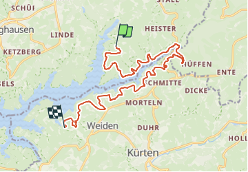
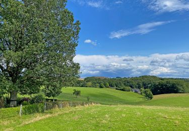
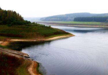
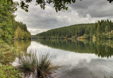
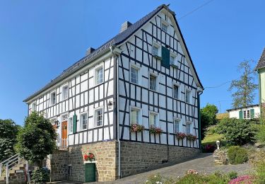
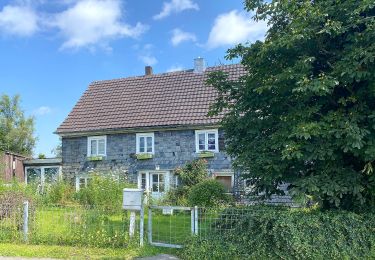
Trail On foot of 15.5 km to be discovered at North Rhine-Westphalia, Rheinisch-Bergischer Kreis, Wermelskirchen. This trail is proposed by SityTrail - itinéraires balisés pédestres.

Description

Trail created by Sauerländischer Gebirgsverein Bergisches Land.

Symbol: Stilisierter weißer Bogen und Schriftzug “dhünn” auf blauem Untergrund


Website: https://www.wermelskirchen.de/fileadmin/user_upload/Dokumente/Tourismus/Dhuennhochflaeche_Talsperrenweg.pdf

Photos

Positioning

Country:
Germany
Region :
North Rhine-Westphalia
Department/Province :
Rheinisch-Bergischer Kreis
Municipality :
Wermelskirchen
Location:
Unknown
Start:(UTM)
377287 ; 5660993 (32U) N.

Trails nearby

Trail On foot Kürten - Denkmalweg Olpe - Photo
On foot
PRO

On foot

Easy
Kürten, North Rhine-Westphalia, Rheinisch-Bergischer Kreis, Germany
7 km | 8.9 km-effort
2h 1min
Yes
Trail On foot Odenthal - D8 - Über den Bömberg - Photo
On foot
PRO

On foot

Easy
Odenthal, North Rhine-Westphalia, Rheinisch-Bergischer Kreis, Germany
4.6 km | 5.8 km-effort
1h 18min
Yes
Trail On foot Wermelskirchen - D4 - Naturwelten - Photo
On foot
PRO

On foot

Easy
Wermelskirchen, North Rhine-Westphalia, Rheinisch-Bergischer Kreis, Germany
5 km | 7 km-effort
1h 35min
Yes
Trail On foot Wermelskirchen - D3 - Kirchweg - Photo
On foot
PRO

On foot

Easy
Wermelskirchen, North Rhine-Westphalia, Rheinisch-Bergischer Kreis, Germany
9.4 km | 12 km-effort
2h 43min
Yes
Trail On foot Kürten - D5 - Dunkle Wälder, sonnige Höhen - Photo
On foot
PRO

On foot

Easy
Kürten, North Rhine-Westphalia, Rheinisch-Bergischer Kreis, Germany
3.7 km | 4.8 km-effort
1h 4min
Yes
Trail On foot Wermelskirchen - unverDHÜNNt 2 - Photo
On foot
PRO

On foot

Easy
Wermelskirchen, North Rhine-Westphalia, Rheinisch-Bergischer Kreis, Germany
11.8 km | 14.8 km-effort
3h 22min
Yes
Trail On foot Kürten - Mühlenweg - Photo
On foot
PRO

On foot

Easy
Kürten, North Rhine-Westphalia, Rheinisch-Bergischer Kreis, Germany
4.9 km | 6.4 km-effort
1h 27min
No
Trail On foot Wermelskirchen - Dhünn Rundweg A1 - Photo
On foot
PRO

On foot

Easy
Wermelskirchen, North Rhine-Westphalia, Rheinisch-Bergischer Kreis, Germany
6.7 km | 9 km-effort
2h 3min
Yes
Trail On foot Wermelskirchen - Habenichts Rundweg A3 - Photo
On foot
PRO

On foot

Easy
Wermelskirchen, North Rhine-Westphalia, Rheinisch-Bergischer Kreis, Germany
5.3 km | 6.9 km-effort
1h 34min
No


Close
My subscriptions