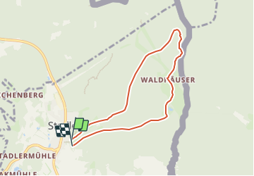
Trail On foot Stadlern - 432 Goldbrunnenweg - Photo

Tous les sentiers balisés d’Europe GUIDE+

© OpenStreetMap contributors
Length
Length
6.4 km
Max alt
Max alt
807 m
Uphill gradient
Uphill gradient
209 m
Km-Effort
Km-Effort  
9.2 km
Min alt
Min alt
622 m
Downhill gradient
Downhill gradient
218 m
Boucle
Boucle
Yes
Signpost
Signpost
Creation date :
2022-02-11 15:14:40.163
Updated on :
2022-02-11 15:14:40.163

(0 Reviews)

On foot
On foot
2h06
Difficulty : Easy

Scan this QR Code to open this trail in the SityTrail application

FREE GPS app for hiking

Logo SityTrail SityTrail

IGN / Geographical institutes

Download SityTrail from the App Store Download SityTrail from Google Play

Logo SityTrail SityTrail World

The world is yours!

Download SityTrail from the App Store Download SityTrail from Google Play Download SityTrail on Huawei AppGallery

About

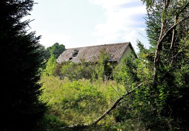
Trail On foot of 6.4 km to be discovered at Bavaria, Landkreis Schwandorf, Stadlern. This trail is proposed by SityTrail - itinéraires balisés pédestres.

Description

Symbol: Schwarze Wegnummer auf gelben Grund

Elevation profile

Photos

Positioning

Country:
Germany
Region :
Bavaria
Department/Province :
Landkreis Schwandorf
Municipality :
Stadlern
Location:
Unknown
Start:(UTM)
327376 ; 5486337 (33U) N.

Trails nearby

Trail On foot Schönsee - 41 Bügellohweg - Photo
On foot
GUIDE+

On foot

Easy
Schönsee, Bavaria, Landkreis Schwandorf, Germany
3.8 km | 4.6 km-effort
1h 3min
No


Close
My subscriptions