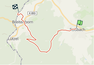
![](/images/other/stat-length.png)
![Trail On foot Biebergemünd - Spessartbogen Zubringer Roßbach - Breitenborn - Photo](https://media.geolcdn.com/t/1900/400/0fee88fb-ff19-432e-becf-3384decb3417.jpeg&format=pjpeg&maxdim=2)
Spessartbogen Zubringer Roßbach - Breitenborn
SityTrail - itinéraires balisés pédestres
Tous les sentiers balisés d’Europe GUIDE+
![Length](/images/other/stat-length.png)
![Max alt](https://static1.geolcdn.com/siteimages/upload/files/1508320355ic_sort_altitude_max_24dp.png)
![Uphill gradient](https://static1.geolcdn.com/siteimages/upload/files/1508320355ic_sort_den_pos_24dp.png)
![Km-Effort](/images/other/stat-length.png)
![Min alt](https://static1.geolcdn.com/siteimages/upload/files/1508320355ic_sort_altitude_min_24dp.png)
![Downhill gradient](https://static1.geolcdn.com/siteimages/upload/files/1508320355ic_sort_den_neg_24dp.png)
![Boucle](https://static1.geolcdn.com/siteimages/upload/files/16400158638029165_repeat_loop_refresh_sync_direction_icon.png)
![On foot](https://static1.geolcdn.com/sitytour/trail-icons/100.png)
1h59
Difficulty : Easy
![Scan this QR Code to open this trail in the SityTrail application](https://capi.geolives.com/qq0zvz2zws4bq2lad0pu/sitytour/trails/3093810/qr.png?size=200)
FREE GPS app for hiking
About
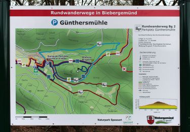
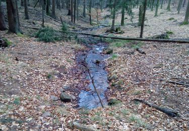
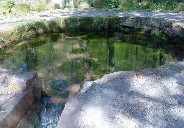
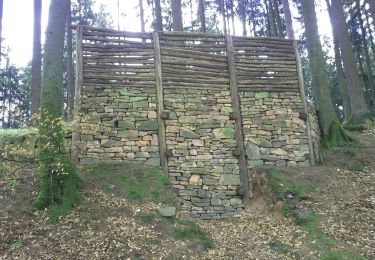
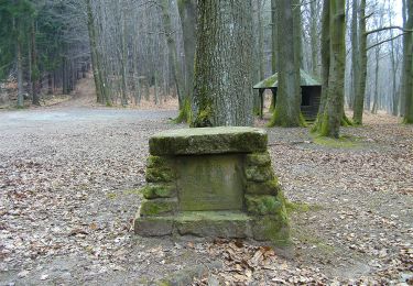
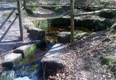
Trail On foot of 5.7 km to be discovered at Hesse, Main-Kinzig-Kreis, Biebergemünd. This trail is proposed by SityTrail - itinéraires balisés pédestres.
Description
Trail created by Naturpark Hessischer Spessart.
Der Wegeverlauf hat sich ab der Kaisereiche geändert!
Symbol: dunkelgrauer Strich und mittelgrauer Bogen über hellgrauem Rechteck
Website: https://www.spessartbogen.de/de/startseite/
Positioning
Comments
Trails nearby
![Trail On foot Biebergemünd - Spessartspuren - Bieber - Photo](https://media.geolcdn.com/t/375/260/62cb8d3f-1937-4ed4-9d97-142b12397164.jpeg&format=jpg&maxdim=2)
![On foot On foot](https://static1.geolcdn.com/sitytour/trail-icons/100.png)
On foot
![](/images/other/stat-length.png)
![](https://static1.geolcdn.com/siteimages/upload/files/16400158638029165_repeat_loop_refresh_sync_direction_icon.png)
![Trail On foot Biebergemünd - Biebergemünd - Rundwanderweg Bg 1 - Photo](https://media.geolcdn.com/t/375/260/0c3b2e2d-97d1-459a-820a-68ab605d7252.jpeg&format=jpg&maxdim=2)
![On foot On foot](https://static1.geolcdn.com/sitytour/trail-icons/100.png)
On foot
![](/images/other/stat-length.png)
![](https://static1.geolcdn.com/siteimages/upload/files/16400158638029165_repeat_loop_refresh_sync_direction_icon.png)
![Trail On foot Biebergemünd - Biebergemünd - Rundwanderweg Bg 2 - Photo](https://media.geolcdn.com/t/375/260/104b84aa-6517-422b-ac20-a2aea28e3a13.jpeg&format=jpg&maxdim=2)
![On foot On foot](https://static1.geolcdn.com/sitytour/trail-icons/100.png)
On foot
![](/images/other/stat-length.png)
![](https://static1.geolcdn.com/siteimages/upload/files/16400158638029165_repeat_loop_refresh_sync_direction_icon.png)
![Trail On foot Kleinkahl - Schwarzer Fuchs, Rundwanderweg Kleinkahl - Photo](https://media.geolcdn.com/t/375/260/93d92a04-9ecd-4bde-b756-48c3d05c92cf.jpeg&format=jpg&maxdim=2)
![On foot On foot](https://static1.geolcdn.com/sitytour/trail-icons/100.png)
On foot
![](/images/other/stat-length.png)
![](https://static1.geolcdn.com/siteimages/upload/files/16400158638029165_repeat_loop_refresh_sync_direction_icon.png)
![Trail On foot Wiesener Forst - Ortswanderweg Kleinkahl 1 - Photo](https://media.geolcdn.com/t/375/260/b9c14740-780a-4754-b30e-83ec6d6ba129.jpeg&format=jpg&maxdim=2)
![On foot On foot](https://static1.geolcdn.com/sitytour/trail-icons/100.png)
On foot
![](/images/other/stat-length.png)
![](https://static1.geolcdn.com/siteimages/upload/files/16400158638029165_repeat_loop_refresh_sync_direction_icon.png)
![Trail On foot Bad Orb - Bad Orb Rundwanderweg 14 (Feuchtbiotop Eschenkar) - Photo](https://media.geolcdn.com/t/375/260/1eb446d9-e2a0-47a9-a5a3-e3cbc26b9091.jpeg&format=jpg&maxdim=2)
![On foot On foot](https://static1.geolcdn.com/sitytour/trail-icons/100.png)
On foot
![](/images/other/stat-length.png)
![](https://static1.geolcdn.com/siteimages/upload/files/16400158638029165_repeat_loop_refresh_sync_direction_icon.png)
![Trail On foot Linsengericht - Linsengerichter Rundwanderweg Nr.3 - Photo](https://media.geolcdn.com/t/375/260/bf0ec336-0ca2-4450-ac13-44e29b3934cc.jpeg&format=jpg&maxdim=2)
![On foot On foot](https://static1.geolcdn.com/sitytour/trail-icons/100.png)
On foot
![](/images/other/stat-length.png)
![](https://static1.geolcdn.com/siteimages/upload/files/16400158638029165_repeat_loop_refresh_sync_direction_icon.png)
![Trail On foot Biebergemünd - Kulturweg Biebergemünd 2 - Photo](https://media.geolcdn.com/t/375/260/0c3b2e2d-97d1-459a-820a-68ab605d7252.jpeg&format=jpg&maxdim=2)
![On foot On foot](https://static1.geolcdn.com/sitytour/trail-icons/100.png)
On foot
![](/images/other/stat-length.png)
![](https://static1.geolcdn.com/siteimages/upload/files/16400158638029165_repeat_loop_refresh_sync_direction_icon.png)
![Trail On foot Wiesener Forst - Schwarzer Keiler, Rundweg Wiesen - Photo](https://media.geolcdn.com/t/375/260/c57119de-a390-425b-b83b-e40eac57ee5c.jpeg&format=jpg&maxdim=2)
![On foot On foot](https://static1.geolcdn.com/sitytour/trail-icons/100.png)
On foot
![](/images/other/stat-length.png)
![](https://static1.geolcdn.com/siteimages/upload/files/16400158638029165_repeat_loop_refresh_sync_direction_icon.png)