![](/images/other/stat-length.png)
![Trail On foot Geilenkirchen - Moorrundweg - Photo](https://media.geolcdn.com/t/1900/400/ext.pjpeg?maxdim=2&url=https%3A%2F%2Fmedia.geolcdn.com%2Ff%2F71eefdf8-006b-4c1c-9a8a-a84d3bd15b54.jpeg)
Moorrundweg
SityTrail - itinéraires balisés pédestres
Tous les sentiers balisés d’Europe PRO
![Length](/images/other/stat-length.png)
Length
5.8 km
![Max alt](https://static1.geolcdn.com/siteimages/upload/files/1508320355ic_sort_altitude_max_24dp.png)
Max alt
113 m
![Uphill gradient](https://static1.geolcdn.com/siteimages/upload/files/1508320355ic_sort_den_pos_24dp.png)
Uphill gradient
49 m
![Km-Effort](/images/other/stat-length.png)
Km-Effort
6.5 km
![Min alt](https://static1.geolcdn.com/siteimages/upload/files/1508320355ic_sort_altitude_min_24dp.png)
Min alt
88 m
![Downhill gradient](https://static1.geolcdn.com/siteimages/upload/files/1508320355ic_sort_den_neg_24dp.png)
Downhill gradient
49 m
![Boucle](https://static1.geolcdn.com/siteimages/upload/files/16400158638029165_repeat_loop_refresh_sync_direction_icon.png)
Boucle
Yes
Signpost
Creation date :
2022-02-11 14:34:46.901
Updated on :
2022-02-11 14:34:46.901
![On foot](https://static1.geolcdn.com/sitytour/trail-icons/100.png)
1h28
Difficulty : Easy
![Scan this QR Code to open this trail in the SityTrail application](https://capi.geolives.com/qq0zvz2zws4bq2lad0pu/sitytour/trails/3092848/qr.png?size=200)
FREE GPS app for hiking
About
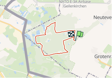
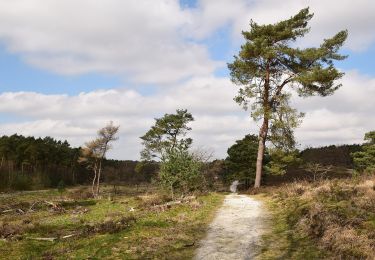
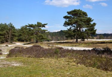
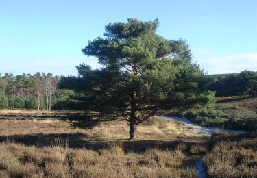
Trail On foot of 5.8 km to be discovered at North Rhine-Westphalia, Kreis Heinsberg, Geilenkirchen. This trail is proposed by SityTrail - itinéraires balisés pédestres.
Description
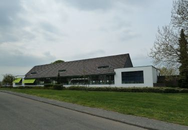
Trail created by Heinsberger Tourist-Service e.V..
Symbol: Vordergrund:schwarzer Balken Hintergrund:naturbelassenes Holz(grau)
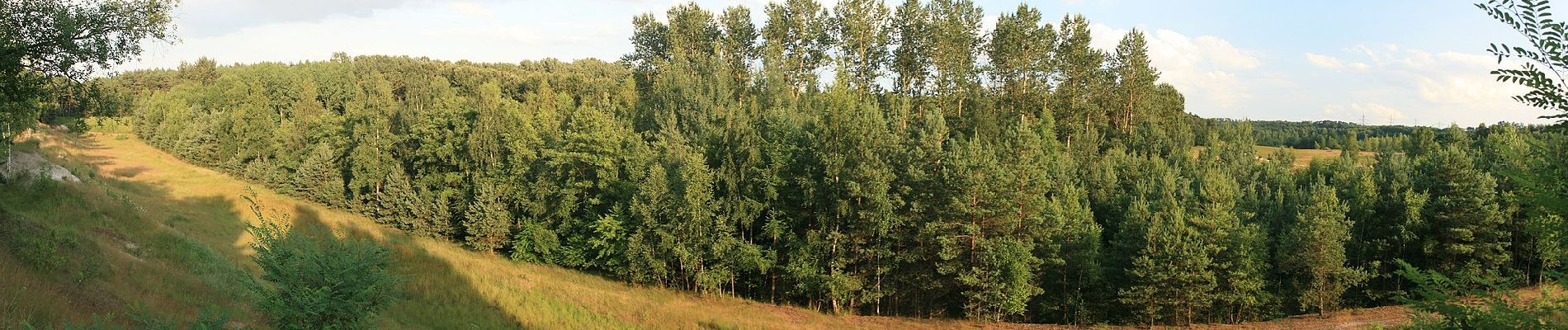
Positioning
Country:
Germany
Region :
North Rhine-Westphalia
Department/Province :
Kreis Heinsberg
Municipality :
Geilenkirchen
Location:
Unknown
Start:(Dec)
Start:(UTM)
292368 ; 5647919 (32U) N.
Comments
Trails nearby
![Trail Walking Brunssum - 2021-07-01_12h19m50_1288 - Photo](https://media.geolcdn.com/t/375/260/ext.jpg?maxdim=2&url=https%3A%2F%2Fmedia.geolcdn.com%2Ff%2Fbe5d1686-e005-4060-95f9-6d7688290c56.jpg)
![Walking Walking](https://static1.geolcdn.com/sitytour/trail-icons/101.png)
2021-07-01_12h19m50_1288
Walking
Easy
(1)
Brunssum,
Limburg,
Unknown,
Netherlands
![](/images/other/stat-length.png)
15.1 km | 17.4 km-effort
3h 56min
![](https://static1.geolcdn.com/siteimages/upload/files/16400158638029165_repeat_loop_refresh_sync_direction_icon.png)
Yes
![Trail On foot Landgraaf - Brunssummer Heide Paarse route - Photo](https://media.geolcdn.com/t/375/260/ext.jpg?maxdim=2&url=https%3A%2F%2Fmedia.geolcdn.com%2Ff%2Ffc5733ac-21b1-4256-9efd-d70ddf8f828f.jpeg)
![On foot On foot](https://static1.geolcdn.com/sitytour/trail-icons/100.png)
Brunssummer Heide Paarse route
On foot
Easy
Landgraaf,
Limburg,
Unknown,
Netherlands
![](/images/other/stat-length.png)
4.7 km | 5.4 km-effort
1h 13min
![](https://static1.geolcdn.com/siteimages/upload/files/16400158638029165_repeat_loop_refresh_sync_direction_icon.png)
Yes
![Trail On foot Heerlen - Brunssummer Heide Lichtgroene route - Photo](https://media.geolcdn.com/t/375/260/ext.jpg?maxdim=2&url=https%3A%2F%2Fmedia.geolcdn.com%2Ff%2F508b716c-8807-4753-8004-f75de6f128b2.jpeg)
![On foot On foot](https://static1.geolcdn.com/sitytour/trail-icons/100.png)
Brunssummer Heide Lichtgroene route
On foot
Easy
Heerlen,
Limburg,
Unknown,
Netherlands
![](/images/other/stat-length.png)
4.9 km | 5.8 km-effort
1h 19min
![](https://static1.geolcdn.com/siteimages/upload/files/16400158638029165_repeat_loop_refresh_sync_direction_icon.png)
Yes
![Trail On foot Heerlen - Brunssummer Heide Lichtblauwe route - Photo](https://media.geolcdn.com/t/375/260/ext.jpg?maxdim=2&url=https%3A%2F%2Fmedia.geolcdn.com%2Ff%2F39c8b9d7-66fe-45a6-8073-0f378ccb205b.jpeg)
![On foot On foot](https://static1.geolcdn.com/sitytour/trail-icons/100.png)
Brunssummer Heide Lichtblauwe route
On foot
Easy
Heerlen,
Limburg,
Unknown,
Netherlands
![](/images/other/stat-length.png)
4.5 km | 5.5 km-effort
1h 14min
![](https://static1.geolcdn.com/siteimages/upload/files/16400158638029165_repeat_loop_refresh_sync_direction_icon.png)
Yes
![Trail On foot Heerlen - Brunssummer Heide Donkergroene route - Photo](https://media.geolcdn.com/t/375/260/ext.jpg?maxdim=2&url=https%3A%2F%2Fmedia.geolcdn.com%2Ff%2Fad778f8c-75f7-4599-b089-d9f2e7b1eaf0.jpeg)
![On foot On foot](https://static1.geolcdn.com/sitytour/trail-icons/100.png)
Brunssummer Heide Donkergroene route
On foot
Easy
(1)
Heerlen,
Limburg,
Unknown,
Netherlands
![](/images/other/stat-length.png)
12.6 km | 14.8 km-effort
3h 21min
![](https://static1.geolcdn.com/siteimages/upload/files/16400158638029165_repeat_loop_refresh_sync_direction_icon.png)
Yes
![Trail On foot Beekdaelen - Rode Route - Photo](https://media.geolcdn.com/t/375/260/ext.jpg?maxdim=2&url=https%3A%2F%2Fmedia.geolcdn.com%2Ff%2Fee24fe33-e676-4d4e-8211-77f2cd86e479.jpeg)
![On foot On foot](https://static1.geolcdn.com/sitytour/trail-icons/100.png)
Rode Route
On foot
Easy
Beekdaelen,
Limburg,
Unknown,
Netherlands
![](/images/other/stat-length.png)
5.2 km | 5.8 km-effort
1h 19min
![](https://static1.geolcdn.com/siteimages/upload/files/16400158638029165_repeat_loop_refresh_sync_direction_icon.png)
No
![Trail On foot Beekdaelen - Groene Route - Photo](https://media.geolcdn.com/t/375/260/ext.jpg?maxdim=2&url=https%3A%2F%2Fmedia.geolcdn.com%2Ff%2Fee24fe33-e676-4d4e-8211-77f2cd86e479.jpeg)
![On foot On foot](https://static1.geolcdn.com/sitytour/trail-icons/100.png)
Groene Route
On foot
Easy
Beekdaelen,
Limburg,
Unknown,
Netherlands
![](/images/other/stat-length.png)
6.2 km | 6.8 km-effort
1h 33min
![](https://static1.geolcdn.com/siteimages/upload/files/16400158638029165_repeat_loop_refresh_sync_direction_icon.png)
No
![Trail On foot Beekdaelen - Niederbusch Wanderweg - Photo](https://media.geolcdn.com/t/375/260/ext.jpg?maxdim=2&url=https%3A%2F%2Fmedia.geolcdn.com%2Ff%2Fee24fe33-e676-4d4e-8211-77f2cd86e479.jpeg)
![On foot On foot](https://static1.geolcdn.com/sitytour/trail-icons/100.png)
Niederbusch Wanderweg
On foot
Easy
Beekdaelen,
Limburg,
Unknown,
Netherlands
![](/images/other/stat-length.png)
9.1 km | 10.3 km-effort
2h 21min
![](https://static1.geolcdn.com/siteimages/upload/files/16400158638029165_repeat_loop_refresh_sync_direction_icon.png)
Yes
![Trail On foot Beekdaelen - Blauwe Route - Photo](https://media.geolcdn.com/t/375/260/ext.jpg?maxdim=2&url=https%3A%2F%2Fmedia.geolcdn.com%2Ff%2Ff0254392-3f34-4697-921c-482aa71516af.jpeg)
![On foot On foot](https://static1.geolcdn.com/sitytour/trail-icons/100.png)
Blauwe Route
On foot
Easy
Beekdaelen,
Limburg,
Unknown,
Netherlands
![](/images/other/stat-length.png)
5.2 km | 5.9 km-effort
1h 20min
![](https://static1.geolcdn.com/siteimages/upload/files/16400158638029165_repeat_loop_refresh_sync_direction_icon.png)
Yes