


4.6 km | 5.7 km-effort


Tous les sentiers balisés d’Europe GUIDE+


FREE GPS app for hiking
 SityTrail
IGN / Geographical institutes
SityTrail World
The world is yours!
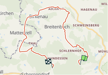
Trail On foot of 9.2 km to be discovered at Bavaria, Landkreis Cham, Falkenstein. This trail is proposed by SityTrail - itinéraires balisés pédestres.
Trail created by Verein Naturpark Vorderer Bayerischer Wald.
FIXME: ein paar Wegsegmente fehlen noch
Symbol: Auf einem rechteckigen weißen Grund in Schwarz links der Wilde Mann (Zeichnung), rechts die Wanderwegnummer, darüber der Text "WANDERWEG".
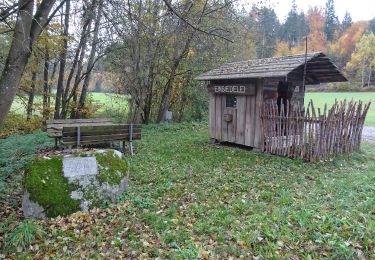
On foot
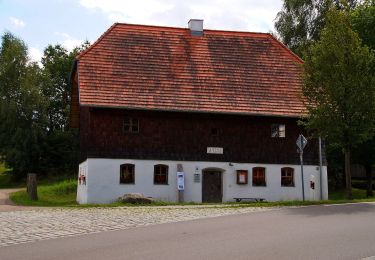
On foot

On foot
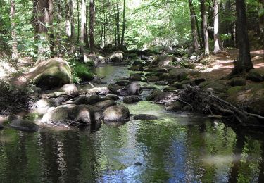
On foot

On foot