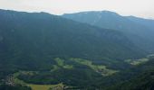

Wanderweg 26 - Auf die Hochries
SityTrail - itinéraires balisés pédestres
Tous les sentiers balisés d’Europe GUIDE+

Length
12.9 km

Max alt
1418 m

Uphill gradient
661 m

Km-Effort
22 km

Min alt
622 m

Downhill gradient
837 m
Boucle
No
Signpost
Creation date :
2022-02-11 14:08:19.713
Updated on :
2022-02-11 14:08:19.713
5h04
Difficulty : Medium

FREE GPS app for hiking
About
Trail On foot of 12.9 km to be discovered at Bavaria, Landkreis Rosenheim, Aschau im Chiemgau. This trail is proposed by SityTrail - itinéraires balisés pédestres.
Description
Trail created by Tourist Info Aschau i.Ch..
Positioning
Country:
Germany
Region :
Bavaria
Department/Province :
Landkreis Rosenheim
Municipality :
Aschau im Chiemgau
Location:
Unknown
Start:(Dec)
Start:(UTM)
296508 ; 5293244 (33T) N.
Comments
Trails nearby
Wanderweg 10 - Aschau


On foot
Easy
Aschau im Chiemgau,
Bavaria,
Landkreis Rosenheim,
Germany

7.5 km | 16.7 km-effort
3h 47min
No

St. Florians-Runde


On foot
Easy
Frasdorf,
Bavaria,
Landkreis Rosenheim,
Germany

6.1 km | 7.7 km-effort
1h 45min
Yes
Wildenwarter-Runde


On foot
Easy
Frasdorf,
Bavaria,
Landkreis Rosenheim,
Germany

10.3 km | 12.7 km-effort
2h 53min
Yes

Sonnseitn-Runde


On foot
Easy
Frasdorf,
Bavaria,
Landkreis Rosenheim,
Germany

7.6 km | 9.2 km-effort
2h 5min
Yes
Berghäuser-Runde


On foot
Easy
Frasdorf,
Bavaria,
Landkreis Rosenheim,
Germany

6.9 km | 8.7 km-effort
1h 59min
Yes
Winterstuben-Runde


On foot
Easy
Frasdorf,
Bavaria,
Landkreis Rosenheim,
Germany

7 km | 11.1 km-effort
2h 30min
Yes

Hofalm-Runde


On foot
Easy
Frasdorf,
Bavaria,
Landkreis Rosenheim,
Germany

10 km | 15.2 km-effort
3h 26min
Yes

Burghölz-Runde


On foot
Easy
Frasdorf,
Bavaria,
Landkreis Rosenheim,
Germany

5.1 km | 6.5 km-effort
1h 28min
Yes
SalzAlpenTour Chiemsee-Alpenland


On foot
Very difficult
Frasdorf,
Bavaria,
Landkreis Rosenheim,
Germany

49 km | 86 km-effort
19h 27min
Yes


 SityTrail


