


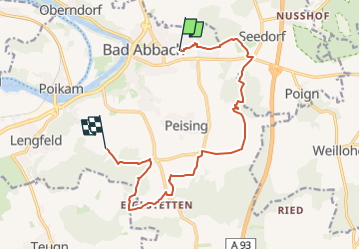

6.3 km | 6.8 km-effort

Tous les sentiers balisés d’Europe GUIDE+


FREE GPS app for hiking
 SityTrail
IGN / Geographical institutes
SityTrail World
The world is yours!
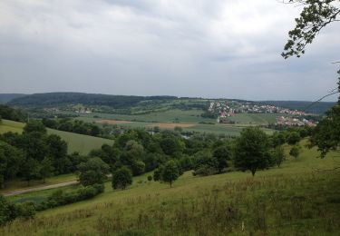
Trail On foot of 12.5 km to be discovered at Bavaria, Landkreis Kelheim, Bad Abbach. This trail is proposed by SityTrail - itinéraires balisés pédestres.
Trail created by Gebietsgemeinschaft Bayerischer Jura.
geprüft (März 2014, by cycling_zno)
Symbol: Gelbe Schleife auf blauem Grund


On foot
On foot

On foot
On foot
On foot
On foot
![Trail On foot Pentling - S 20 Hohengebraching - Unterirading [Walba] (Blaues Rechteck) - Photo](https://media.geolcdn.com/t/375/260/81f267c5-b53b-4c4e-b86a-f20025f30912.jpeg&format=jpg&maxdim=2)
On foot

On foot

On foot