


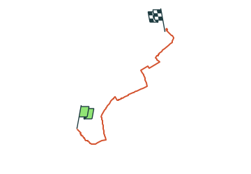

3.4 km | 3.9 km-effort
![Trail On foot Klein-Winternheim - [Rotes Eichenblatt] Mainz (Hbf) - Marienborn - Zahlbach - Photo](https://media.geolcdn.com/t/1900/400/29f95c8a-1e3d-4c7e-9ab0-7a1f3486a7e7.jpeg&format=pjpeg&maxdim=2)

Tous les sentiers balisés d’Europe GUIDE+


FREE GPS app for hiking
 SityTrail
IGN / Geographical institutes
SityTrail World
The world is yours!
Trail On foot of 7.5 km to be discovered at Rhineland-Palatinate, Landkreis Mainz-Bingen, Klein-Winternheim. This trail is proposed by SityTrail - itinéraires balisés pédestres.
Dieser Weg wird in der Realität nicht mehr gewartet. Die Beschilderung verblasst und wird zunehmend lückenhaft.
Symbol: Rotes Eichenblatt auf weißem Grund
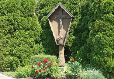
![Trail On foot Klein-Winternheim - [Rotes Eichenblatt] Mainz (Hbf) - Marienborn - Zahlbach - Photo 1](https://media.geolcdn.com/t/2048/auto/1b04487e-4729-4051-9649-2be625704aa0.jpeg&format=jpg&maxdim=0 "Trail On foot Klein-Winternheim - [Rotes Eichenblatt] Mainz (Hbf) - Marienborn - Zahlbach - Photo 1")
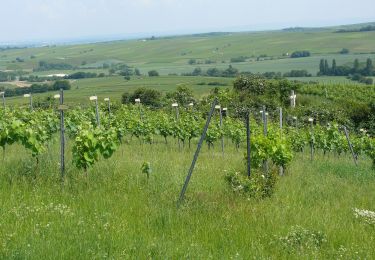
![Trail On foot Klein-Winternheim - [Rotes Eichenblatt] Mainz (Hbf) - Marienborn - Zahlbach - Photo 2](https://media.geolcdn.com/t/2048/auto/1a5eb18a-c212-4ed3-b7bf-4365b4faf7ba.jpeg&format=jpg&maxdim=0 "Trail On foot Klein-Winternheim - [Rotes Eichenblatt] Mainz (Hbf) - Marienborn - Zahlbach - Photo 2")
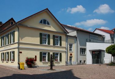
![Trail On foot Klein-Winternheim - [Rotes Eichenblatt] Mainz (Hbf) - Marienborn - Zahlbach - Photo 3](https://media.geolcdn.com/t/2048/auto/c1555230-a67a-464b-8e41-6a718efac0bd.jpeg&format=jpg&maxdim=0 "Trail On foot Klein-Winternheim - [Rotes Eichenblatt] Mainz (Hbf) - Marienborn - Zahlbach - Photo 3")
![Trail On foot Klein-Winternheim - [Rotes Eichenblatt] Mainz (Hbf) - Marienborn - Zahlbach - Photo 4](https://media.geolcdn.com/t/2048/auto/0b1aa564-6343-403e-ac8b-55af148f1102.jpeg&format=jpg&maxdim=0 "Trail On foot Klein-Winternheim - [Rotes Eichenblatt] Mainz (Hbf) - Marienborn - Zahlbach - Photo 4")
![Trail On foot Klein-Winternheim - [Rotes Eichenblatt] Mainz (Hbf) - Marienborn - Zahlbach - Photo 5](https://media.geolcdn.com/t/2048/auto/7f568957-1147-4c2b-abdc-6efb13485eaf.jpeg&format=jpg&maxdim=0 "Trail On foot Klein-Winternheim - [Rotes Eichenblatt] Mainz (Hbf) - Marienborn - Zahlbach - Photo 5")
![Trail On foot Klein-Winternheim - [Rotes Eichenblatt] Mainz (Hbf) - Marienborn - Zahlbach - Photo 6](https://media.geolcdn.com/t/2048/auto/c0d4c0a0-e19f-4e03-a5ff-c6449fcbf3ed.jpeg&format=jpg&maxdim=0 "Trail On foot Klein-Winternheim - [Rotes Eichenblatt] Mainz (Hbf) - Marienborn - Zahlbach - Photo 6")
![Trail On foot Klein-Winternheim - [Rotes Eichenblatt] Mainz (Hbf) - Marienborn - Zahlbach - Photo 7](https://media.geolcdn.com/t/2048/auto/4ae7f0fd-b51d-4222-ae5d-7611909451d7.jpeg&format=jpg&maxdim=0 "Trail On foot Klein-Winternheim - [Rotes Eichenblatt] Mainz (Hbf) - Marienborn - Zahlbach - Photo 7")
![Trail On foot Klein-Winternheim - [Rotes Eichenblatt] Mainz (Hbf) - Marienborn - Zahlbach - Photo 8](https://media.geolcdn.com/t/2048/auto/734c009b-c03b-4cf7-bc78-d1d1ce2359b0.jpeg&format=jpg&maxdim=0 "Trail On foot Klein-Winternheim - [Rotes Eichenblatt] Mainz (Hbf) - Marienborn - Zahlbach - Photo 8")
![Trail On foot Klein-Winternheim - [Rotes Eichenblatt] Mainz (Hbf) - Marienborn - Zahlbach - Photo 9](https://media.geolcdn.com/t/2048/auto/0552fb83-ac74-48d5-ab1f-e0f9b0dcb4a3.jpeg&format=jpg&maxdim=0 "Trail On foot Klein-Winternheim - [Rotes Eichenblatt] Mainz (Hbf) - Marienborn - Zahlbach - Photo 9")
![Trail On foot Klein-Winternheim - [Rotes Eichenblatt] Mainz (Hbf) - Marienborn - Zahlbach - Photo 10](https://media.geolcdn.com/t/2048/auto/29f95c8a-1e3d-4c7e-9ab0-7a1f3486a7e7.jpeg&format=jpg&maxdim=0 "Trail On foot Klein-Winternheim - [Rotes Eichenblatt] Mainz (Hbf) - Marienborn - Zahlbach - Photo 10")
On foot
On foot
On foot

Bicycle tourism
Cycle