


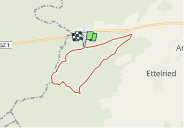

9.9 km | 12.4 km-effort


Tous les sentiers balisés d’Europe GUIDE+


FREE GPS app for hiking
 SityTrail
IGN / Geographical institutes
SityTrail World
The world is yours!
Trail On foot of 5.5 km to be discovered at Bavaria, Augsburg (district), Dinkelscherben. This trail is proposed by SityTrail - itinéraires balisés pédestres.
Trail created by Naturpark Augsburg - Westliche Wälder e.V..
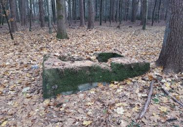
variation eingezeichnet, da orginaler weg nicht passierbar mfg operatorofhell
Symbol: grüne Schrift auf weißem Grund
On foot

On foot