


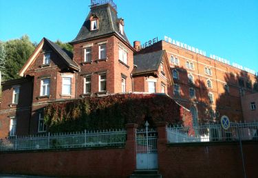
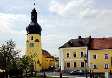
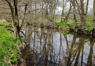
6.9 km | 7.9 km-effort
![Trail On foot Arzberg - Arzberg [6] Humboldweg - Photo](https://media.geolcdn.com/t/1900/400/e6596be1-2cee-4ec3-8879-4b964cf9e914.jpeg&format=pjpeg&maxdim=2)

Tous les sentiers balisés d’Europe GUIDE+


FREE GPS app for hiking
 SityTrail
IGN / Geographical institutes
SityTrail World
The world is yours!
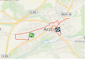
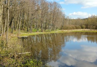
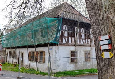
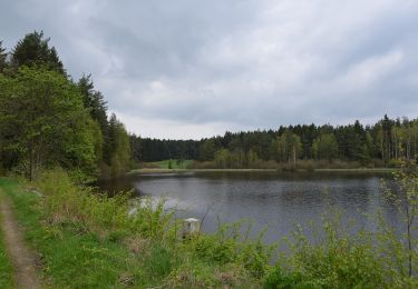
Trail On foot of 3.3 km to be discovered at Bavaria, Landkreis Wunsiedel im Fichtelgebirge, Arzberg. This trail is proposed by SityTrail - itinéraires balisés pédestres.
Trail created by Fichtelgebirgsverein.
Symbol: Weiße 6 auf rechteckigen, grünen Grund
![Trail On foot Arzberg - Arzberg [6] Humboldweg - Photo 1](https://media.geolcdn.com/t/2048/auto/f778cd00-7a65-4312-8a7c-eda2750d39c2.jpeg&format=jpg&maxdim=0 "Trail On foot Arzberg - Arzberg [6] Humboldweg - Photo 1")
![Trail On foot Arzberg - Arzberg [6] Humboldweg - Photo 2](https://media.geolcdn.com/t/2048/auto/e6596be1-2cee-4ec3-8879-4b964cf9e914.jpeg&format=jpg&maxdim=0 "Trail On foot Arzberg - Arzberg [6] Humboldweg - Photo 2")
![Trail On foot Arzberg - Arzberg [6] Humboldweg - Photo 3](https://media.geolcdn.com/t/2048/auto/042c3b60-0f56-47d5-a060-2f9d61b1c428.jpeg&format=jpg&maxdim=0 "Trail On foot Arzberg - Arzberg [6] Humboldweg - Photo 3")
![Trail On foot Arzberg - Arzberg [6] Humboldweg - Photo 4](https://media.geolcdn.com/t/2048/auto/277fbc1c-4457-4eb1-a8fd-5bb4c4b6432a.jpeg&format=jpg&maxdim=0 "Trail On foot Arzberg - Arzberg [6] Humboldweg - Photo 4")
![Trail On foot Arzberg - Arzberg [6] Humboldweg - Photo 5](https://media.geolcdn.com/t/2048/auto/018c76ab-bb8a-4313-b7b4-11579a9ef12e.jpeg&format=jpg&maxdim=0 "Trail On foot Arzberg - Arzberg [6] Humboldweg - Photo 5")
![Trail On foot Arzberg - Arzberg [6] Humboldweg - Photo 6](https://media.geolcdn.com/t/2048/auto/cad6f22e-48bd-4caa-80d0-401aed0d0a04.jpeg&format=jpg&maxdim=0 "Trail On foot Arzberg - Arzberg [6] Humboldweg - Photo 6")
![Trail On foot Arzberg - Arzberg [6] Humboldweg - Photo 7](https://media.geolcdn.com/t/2048/auto/e0812635-d6e8-4532-9b5b-7b01051062b8.jpeg&format=jpg&maxdim=0 "Trail On foot Arzberg - Arzberg [6] Humboldweg - Photo 7")
On foot
On foot
On foot
![Trail On foot Arzberg - Arzberg [5] Museumsweg - Photo](https://media.geolcdn.com/t/375/260/e6596be1-2cee-4ec3-8879-4b964cf9e914.jpeg&format=jpg&maxdim=2)
On foot
On foot
On foot
On foot
On foot
![Trail On foot Arzberg - Arzberg [4] Siebenlindenweg - Photo](https://media.geolcdn.com/t/375/260/f1086eaa-2073-4595-aeda-b0da4719bf91.jpeg&format=jpg&maxdim=2)
On foot