


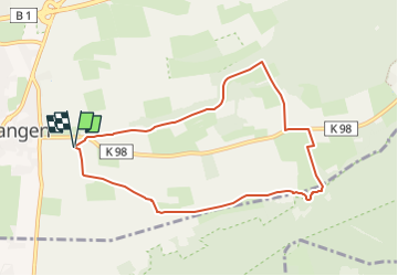

4.7 km | 6.3 km-effort
![Trail On foot Schlangen - Rundwanderweg A1 [Langes Tal / Noaks Pumpe] - Photo](https://media.geolcdn.com/t/1900/400/9c78f9bc-1d70-4198-9b9b-59255b87407a.jpeg&format=pjpeg&maxdim=2)

Tous les sentiers balisés d’Europe GUIDE+


FREE GPS app for hiking
 SityTrail
IGN / Geographical institutes
SityTrail World
The world is yours!
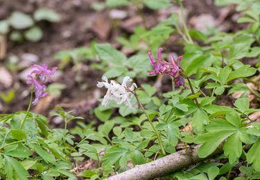
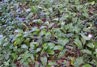
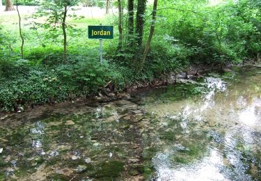
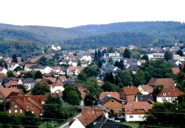
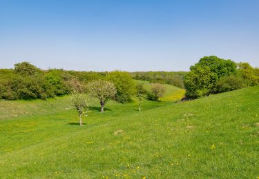
Trail On foot of 7.4 km to be discovered at North Rhine-Westphalia, Kreis Lippe, Schlangen. This trail is proposed by SityTrail - itinéraires balisés pédestres.
Trail created by Eggegebirgsverein.
Symbol: white A1 on black background
![Trail On foot Schlangen - Rundwanderweg A1 [Langes Tal / Noaks Pumpe] - Photo 1](https://media.geolcdn.com/t/2048/auto/cdf84826-b360-4b9b-9c28-b678b33d69de.jpeg&format=jpg&maxdim=0 "Trail On foot Schlangen - Rundwanderweg A1 [Langes Tal / Noaks Pumpe] - Photo 1")
![Trail On foot Schlangen - Rundwanderweg A1 [Langes Tal / Noaks Pumpe] - Photo 2](https://media.geolcdn.com/t/2048/auto/22b348b2-fb33-4654-a1e0-78467f555e07.jpeg&format=jpg&maxdim=0 "Trail On foot Schlangen - Rundwanderweg A1 [Langes Tal / Noaks Pumpe] - Photo 2")
![Trail On foot Schlangen - Rundwanderweg A1 [Langes Tal / Noaks Pumpe] - Photo 3](https://media.geolcdn.com/t/2048/auto/7d48b873-4f36-4e8a-9783-d6dab8c98c3b.jpeg&format=jpg&maxdim=0 "Trail On foot Schlangen - Rundwanderweg A1 [Langes Tal / Noaks Pumpe] - Photo 3")
![Trail On foot Schlangen - Rundwanderweg A1 [Langes Tal / Noaks Pumpe] - Photo 4](https://media.geolcdn.com/t/2048/auto/13abc61d-de00-4891-aaf6-e4abe4969daa.jpeg&format=jpg&maxdim=0 "Trail On foot Schlangen - Rundwanderweg A1 [Langes Tal / Noaks Pumpe] - Photo 4")
![Trail On foot Schlangen - Rundwanderweg A1 [Langes Tal / Noaks Pumpe] - Photo 5](https://media.geolcdn.com/t/2048/auto/dc37a4c3-c9a4-4c26-b152-d9ed4070039c.jpeg&format=jpg&maxdim=0 "Trail On foot Schlangen - Rundwanderweg A1 [Langes Tal / Noaks Pumpe] - Photo 5")
![Trail On foot Schlangen - Rundwanderweg A1 [Langes Tal / Noaks Pumpe] - Photo 6](https://media.geolcdn.com/t/2048/auto/51f0d4ae-1753-44ed-a454-8d7455dff628.jpeg&format=jpg&maxdim=0 "Trail On foot Schlangen - Rundwanderweg A1 [Langes Tal / Noaks Pumpe] - Photo 6")
![Trail On foot Schlangen - Rundwanderweg A1 [Langes Tal / Noaks Pumpe] - Photo 7](https://media.geolcdn.com/t/2048/auto/9c78f9bc-1d70-4198-9b9b-59255b87407a.jpeg&format=jpg&maxdim=0 "Trail On foot Schlangen - Rundwanderweg A1 [Langes Tal / Noaks Pumpe] - Photo 7")
![Trail On foot Schlangen - Rundwanderweg A1 [Langes Tal / Noaks Pumpe] - Photo 8](https://media.geolcdn.com/t/2048/auto/eb06eb62-c707-4ad1-a75b-4064a92533fe.jpeg&format=jpg&maxdim=0 "Trail On foot Schlangen - Rundwanderweg A1 [Langes Tal / Noaks Pumpe] - Photo 8")
![Trail On foot Schlangen - Rundwanderweg A1 [Langes Tal / Noaks Pumpe] - Photo 9](https://media.geolcdn.com/t/2048/auto/d39014fc-51e9-4328-9b12-8a05f4a4ce60.jpeg&format=jpg&maxdim=0 "Trail On foot Schlangen - Rundwanderweg A1 [Langes Tal / Noaks Pumpe] - Photo 9")
![Trail On foot Schlangen - Rundwanderweg A1 [Langes Tal / Noaks Pumpe] - Photo 10](https://media.geolcdn.com/t/2048/auto/a1f14b60-4643-4203-8800-bfa03022744f.jpeg&format=jpg&maxdim=0 "Trail On foot Schlangen - Rundwanderweg A1 [Langes Tal / Noaks Pumpe] - Photo 10")
On foot
On foot
On foot
On foot
On foot
On foot
![Trail On foot Schlangen - Rundwanderweg 34 [Barnacken] - Photo](https://media.geolcdn.com/t/375/260/83e8c965-88dc-4fa7-9331-4da86113c518.jpeg&format=jpg&maxdim=2)
On foot
On foot

On foot