![](/images/other/stat-length.png)
![Trail On foot Morbach - Saar-Hunsrück-Steig Traumschleifen LandZeitTour - Photo](https://media.geolcdn.com/t/1900/400/7271eee3-360d-47fb-849f-81a5144e2488.jpeg&format=pjpeg&maxdim=2)
Saar-Hunsrück-Steig Traumschleifen LandZeitTour
SityTrail - itinéraires balisés pédestres
Tous les sentiers balisés d’Europe GUIDE+
![Length](/images/other/stat-length.png)
Length
8.2 km
![Max alt](https://static1.geolcdn.com/siteimages/upload/files/1508320355ic_sort_altitude_max_24dp.png)
Max alt
544 m
![Uphill gradient](https://static1.geolcdn.com/siteimages/upload/files/1508320355ic_sort_den_pos_24dp.png)
Uphill gradient
139 m
![Km-Effort](/images/other/stat-length.png)
Km-Effort
10.1 km
![Min alt](https://static1.geolcdn.com/siteimages/upload/files/1508320355ic_sort_altitude_min_24dp.png)
Min alt
464 m
![Downhill gradient](https://static1.geolcdn.com/siteimages/upload/files/1508320355ic_sort_den_neg_24dp.png)
Downhill gradient
135 m
![Boucle](https://static1.geolcdn.com/siteimages/upload/files/16400158638029165_repeat_loop_refresh_sync_direction_icon.png)
Boucle
Yes
Signpost
Creation date :
2022-02-11 13:25:00.649
Updated on :
2022-02-11 13:25:00.649
![On foot](https://static1.geolcdn.com/sitytour/trail-icons/100.png)
2h17
Difficulty : Easy
![Scan this QR Code to open this trail in the SityTrail application](https://capi.geolives.com/qq0zvz2zws4bq2lad0pu/sitytour/trails/3090252/qr.png?size=200)
FREE GPS app for hiking
About
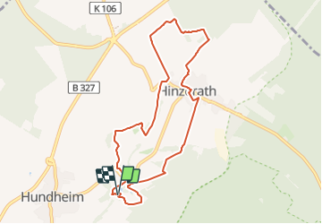
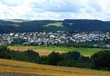
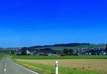
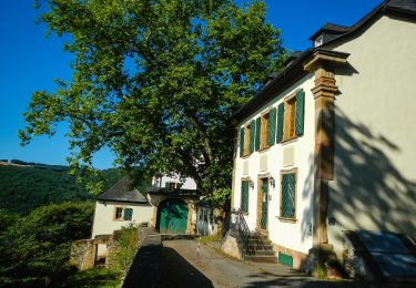
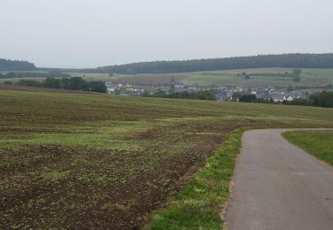
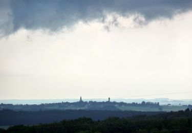
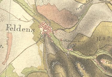
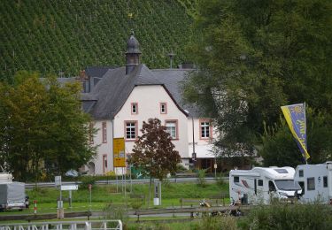
Trail On foot of 8.2 km to be discovered at Rhineland-Palatinate, Landkreis Bernkastel-Wittlich, Morbach. This trail is proposed by SityTrail - itinéraires balisés pédestres.
Description
Trail created by Projektbüro Saar-Hunsrück-Steig.
Symbol: stilisiertes S und H auf lila Grund
Positioning
Country:
Germany
Region :
Rhineland-Palatinate
Department/Province :
Landkreis Bernkastel-Wittlich
Municipality :
Morbach
Location:
Unknown
Start:(Dec)
Start:(UTM)
368034 ; 5521884 (32U) N.
Comments
Trails nearby
![Trail On foot Rhaunen - Traumschleife Stumm-Orgel-Weg - Photo](https://media.geolcdn.com/t/375/260/b71eca11-e9f7-427d-8986-3e823bb8d862.jpeg&format=jpg&maxdim=2)
![On foot On foot](https://static1.geolcdn.com/sitytour/trail-icons/100.png)
Traumschleife Stumm-Orgel-Weg
On foot
Easy
Rhaunen,
Rhineland-Palatinate,
Landkreis Birkenfeld,
Germany
![](/images/other/stat-length.png)
14 km | 18 km-effort
4h 5min
![](https://static1.geolcdn.com/siteimages/upload/files/16400158638029165_repeat_loop_refresh_sync_direction_icon.png)
Yes
![Trail On foot Horbruch - Traumschleife Via Molarum - Photo](https://media.geolcdn.com/t/375/260/a31b90b0-63bf-49c0-aca7-fc2ae292a7d4.jpeg&format=jpg&maxdim=2)
![On foot On foot](https://static1.geolcdn.com/sitytour/trail-icons/100.png)
Traumschleife Via Molarum
On foot
Medium
Horbruch,
Rhineland-Palatinate,
Landkreis Birkenfeld,
Germany
![](/images/other/stat-length.png)
16 km | 20 km-effort
4h 36min
![](https://static1.geolcdn.com/siteimages/upload/files/16400158638029165_repeat_loop_refresh_sync_direction_icon.png)
Yes
![Trail On foot Oberhausen bei Kirn - Drei-Burgen-Weg - Photo](https://media.geolcdn.com/t/375/260/6c888f2a-5efb-42e2-b238-e5a63375d933.jpeg&format=jpg&maxdim=2)
![On foot On foot](https://static1.geolcdn.com/sitytour/trail-icons/100.png)
Drei-Burgen-Weg
On foot
Easy
Oberhausen bei Kirn,
Rhineland-Palatinate,
Landkreis Bad Kreuznach,
Germany
![](/images/other/stat-length.png)
13.3 km | 19.7 km-effort
4h 28min
![](https://static1.geolcdn.com/siteimages/upload/files/16400158638029165_repeat_loop_refresh_sync_direction_icon.png)
Yes
![Trail On foot Bernkastel-Kues - Moselsteig Seitensprung Bernkasteler Bärensteig - Photo](https://media.geolcdn.com/t/375/260/7fd007be-cf57-41d6-aef3-4b117491e3df.jpeg&format=jpg&maxdim=2)
![On foot On foot](https://static1.geolcdn.com/sitytour/trail-icons/100.png)
Moselsteig Seitensprung Bernkasteler Bärensteig
On foot
Easy
Bernkastel-Kues,
Rhineland-Palatinate,
Landkreis Bernkastel-Wittlich,
Germany
![](/images/other/stat-length.png)
6.3 km | 10.5 km-effort
2h 23min
![](https://static1.geolcdn.com/siteimages/upload/files/16400158638029165_repeat_loop_refresh_sync_direction_icon.png)
Yes
![Trail On foot Bärenbach - Vitaltour: Bärenroute - Photo](https://media.geolcdn.com/t/375/260/1d0d7e6f-4964-4069-9267-d5042488d475.jpeg&format=jpg&maxdim=2)
![On foot On foot](https://static1.geolcdn.com/sitytour/trail-icons/100.png)
Vitaltour: Bärenroute
On foot
Easy
Bärenbach,
Rhineland-Palatinate,
Landkreis Bad Kreuznach,
Germany
![](/images/other/stat-length.png)
12.3 km | 18.3 km-effort
4h 9min
![](https://static1.geolcdn.com/siteimages/upload/files/16400158638029165_repeat_loop_refresh_sync_direction_icon.png)
Yes
![Trail On foot Veldenz - Jakob-Maria-Mierscheid-Weg - Photo](https://media.geolcdn.com/t/375/260/df270117-5716-49f6-92b3-8d70da3fb659.jpeg&format=jpg&maxdim=2)
![On foot On foot](https://static1.geolcdn.com/sitytour/trail-icons/100.png)
Jakob-Maria-Mierscheid-Weg
On foot
Easy
Veldenz,
Rhineland-Palatinate,
Landkreis Bernkastel-Wittlich,
Germany
![](/images/other/stat-length.png)
14.8 km | 20 km-effort
4h 32min
![](https://static1.geolcdn.com/siteimages/upload/files/16400158638029165_repeat_loop_refresh_sync_direction_icon.png)
Yes
![Trail On foot Sohren - Gedichte Pfad Sohren - Photo](https://media.geolcdn.com/t/375/260/5da5ebc2-8b1a-491f-b950-482ba43132d5.jpeg&format=jpg&maxdim=2)
![On foot On foot](https://static1.geolcdn.com/sitytour/trail-icons/100.png)
Gedichte Pfad Sohren
On foot
Easy
Sohren,
Rhineland-Palatinate,
Rhein-Hunsrück-Kreis,
Germany
![](/images/other/stat-length.png)
3.2 km | 4.1 km-effort
55min
![](https://static1.geolcdn.com/siteimages/upload/files/16400158638029165_repeat_loop_refresh_sync_direction_icon.png)
Yes
![Trail On foot Mülheim an der Mosel - Ponoramaweg - Photo](https://media.geolcdn.com/t/375/260/8ee021a1-10e3-4c58-8032-bbec2df5a624.jpeg&format=jpg&maxdim=2)
![On foot On foot](https://static1.geolcdn.com/sitytour/trail-icons/100.png)
Ponoramaweg
On foot
Easy
Mülheim an der Mosel,
Rhineland-Palatinate,
Landkreis Bernkastel-Wittlich,
Germany
![](/images/other/stat-length.png)
10.2 km | 13.1 km-effort
2h 58min
![](https://static1.geolcdn.com/siteimages/upload/files/16400158638029165_repeat_loop_refresh_sync_direction_icon.png)
Yes
![Trail On foot Graach an der Mosel - Himmelreich Wanderweg - Photo](https://media.geolcdn.com/t/375/260/9a2018db-0271-4a75-a325-1dba57651056.jpeg&format=jpg&maxdim=2)
![On foot On foot](https://static1.geolcdn.com/sitytour/trail-icons/100.png)
Himmelreich Wanderweg
On foot
Easy
Graach an der Mosel,
Rhineland-Palatinate,
Landkreis Bernkastel-Wittlich,
Germany
![](/images/other/stat-length.png)
6.5 km | 8.9 km-effort
2h 1min
![](https://static1.geolcdn.com/siteimages/upload/files/16400158638029165_repeat_loop_refresh_sync_direction_icon.png)
Yes