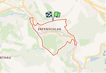
![](/images/other/stat-length.png)
![Trail On foot Unknown - Rundweg um Erfenschlag - Photo](https://media.geolcdn.com/t/1900/400/4a51c7b5-e45d-4336-8f92-6199b04f7505.jpeg&format=pjpeg&maxdim=2)
Rundweg um Erfenschlag
SityTrail - itinéraires balisés pédestres
Tous les sentiers balisés d’Europe GUIDE+
![Length](/images/other/stat-length.png)
Length
6.9 km
![Max alt](https://static1.geolcdn.com/siteimages/upload/files/1508320355ic_sort_altitude_max_24dp.png)
Max alt
456 m
![Uphill gradient](https://static1.geolcdn.com/siteimages/upload/files/1508320355ic_sort_den_pos_24dp.png)
Uphill gradient
210 m
![Km-Effort](/images/other/stat-length.png)
Km-Effort
9.7 km
![Min alt](https://static1.geolcdn.com/siteimages/upload/files/1508320355ic_sort_altitude_min_24dp.png)
Min alt
326 m
![Downhill gradient](https://static1.geolcdn.com/siteimages/upload/files/1508320355ic_sort_den_neg_24dp.png)
Downhill gradient
208 m
![Boucle](https://static1.geolcdn.com/siteimages/upload/files/16400158638029165_repeat_loop_refresh_sync_direction_icon.png)
Boucle
Yes
Signpost
Creation date :
2022-02-11 13:17:33.97
Updated on :
2022-02-11 13:17:33.97
![On foot](https://static1.geolcdn.com/sitytour/trail-icons/100.png)
2h12
Difficulty : Easy
![Scan this QR Code to open this trail in the SityTrail application](https://capi.geolives.com/qq0zvz2zws4bq2lad0pu/sitytour/trails/3089866/qr.png?size=200)
FREE GPS app for hiking
About
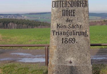
Trail On foot of 6.9 km to be discovered at Saxony, Chemnitz. This trail is proposed by SityTrail - itinéraires balisés pédestres.
Description
Symbol: ein gelbes Dreieck (oben rechts) und ein weißes Dreieck (unten links) bilden ein Quadrat
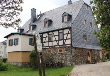
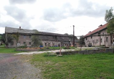
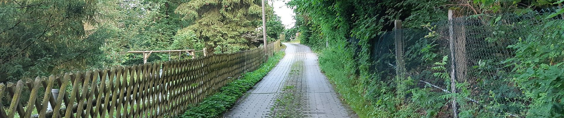
Positioning
Country:
Germany
Region :
Saxony
Department/Province :
Chemnitz
Municipality :
Unknown
Location:
Unknown
Start:(Dec)
Start:(UTM)
356151 ; 5628413 (33U) N.
Comments
Trails nearby
![Trail On foot Unknown - Winterwanderung - Photo](https://media.geolcdn.com/t/375/260/b3cfedcb-d276-4108-a84a-8fb5b2334829.jpeg&format=jpg&maxdim=2)
![On foot On foot](https://static1.geolcdn.com/sitytour/trail-icons/100.png)
![Trail On foot Amtsberg - Naturlehrpfad Dittersdorf - Kemtau - Photo](https://media.geolcdn.com/t/375/260/4aaf6577-17d5-47a4-be0a-4c1e4421395c.jpeg&format=jpg&maxdim=2)
![On foot On foot](https://static1.geolcdn.com/sitytour/trail-icons/100.png)
Naturlehrpfad Dittersdorf - Kemtau
On foot
Easy
Amtsberg,
Saxony,
Erzgebirgskreis,
Germany
![](/images/other/stat-length.png)
3.7 km | 4.4 km-effort
1h 0min
![](https://static1.geolcdn.com/siteimages/upload/files/16400158638029165_repeat_loop_refresh_sync_direction_icon.png)
No
![Trail On foot Amtsberg - Rundweg Dittersdorf - Photo](https://media.geolcdn.com/t/375/260/4aaf6577-17d5-47a4-be0a-4c1e4421395c.jpeg&format=jpg&maxdim=2)
![On foot On foot](https://static1.geolcdn.com/sitytour/trail-icons/100.png)
Rundweg Dittersdorf
On foot
Medium
Amtsberg,
Saxony,
Erzgebirgskreis,
Germany
![](/images/other/stat-length.png)
18.3 km | 23 km-effort
5h 15min
![](https://static1.geolcdn.com/siteimages/upload/files/16400158638029165_repeat_loop_refresh_sync_direction_icon.png)
Yes
![Trail On foot - Rundweg Pfarrhübel - Photo](https://media.geolcdn.com/t/375/260/f500a60c-3fe2-4be5-ad35-42d1db62d617.jpeg&format=jpg&maxdim=2)
![On foot On foot](https://static1.geolcdn.com/sitytour/trail-icons/100.png)
![Trail On foot - Ww Altchemnitz-Berbisdorf-Eisenweg - Photo](https://media.geolcdn.com/t/375/260/4a51c7b5-e45d-4336-8f92-6199b04f7505.jpeg&format=jpg&maxdim=2)
![On foot On foot](https://static1.geolcdn.com/sitytour/trail-icons/100.png)
Ww Altchemnitz-Berbisdorf-Eisenweg
On foot
Easy
,
Saxony,
Chemnitz,
Germany
![](/images/other/stat-length.png)
8.8 km | 11.5 km-effort
2h 36min
![](https://static1.geolcdn.com/siteimages/upload/files/16400158638029165_repeat_loop_refresh_sync_direction_icon.png)
No
![Trail On foot Amtsberg - Vom Rundweg Dittersdorf zum Goldenen Hahn - Photo](https://media.geolcdn.com/t/375/260/784e397a-410c-48b5-bca5-92ef6e3b5f9e.jpeg&format=jpg&maxdim=2)
![On foot On foot](https://static1.geolcdn.com/sitytour/trail-icons/100.png)
Vom Rundweg Dittersdorf zum Goldenen Hahn
On foot
Easy
Amtsberg,
Saxony,
Erzgebirgskreis,
Germany
![](/images/other/stat-length.png)
3.1 km | 4.1 km-effort
55min
![](https://static1.geolcdn.com/siteimages/upload/files/16400158638029165_repeat_loop_refresh_sync_direction_icon.png)
No
![Trail On foot Amtsberg - Einsiedel - Dittersdorfer Höhe - Altenhain - Photo](https://media.geolcdn.com/t/375/260/784e397a-410c-48b5-bca5-92ef6e3b5f9e.jpeg&format=jpg&maxdim=2)
![On foot On foot](https://static1.geolcdn.com/sitytour/trail-icons/100.png)
Einsiedel - Dittersdorfer Höhe - Altenhain
On foot
Easy
Amtsberg,
Saxony,
Erzgebirgskreis,
Germany
![](/images/other/stat-length.png)
7.3 km | 9.8 km-effort
2h 13min
![](https://static1.geolcdn.com/siteimages/upload/files/16400158638029165_repeat_loop_refresh_sync_direction_icon.png)
No
![Trail On foot - Würschnitztalwanderweg - Photo](https://media.geolcdn.com/t/375/260/ext.jpg?maxdim=2&url=https%3A%2F%2Fstatic1.geolcdn.com%2Fsiteimages%2Fupload%2Ffiles%2F1545311037marcheuse_200dpi.jpg)
![On foot On foot](https://static1.geolcdn.com/sitytour/trail-icons/100.png)
![Trail On foot - Chemnitztalwanderweg - Photo](https://media.geolcdn.com/t/375/260/ext.jpg?maxdim=2&url=https%3A%2F%2Fstatic1.geolcdn.com%2Fsiteimages%2Fupload%2Ffiles%2F1545311037marcheuse_200dpi.jpg)
![On foot On foot](https://static1.geolcdn.com/sitytour/trail-icons/100.png)