![](/images/other/stat-length.png)
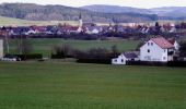
![Trail On foot Neumarkt in der Oberpfalz - TyrolsbergerWaldrundweg - Photo](https://media.geolcdn.com/t/1900/400/1e967018-a4fc-44ba-bcfa-c479fca281f8.jpeg&format=pjpeg&maxdim=2)
TyrolsbergerWaldrundweg
SityTrail - itinéraires balisés pédestres
Tous les sentiers balisés d’Europe GUIDE+
![Length](/images/other/stat-length.png)
Length
4.8 km
![Max alt](https://static1.geolcdn.com/siteimages/upload/files/1508320355ic_sort_altitude_max_24dp.png)
Max alt
562 m
![Uphill gradient](https://static1.geolcdn.com/siteimages/upload/files/1508320355ic_sort_den_pos_24dp.png)
Uphill gradient
87 m
![Km-Effort](/images/other/stat-length.png)
Km-Effort
6.1 km
![Min alt](https://static1.geolcdn.com/siteimages/upload/files/1508320355ic_sort_altitude_min_24dp.png)
Min alt
460 m
![Downhill gradient](https://static1.geolcdn.com/siteimages/upload/files/1508320355ic_sort_den_neg_24dp.png)
Downhill gradient
125 m
![Boucle](https://static1.geolcdn.com/siteimages/upload/files/16400158638029165_repeat_loop_refresh_sync_direction_icon.png)
Boucle
No
Signpost
Creation date :
2022-02-11 13:14:25.145
Updated on :
2022-02-11 13:14:25.145
![On foot](https://static1.geolcdn.com/sitytour/trail-icons/100.png)
1h23
Difficulty : Easy
![Scan this QR Code to open this trail in the SityTrail application](https://capi.geolives.com/qq0zvz2zws4bq2lad0pu/sitytour/trails/3089651/qr.png?size=200)
FREE GPS app for hiking
About
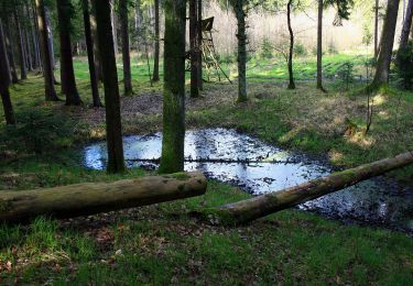
Trail On foot of 4.8 km to be discovered at Bavaria, Landkreis Neumarkt in der Oberpfalz, Neumarkt in der Oberpfalz. This trail is proposed by SityTrail - itinéraires balisés pédestres.
Description
Trail created by Gemeinde Berngau.
abgeschlossen (Jan 2013 by cycling_zno)
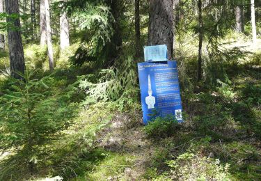
Symbol: Weisse 4 auf grünem Grund
Positioning
Country:
Germany
Region :
Bavaria
Department/Province :
Landkreis Neumarkt in der Oberpfalz
Municipality :
Neumarkt in der Oberpfalz
Location:
Unknown
Start:(Dec)
Start:(UTM)
673870 ; 5461934 (32U) N.
Comments
Trails nearby
![Trail On foot Berngau - BerngauerWestschlaufe - Photo](https://media.geolcdn.com/t/375/260/03d509a5-f51d-4cf3-b933-e47be4990d21.jpeg&format=jpg&maxdim=2)
![On foot On foot](https://static1.geolcdn.com/sitytour/trail-icons/100.png)
BerngauerWestschlaufe
On foot
Easy
Berngau,
Bavaria,
Landkreis Neumarkt in der Oberpfalz,
Germany
![](/images/other/stat-length.png)
5.1 km | 5.3 km-effort
1h 12min
![](https://static1.geolcdn.com/siteimages/upload/files/16400158638029165_repeat_loop_refresh_sync_direction_icon.png)
No
![Trail On foot Berngau - Berngauer Südschlaufe - Photo](https://media.geolcdn.com/t/375/260/03d509a5-f51d-4cf3-b933-e47be4990d21.jpeg&format=jpg&maxdim=2)
![On foot On foot](https://static1.geolcdn.com/sitytour/trail-icons/100.png)
Berngauer Südschlaufe
On foot
Easy
Berngau,
Bavaria,
Landkreis Neumarkt in der Oberpfalz,
Germany
![](/images/other/stat-length.png)
4.9 km | 5.7 km-effort
1h 17min
![](https://static1.geolcdn.com/siteimages/upload/files/16400158638029165_repeat_loop_refresh_sync_direction_icon.png)
No
![Trail On foot Postbauer-Heng - Keltenrunde - Photo](https://media.geolcdn.com/t/375/260/eae0f31c-7b2a-4626-b75e-cdbb47f57bf5.jpeg&format=jpg&maxdim=2)
![On foot On foot](https://static1.geolcdn.com/sitytour/trail-icons/100.png)
Keltenrunde
On foot
Easy
Postbauer-Heng,
Bavaria,
Landkreis Neumarkt in der Oberpfalz,
Germany
![](/images/other/stat-length.png)
6.5 km | 7.8 km-effort
1h 46min
![](https://static1.geolcdn.com/siteimages/upload/files/16400158638029165_repeat_loop_refresh_sync_direction_icon.png)
No
![Trail On foot Postbauer-Heng - Burgthann Walking Etzelrunde - Photo](https://media.geolcdn.com/t/375/260/cdab7971-b641-4d8b-9dce-9da3a63af62a.jpeg&format=jpg&maxdim=2)
![On foot On foot](https://static1.geolcdn.com/sitytour/trail-icons/100.png)
Burgthann Walking Etzelrunde
On foot
Easy
Postbauer-Heng,
Bavaria,
Landkreis Neumarkt in der Oberpfalz,
Germany
![](/images/other/stat-length.png)
7.3 km | 8.4 km-effort
1h 53min
![](https://static1.geolcdn.com/siteimages/upload/files/16400158638029165_repeat_loop_refresh_sync_direction_icon.png)
No
![Trail On foot Berngau - Berngauer Nordschlaufe - Photo](https://media.geolcdn.com/t/375/260/3eba7d69-b074-49a6-bd0f-fe3782faebd0.jpeg&format=jpg&maxdim=2)
![On foot On foot](https://static1.geolcdn.com/sitytour/trail-icons/100.png)
Berngauer Nordschlaufe
On foot
Easy
Berngau,
Bavaria,
Landkreis Neumarkt in der Oberpfalz,
Germany
![](/images/other/stat-length.png)
8.6 km | 9.5 km-effort
2h 9min
![](https://static1.geolcdn.com/siteimages/upload/files/16400158638029165_repeat_loop_refresh_sync_direction_icon.png)
Yes
![Trail On foot Postbauer-Heng - Ebenbühlweg - Photo](https://media.geolcdn.com/t/375/260/a9d91b06-96ad-4b4a-a5f9-ded4702d7ace.jpeg&format=jpg&maxdim=2)
![On foot On foot](https://static1.geolcdn.com/sitytour/trail-icons/100.png)
Ebenbühlweg
On foot
Easy
Postbauer-Heng,
Bavaria,
Landkreis Neumarkt in der Oberpfalz,
Germany
![](/images/other/stat-length.png)
16.7 km | 19.3 km-effort
4h 22min
![](https://static1.geolcdn.com/siteimages/upload/files/16400158638029165_repeat_loop_refresh_sync_direction_icon.png)
No
![Trail On foot Postbauer-Heng - Beerenschlag-Weg - Photo](https://media.geolcdn.com/t/375/260/adce6f83-7736-4972-bc43-b055fcd2ffd8.jpeg&format=jpg&maxdim=2)
![On foot On foot](https://static1.geolcdn.com/sitytour/trail-icons/100.png)
Beerenschlag-Weg
On foot
Easy
Postbauer-Heng,
Bavaria,
Landkreis Neumarkt in der Oberpfalz,
Germany
![](/images/other/stat-length.png)
7.2 km | 8.3 km-effort
1h 53min
![](https://static1.geolcdn.com/siteimages/upload/files/16400158638029165_repeat_loop_refresh_sync_direction_icon.png)
No
![Trail On foot Berg b.Neumarkt i.d.OPf. - Kaltenbach-Weg - Photo](https://media.geolcdn.com/t/375/260/70132e7e-9f3f-4787-8f28-d294672864ef.jpeg&format=jpg&maxdim=2)
![On foot On foot](https://static1.geolcdn.com/sitytour/trail-icons/100.png)
Kaltenbach-Weg
On foot
Easy
Berg b.Neumarkt i.d.OPf.,
Bavaria,
Landkreis Neumarkt in der Oberpfalz,
Germany
![](/images/other/stat-length.png)
4 km | 5.7 km-effort
1h 17min
![](https://static1.geolcdn.com/siteimages/upload/files/16400158638029165_repeat_loop_refresh_sync_direction_icon.png)
No
![Trail On foot Berg b.Neumarkt i.d.OPf. - Hausheimer Runde - Photo](https://media.geolcdn.com/t/375/260/70132e7e-9f3f-4787-8f28-d294672864ef.jpeg&format=jpg&maxdim=2)
![On foot On foot](https://static1.geolcdn.com/sitytour/trail-icons/100.png)
Hausheimer Runde
On foot
Easy
Berg b.Neumarkt i.d.OPf.,
Bavaria,
Landkreis Neumarkt in der Oberpfalz,
Germany
![](/images/other/stat-length.png)
8.2 km | 11 km-effort
2h 29min
![](https://static1.geolcdn.com/siteimages/upload/files/16400158638029165_repeat_loop_refresh_sync_direction_icon.png)
No