![](/images/other/stat-length.png)
![Trail On foot Leutenbach - Rundwanderweg Walberla - Photo](https://media.geolcdn.com/t/1900/400/83515f49-eff2-4bc1-b8ba-1cece4f1bf01.jpeg&format=pjpeg&maxdim=2)
Rundwanderweg Walberla
SityTrail - itinéraires balisés pédestres
Tous les sentiers balisés d’Europe GUIDE+
![Length](/images/other/stat-length.png)
Length
4.1 km
![Max alt](https://static1.geolcdn.com/siteimages/upload/files/1508320355ic_sort_altitude_max_24dp.png)
Max alt
476 m
![Uphill gradient](https://static1.geolcdn.com/siteimages/upload/files/1508320355ic_sort_den_pos_24dp.png)
Uphill gradient
115 m
![Km-Effort](/images/other/stat-length.png)
Km-Effort
5.7 km
![Min alt](https://static1.geolcdn.com/siteimages/upload/files/1508320355ic_sort_altitude_min_24dp.png)
Min alt
391 m
![Downhill gradient](https://static1.geolcdn.com/siteimages/upload/files/1508320355ic_sort_den_neg_24dp.png)
Downhill gradient
131 m
![Boucle](https://static1.geolcdn.com/siteimages/upload/files/16400158638029165_repeat_loop_refresh_sync_direction_icon.png)
Boucle
No
Signpost
Creation date :
2022-02-11 13:13:40.4
Updated on :
2022-02-11 13:13:40.4
![On foot](https://static1.geolcdn.com/sitytour/trail-icons/100.png)
1h17
Difficulty : Easy
![Scan this QR Code to open this trail in the SityTrail application](https://capi.geolives.com/qq0zvz2zws4bq2lad0pu/sitytour/trails/3089600/qr.png?size=200)
FREE GPS app for hiking
About
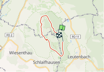
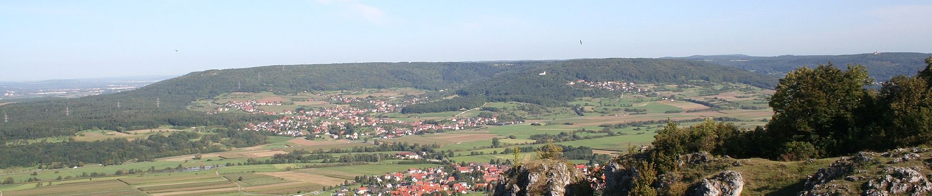
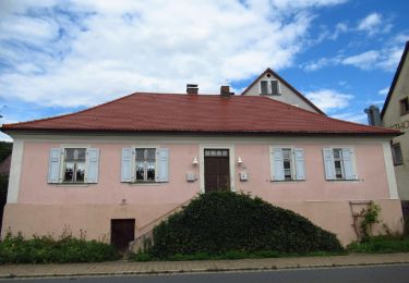
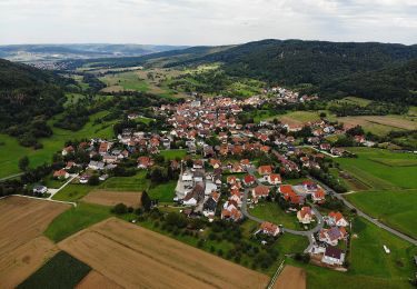
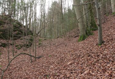
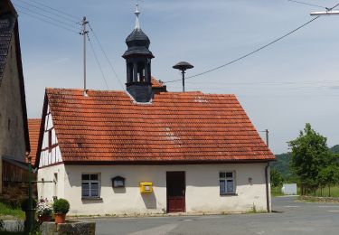
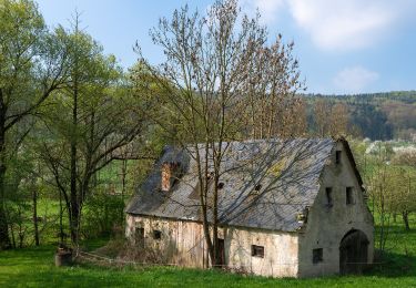
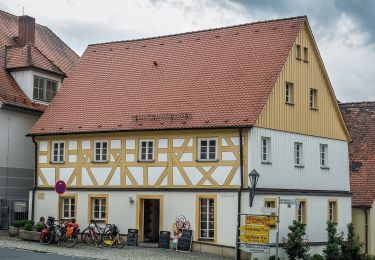
Trail On foot of 4.1 km to be discovered at Bavaria, Landkreis Forchheim, Leutenbach. This trail is proposed by SityTrail - itinéraires balisés pédestres.
Description
Trail created by Gemeinde Leutenbach.
abgeschlossen (Feb. 2013 by cycling_zno)
Symbol: weisser Kreis mit schwarzer Krone auf rotem Hintergrund
Positioning
Country:
Germany
Region :
Bavaria
Department/Province :
Landkreis Forchheim
Municipality :
Leutenbach
Location:
Unknown
Start:(Dec)
Start:(UTM)
655674 ; 5509563 (32U) N.
Comments
Trails nearby
![Trail On foot Pretzfeld - Lauferlebnis Fränkische Schweiz W2 - Photo](https://media.geolcdn.com/t/375/260/16fede52-043b-4da7-a7fe-785f18fe0af6.jpeg&format=jpg&maxdim=2)
![On foot On foot](https://static1.geolcdn.com/sitytour/trail-icons/100.png)
Lauferlebnis Fränkische Schweiz W2
On foot
Easy
Pretzfeld,
Bavaria,
Landkreis Forchheim,
Germany
![](/images/other/stat-length.png)
10 km | 10.8 km-effort
2h 26min
![](https://static1.geolcdn.com/siteimages/upload/files/16400158638029165_repeat_loop_refresh_sync_direction_icon.png)
Yes
![Trail On foot Pretzfeld - Lauferlebnis Fränkische Schweiz W1 - Photo](https://media.geolcdn.com/t/375/260/97a9afd1-03e1-4c76-befb-634ebb2476e3.jpeg&format=jpg&maxdim=2)
![On foot On foot](https://static1.geolcdn.com/sitytour/trail-icons/100.png)
Lauferlebnis Fränkische Schweiz W1
On foot
Easy
Pretzfeld,
Bavaria,
Landkreis Forchheim,
Germany
![](/images/other/stat-length.png)
4.7 km | 5 km-effort
1h 8min
![](https://static1.geolcdn.com/siteimages/upload/files/16400158638029165_repeat_loop_refresh_sync_direction_icon.png)
Yes
![Trail On foot Weilersbach - Wanderweg Roter Schrägbalken - Photo](https://media.geolcdn.com/t/375/260/3d96a8d8-1ce4-4292-a682-9cf55a71460e.jpeg&format=jpg&maxdim=2)
![On foot On foot](https://static1.geolcdn.com/sitytour/trail-icons/100.png)
Wanderweg Roter Schrägbalken
On foot
Easy
Weilersbach,
Bavaria,
Landkreis Forchheim,
Germany
![](/images/other/stat-length.png)
5.1 km | 5.8 km-effort
1h 19min
![](https://static1.geolcdn.com/siteimages/upload/files/16400158638029165_repeat_loop_refresh_sync_direction_icon.png)
No
![Trail On foot Pretzfeld - Lauferlebnis Fränkische Schweiz W3 - Photo](https://media.geolcdn.com/t/375/260/25b32ced-785c-40a5-a240-9c1e7f2b920b.jpeg&format=jpg&maxdim=2)
![On foot On foot](https://static1.geolcdn.com/sitytour/trail-icons/100.png)
Lauferlebnis Fränkische Schweiz W3
On foot
Easy
Pretzfeld,
Bavaria,
Landkreis Forchheim,
Germany
![](/images/other/stat-length.png)
12.5 km | 14.2 km-effort
3h 13min
![](https://static1.geolcdn.com/siteimages/upload/files/16400158638029165_repeat_loop_refresh_sync_direction_icon.png)
Yes
![Trail On foot Leutenbach - Georg-Kanzler-Gedächtnisweg - Photo](https://media.geolcdn.com/t/375/260/cd12a3b7-e274-4861-b00d-2df38576a40b.jpeg&format=jpg&maxdim=2)
![On foot On foot](https://static1.geolcdn.com/sitytour/trail-icons/100.png)
Georg-Kanzler-Gedächtnisweg
On foot
Easy
Leutenbach,
Bavaria,
Landkreis Forchheim,
Germany
![](/images/other/stat-length.png)
8.4 km | 12 km-effort
2h 44min
![](https://static1.geolcdn.com/siteimages/upload/files/16400158638029165_repeat_loop_refresh_sync_direction_icon.png)
Yes
![Trail On foot Pretzfeld - Rundweg Unterzaunsbach-Schweinthal - Photo](https://media.geolcdn.com/t/375/260/51e2bde1-9665-4460-971a-0249458263d5.jpeg&format=jpg&maxdim=2)
![On foot On foot](https://static1.geolcdn.com/sitytour/trail-icons/100.png)
Rundweg Unterzaunsbach-Schweinthal
On foot
Easy
Pretzfeld,
Bavaria,
Landkreis Forchheim,
Germany
![](/images/other/stat-length.png)
6.4 km | 10.9 km-effort
2h 28min
![](https://static1.geolcdn.com/siteimages/upload/files/16400158638029165_repeat_loop_refresh_sync_direction_icon.png)
Yes
![Trail On foot Pretzfeld - Pretzfeld - Hetzelsdorf - Photo](https://media.geolcdn.com/t/375/260/ce781ee2-1be6-4766-883a-f3c5d2de25d8.jpeg&format=jpg&maxdim=2)
![On foot On foot](https://static1.geolcdn.com/sitytour/trail-icons/100.png)
Pretzfeld - Hetzelsdorf
On foot
Easy
Pretzfeld,
Bavaria,
Landkreis Forchheim,
Germany
![](/images/other/stat-length.png)
4.8 km | 6.5 km-effort
1h 29min
![](https://static1.geolcdn.com/siteimages/upload/files/16400158638029165_repeat_loop_refresh_sync_direction_icon.png)
No
![Trail On foot Pretzfeld - Rundweg Unterzaunsbach-Hundshaupten - Photo](https://media.geolcdn.com/t/375/260/6f28ea41-c392-4d44-bbdc-57efcc6c6c5d.jpeg&format=jpg&maxdim=2)
![On foot On foot](https://static1.geolcdn.com/sitytour/trail-icons/100.png)
Rundweg Unterzaunsbach-Hundshaupten
On foot
Easy
Pretzfeld,
Bavaria,
Landkreis Forchheim,
Germany
![](/images/other/stat-length.png)
4.7 km | 7.2 km-effort
1h 38min
![](https://static1.geolcdn.com/siteimages/upload/files/16400158638029165_repeat_loop_refresh_sync_direction_icon.png)
Yes
![Trail On foot Pretzfeld - Lützelsdorf-Pretzfeld - Photo](https://media.geolcdn.com/t/375/260/3a0c9627-416f-43eb-98af-47ecaea244a9.jpeg&format=jpg&maxdim=2)
![On foot On foot](https://static1.geolcdn.com/sitytour/trail-icons/100.png)
Lützelsdorf-Pretzfeld
On foot
Easy
Pretzfeld,
Bavaria,
Landkreis Forchheim,
Germany
![](/images/other/stat-length.png)
3.7 km | 5.9 km-effort
1h 20min
![](https://static1.geolcdn.com/siteimages/upload/files/16400158638029165_repeat_loop_refresh_sync_direction_icon.png)
No