![](/images/other/stat-length.png)
![Trail On foot Radevormwald - [Ra] Rund um Radevormwald - Photo](https://media.geolcdn.com/t/1900/400/8f2eda21-0a7d-4da7-87a2-0a5d53ecedd4.jpeg&format=pjpeg&maxdim=2)
[Ra] Rund um Radevormwald
SityTrail - itinéraires balisés pédestres
Tous les sentiers balisés d’Europe GUIDE+
![Length](/images/other/stat-length.png)
Length
21 km
![Max alt](https://static1.geolcdn.com/siteimages/upload/files/1508320355ic_sort_altitude_max_24dp.png)
Max alt
376 m
![Uphill gradient](https://static1.geolcdn.com/siteimages/upload/files/1508320355ic_sort_den_pos_24dp.png)
Uphill gradient
484 m
![Km-Effort](/images/other/stat-length.png)
Km-Effort
27 km
![Min alt](https://static1.geolcdn.com/siteimages/upload/files/1508320355ic_sort_altitude_min_24dp.png)
Min alt
211 m
![Downhill gradient](https://static1.geolcdn.com/siteimages/upload/files/1508320355ic_sort_den_neg_24dp.png)
Downhill gradient
485 m
![Boucle](https://static1.geolcdn.com/siteimages/upload/files/16400158638029165_repeat_loop_refresh_sync_direction_icon.png)
Boucle
Yes
Signpost
Creation date :
2022-02-11 13:12:37.334
Updated on :
2022-02-11 13:12:37.334
![On foot](https://static1.geolcdn.com/sitytour/trail-icons/100.png)
6h13
Difficulty : Medium
![Scan this QR Code to open this trail in the SityTrail application](https://capi.geolives.com/qq0zvz2zws4bq2lad0pu/sitytour/trails/3089533/qr.png?size=200)
FREE GPS app for hiking
About
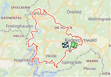
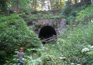
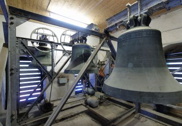
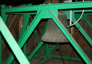
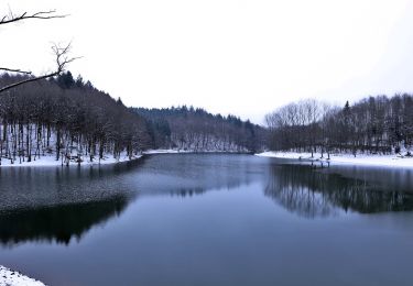
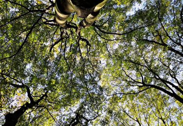
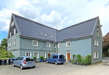
Trail On foot of 21 km to be discovered at North Rhine-Westphalia, Oberbergischer Kreis, Radevormwald. This trail is proposed by SityTrail - itinéraires balisés pédestres.
Description
Trail created by Sauerländischer Gebirgsverein.
Symbol: Ra im Kreis
Positioning
Country:
Germany
Region :
North Rhine-Westphalia
Department/Province :
Oberbergischer Kreis
Municipality :
Radevormwald
Location:
Unknown
Start:(Dec)
Start:(UTM)
384351 ; 5672782 (32U) N.
Comments
Trails nearby
![Trail On foot Hückeswagen - Rund um Hückeswagen - Photo](https://media.geolcdn.com/t/375/260/560cec78-08df-4af6-b478-17e279119cf7.jpeg&format=jpg&maxdim=2)
![On foot On foot](https://static1.geolcdn.com/sitytour/trail-icons/100.png)
Rund um Hückeswagen
On foot
Easy
Hückeswagen,
North Rhine-Westphalia,
Oberbergischer Kreis,
Germany
![](/images/other/stat-length.png)
14.2 km | 18 km-effort
4h 5min
![](https://static1.geolcdn.com/siteimages/upload/files/16400158638029165_repeat_loop_refresh_sync_direction_icon.png)
No
![Trail On foot Hückeswagen - Mauswanderpfad - Photo](https://media.geolcdn.com/t/375/260/63082b26-185b-43da-bd00-d8dc3e361e75.jpeg&format=jpg&maxdim=2)
![On foot On foot](https://static1.geolcdn.com/sitytour/trail-icons/100.png)
Mauswanderpfad
On foot
Easy
Hückeswagen,
North Rhine-Westphalia,
Oberbergischer Kreis,
Germany
![](/images/other/stat-length.png)
4.1 km | 5.2 km-effort
1h 10min
![](https://static1.geolcdn.com/siteimages/upload/files/16400158638029165_repeat_loop_refresh_sync_direction_icon.png)
Yes
![Trail On foot Wipperfürth - Rundwanderweg A5 (Egen) - Photo](https://media.geolcdn.com/t/375/260/6f2688db-848e-4d8f-851a-09bf40073dbd.jpeg&format=jpg&maxdim=2)
![On foot On foot](https://static1.geolcdn.com/sitytour/trail-icons/100.png)
Rundwanderweg A5 (Egen)
On foot
Easy
Wipperfürth,
North Rhine-Westphalia,
Oberbergischer Kreis,
Germany
![](/images/other/stat-length.png)
8.8 km | 10.7 km-effort
2h 25min
![](https://static1.geolcdn.com/siteimages/upload/files/16400158638029165_repeat_loop_refresh_sync_direction_icon.png)
Yes
![Trail On foot Wipperfürth - Rundwanderweg A3 (Egen - Bevertalsperre) - Photo](https://media.geolcdn.com/t/375/260/407f8d52-99ad-4f63-804e-1b9ad16bd4db.jpeg&format=jpg&maxdim=2)
![On foot On foot](https://static1.geolcdn.com/sitytour/trail-icons/100.png)
Rundwanderweg A3 (Egen - Bevertalsperre)
On foot
Easy
Wipperfürth,
North Rhine-Westphalia,
Oberbergischer Kreis,
Germany
![](/images/other/stat-length.png)
7.4 km | 9.5 km-effort
2h 9min
![](https://static1.geolcdn.com/siteimages/upload/files/16400158638029165_repeat_loop_refresh_sync_direction_icon.png)
Yes
![Trail On foot Wipperfürth - Rundwanderweg A2 (Egen) - Photo](https://media.geolcdn.com/t/375/260/6f2688db-848e-4d8f-851a-09bf40073dbd.jpeg&format=jpg&maxdim=2)
![On foot On foot](https://static1.geolcdn.com/sitytour/trail-icons/100.png)
Rundwanderweg A2 (Egen)
On foot
Easy
Wipperfürth,
North Rhine-Westphalia,
Oberbergischer Kreis,
Germany
![](/images/other/stat-length.png)
5 km | 6.3 km-effort
1h 25min
![](https://static1.geolcdn.com/siteimages/upload/files/16400158638029165_repeat_loop_refresh_sync_direction_icon.png)
Yes
![Trail On foot Wipperfürth - Rundwanderweg A1 (Egen) - Photo](https://media.geolcdn.com/t/375/260/6f2688db-848e-4d8f-851a-09bf40073dbd.jpeg&format=jpg&maxdim=2)
![On foot On foot](https://static1.geolcdn.com/sitytour/trail-icons/100.png)
Rundwanderweg A1 (Egen)
On foot
Easy
Wipperfürth,
North Rhine-Westphalia,
Oberbergischer Kreis,
Germany
![](/images/other/stat-length.png)
3.4 km | 4.1 km-effort
55min
![](https://static1.geolcdn.com/siteimages/upload/files/16400158638029165_repeat_loop_refresh_sync_direction_icon.png)
Yes
![Trail On foot Radevormwald - Hölterhof Rundweg A1 - Photo](https://media.geolcdn.com/t/375/260/b0bccdb9-b031-46d5-abb2-3b2d099fefff.jpeg&format=jpg&maxdim=2)
![On foot On foot](https://static1.geolcdn.com/sitytour/trail-icons/100.png)
Hölterhof Rundweg A1
On foot
Easy
Radevormwald,
North Rhine-Westphalia,
Oberbergischer Kreis,
Germany
![](/images/other/stat-length.png)
4.1 km | 5.4 km-effort
1h 12min
![](https://static1.geolcdn.com/siteimages/upload/files/16400158638029165_repeat_loop_refresh_sync_direction_icon.png)
Yes
![Trail On foot Unknown - Jacobsmühle Rundweg A4 - Photo](https://media.geolcdn.com/t/375/260/fc8d9e4e-ebe4-459c-b3be-ce36f4fff971.jpeg&format=jpg&maxdim=2)
![On foot On foot](https://static1.geolcdn.com/sitytour/trail-icons/100.png)
Jacobsmühle Rundweg A4
On foot
Easy
Unknown,
North Rhine-Westphalia,
Remscheid,
Germany
![](/images/other/stat-length.png)
5.4 km | 6.8 km-effort
1h 33min
![](https://static1.geolcdn.com/siteimages/upload/files/16400158638029165_repeat_loop_refresh_sync_direction_icon.png)
Yes
![Trail On foot Hückeswagen - Radevormwald Rundweg A2 - Photo](https://media.geolcdn.com/t/375/260/b0bccdb9-b031-46d5-abb2-3b2d099fefff.jpeg&format=jpg&maxdim=2)
![On foot On foot](https://static1.geolcdn.com/sitytour/trail-icons/100.png)
Radevormwald Rundweg A2
On foot
Easy
Hückeswagen,
North Rhine-Westphalia,
Oberbergischer Kreis,
Germany
![](/images/other/stat-length.png)
9.3 km | 11.9 km-effort
2h 42min
![](https://static1.geolcdn.com/siteimages/upload/files/16400158638029165_repeat_loop_refresh_sync_direction_icon.png)
Yes