![](/images/other/stat-length.png)
![Trail On foot Unknown - Belecke - Nuttlarer Höhe - Photo](https://media.geolcdn.com/t/1900/400/3a867c1e-95ed-4a65-b649-52c6156ebad7.jpeg&format=pjpeg&maxdim=2)
Belecke - Nuttlarer Höhe
SityTrail - itinéraires balisés pédestres
Tous les sentiers balisés d’Europe GUIDE+
![Length](/images/other/stat-length.png)
Length
14.3 km
![Max alt](https://static1.geolcdn.com/siteimages/upload/files/1508320355ic_sort_altitude_max_24dp.png)
Max alt
545 m
![Uphill gradient](https://static1.geolcdn.com/siteimages/upload/files/1508320355ic_sort_den_pos_24dp.png)
Uphill gradient
506 m
![Km-Effort](/images/other/stat-length.png)
Km-Effort
20 km
![Min alt](https://static1.geolcdn.com/siteimages/upload/files/1508320355ic_sort_altitude_min_24dp.png)
Min alt
260 m
![Downhill gradient](https://static1.geolcdn.com/siteimages/upload/files/1508320355ic_sort_den_neg_24dp.png)
Downhill gradient
223 m
![Boucle](https://static1.geolcdn.com/siteimages/upload/files/16400158638029165_repeat_loop_refresh_sync_direction_icon.png)
Boucle
No
Signpost
Creation date :
2022-02-11 13:07:42.804
Updated on :
2022-02-11 13:07:42.804
![On foot](https://static1.geolcdn.com/sitytour/trail-icons/100.png)
4h34
Difficulty : Medium
![Scan this QR Code to open this trail in the SityTrail application](https://capi.geolives.com/qq0zvz2zws4bq2lad0pu/sitytour/trails/3089249/qr.png?size=200)
FREE GPS app for hiking
About
Trail On foot of 14.3 km to be discovered at North Rhine-Westphalia, Kreis Soest, Unknown. This trail is proposed by SityTrail - itinéraires balisés pédestres.
Description
Trail created by Sauerländischer Gebirgsverein.
Positioning
Country:
Germany
Region :
North Rhine-Westphalia
Department/Province :
Kreis Soest
Municipality :
Unknown
Location:
Belecke
Start:(Dec)
Start:(UTM)
453891 ; 5703994 (32U) N.
Comments
Trails nearby
![Trail On foot Warstein - Warsteiner Weg der Montangeschichte - Photo](https://media.geolcdn.com/t/375/260/96437054-cd85-436d-a887-41dcfde85f47.jpeg&format=jpg&maxdim=2)
![On foot On foot](https://static1.geolcdn.com/sitytour/trail-icons/100.png)
Warsteiner Weg der Montangeschichte
On foot
Easy
Warstein,
North Rhine-Westphalia,
Kreis Soest,
Germany
![](/images/other/stat-length.png)
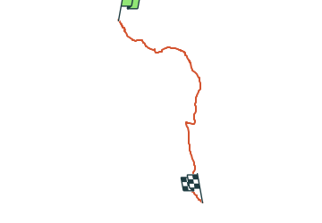
5.1 km | 6.2 km-effort
1h 24min
![](https://static1.geolcdn.com/siteimages/upload/files/16400158638029165_repeat_loop_refresh_sync_direction_icon.png)
No
![Trail On foot Warstein - Warstein Alte Kiche - Sichtigvor < - Photo](https://media.geolcdn.com/t/375/260/d9182f6f-2769-43ca-a988-8e5344cab4bf.jpeg&format=jpg&maxdim=2)
![On foot On foot](https://static1.geolcdn.com/sitytour/trail-icons/100.png)
Warstein Alte Kiche - Sichtigvor <
On foot
Easy
Warstein,
North Rhine-Westphalia,
Kreis Soest,
Germany
![](/images/other/stat-length.png)
7.3 km | 10 km-effort
2h 16min
![](https://static1.geolcdn.com/siteimages/upload/files/16400158638029165_repeat_loop_refresh_sync_direction_icon.png)
No
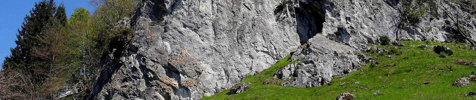
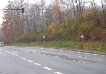
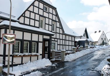
![Trail On foot Unknown - [O] Belecker Rundweg - Photo](https://media.geolcdn.com/t/375/260/4441d898-30d6-49a1-90b9-d313b5f874d3.jpeg&format=jpg&maxdim=2)
![On foot On foot](https://static1.geolcdn.com/sitytour/trail-icons/100.png)
[O] Belecker Rundweg
On foot
Easy
Unknown,
North Rhine-Westphalia,
Kreis Soest,
Germany
![](/images/other/stat-length.png)
6.3 km | 7.5 km-effort
1h 41min
![](https://static1.geolcdn.com/siteimages/upload/files/16400158638029165_repeat_loop_refresh_sync_direction_icon.png)
Yes
![Trail On foot Warstein - Kallenhardt A6 - Photo](https://media.geolcdn.com/t/375/260/defe720d-25a5-4b38-ab42-8b1370c0f112.jpeg&format=jpg&maxdim=2)
![On foot On foot](https://static1.geolcdn.com/sitytour/trail-icons/100.png)
Kallenhardt A6
On foot
Easy
Warstein,
North Rhine-Westphalia,
Kreis Soest,
Germany
![](/images/other/stat-length.png)
3.6 km | 4.8 km-effort
1h 5min
![](https://static1.geolcdn.com/siteimages/upload/files/16400158638029165_repeat_loop_refresh_sync_direction_icon.png)
No
![Trail On foot Warstein - Belecke A2 - Photo](https://media.geolcdn.com/t/375/260/16e04c56-ce2b-420f-afcc-21d70284dc09.jpeg&format=jpg&maxdim=2)
![On foot On foot](https://static1.geolcdn.com/sitytour/trail-icons/100.png)
Belecke A2
On foot
Easy
Warstein,
North Rhine-Westphalia,
Kreis Soest,
Germany
![](/images/other/stat-length.png)
4.5 km | 6.5 km-effort
1h 27min
![](https://static1.geolcdn.com/siteimages/upload/files/16400158638029165_repeat_loop_refresh_sync_direction_icon.png)
Yes
![Trail On foot Warstein - Belecke A7 - Photo](https://media.geolcdn.com/t/375/260/16e04c56-ce2b-420f-afcc-21d70284dc09.jpeg&format=jpg&maxdim=2)
![On foot On foot](https://static1.geolcdn.com/sitytour/trail-icons/100.png)
Belecke A7
On foot
Easy
Warstein,
North Rhine-Westphalia,
Kreis Soest,
Germany
![](/images/other/stat-length.png)
3.8 km | 5.1 km-effort
1h 10min
![](https://static1.geolcdn.com/siteimages/upload/files/16400158638029165_repeat_loop_refresh_sync_direction_icon.png)
Yes
![Trail On foot Warstein - Hirschberg A5 - Photo](https://media.geolcdn.com/t/375/260/8d258a96-b1cb-44b7-aa86-bc9aef5c6732.jpeg&format=jpg&maxdim=2)
![On foot On foot](https://static1.geolcdn.com/sitytour/trail-icons/100.png)
Hirschberg A5
On foot
Easy
Warstein,
North Rhine-Westphalia,
Kreis Soest,
Germany
![](/images/other/stat-length.png)
5.1 km | 6.9 km-effort
1h 33min
![](https://static1.geolcdn.com/siteimages/upload/files/16400158638029165_repeat_loop_refresh_sync_direction_icon.png)
No
![Trail On foot Unknown - Quadrat Belecke - Körtlinghausen - Kallenhardt - Photo](https://media.geolcdn.com/t/375/260/4441d898-30d6-49a1-90b9-d313b5f874d3.jpeg&format=jpg&maxdim=2)
![On foot On foot](https://static1.geolcdn.com/sitytour/trail-icons/100.png)
Quadrat Belecke - Körtlinghausen - Kallenhardt
On foot
Easy
Unknown,
North Rhine-Westphalia,
Kreis Soest,
Germany
![](/images/other/stat-length.png)
8.1 km | 10.9 km-effort
2h 29min
![](https://static1.geolcdn.com/siteimages/upload/files/16400158638029165_repeat_loop_refresh_sync_direction_icon.png)
No
![Trail On foot Warstein - Belecke A3 - Photo](https://media.geolcdn.com/t/375/260/e50aefbf-474b-4a50-8055-7ead66d4658c.jpeg&format=jpg&maxdim=2)
![On foot On foot](https://static1.geolcdn.com/sitytour/trail-icons/100.png)
Belecke A3
On foot
Easy
Warstein,
North Rhine-Westphalia,
Kreis Soest,
Germany
![](/images/other/stat-length.png)
4.9 km | 6.3 km-effort
1h 26min
![](https://static1.geolcdn.com/siteimages/upload/files/16400158638029165_repeat_loop_refresh_sync_direction_icon.png)
Yes