![](/images/other/stat-length.png)
![Trail On foot Wermelskirchen - [Vollquadrat] Burg - Dhünntalsperre - Photo](https://media.geolcdn.com/t/1900/400/dd563847-bd51-41a0-a586-fb107f8dd368.jpeg&format=pjpeg&maxdim=2)
[Vollquadrat] Burg - Dhünntalsperre
SityTrail - itinéraires balisés pédestres
Tous les sentiers balisés d’Europe GUIDE+
![Length](/images/other/stat-length.png)
Length
12.2 km
![Max alt](https://static1.geolcdn.com/siteimages/upload/files/1508320355ic_sort_altitude_max_24dp.png)
Max alt
326 m
![Uphill gradient](https://static1.geolcdn.com/siteimages/upload/files/1508320355ic_sort_den_pos_24dp.png)
Uphill gradient
308 m
![Km-Effort](/images/other/stat-length.png)
Km-Effort
16.2 km
![Min alt](https://static1.geolcdn.com/siteimages/upload/files/1508320355ic_sort_altitude_min_24dp.png)
Min alt
184 m
![Downhill gradient](https://static1.geolcdn.com/siteimages/upload/files/1508320355ic_sort_den_neg_24dp.png)
Downhill gradient
301 m
![Boucle](https://static1.geolcdn.com/siteimages/upload/files/16400158638029165_repeat_loop_refresh_sync_direction_icon.png)
Boucle
No
Signpost
Creation date :
2022-02-11 13:00:23.945
Updated on :
2022-02-11 13:00:23.945
![On foot](https://static1.geolcdn.com/sitytour/trail-icons/100.png)
3h41
Difficulty : Easy
![Scan this QR Code to open this trail in the SityTrail application](https://capi.geolives.com/qq0zvz2zws4bq2lad0pu/sitytour/trails/3088877/qr.png?size=200)
FREE GPS app for hiking
About
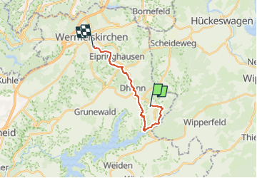
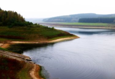
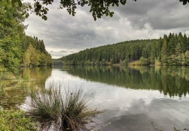
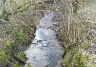
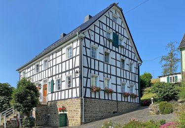
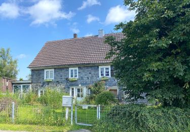
Trail On foot of 12.2 km to be discovered at North Rhine-Westphalia, Rheinisch-Bergischer Kreis, Wermelskirchen. This trail is proposed by SityTrail - itinéraires balisés pédestres.
Description
Trail created by Sauerländischer Gebirgsverein, Bezirk Bergisches Land.
Positioning
Country:
Germany
Region :
North Rhine-Westphalia
Department/Province :
Rheinisch-Bergischer Kreis
Municipality :
Wermelskirchen
Location:
Unknown
Start:(Dec)
Start:(UTM)
379024 ; 5662190 (32U) N.
Comments
Trails nearby
![Trail On foot Wermelskirchen - E1 - Vom Park ins Tal - Photo](https://media.geolcdn.com/t/375/260/b440e6fc-79bf-41f0-96e2-f578bda2ef8b.jpeg&format=jpg&maxdim=2)
![On foot On foot](https://static1.geolcdn.com/sitytour/trail-icons/100.png)
E1 - Vom Park ins Tal
On foot
Easy
Wermelskirchen,
North Rhine-Westphalia,
Rheinisch-Bergischer Kreis,
Germany
![](/images/other/stat-length.png)
7.3 km | 8.8 km-effort
2h 0min
![](https://static1.geolcdn.com/siteimages/upload/files/16400158638029165_repeat_loop_refresh_sync_direction_icon.png)
No
![Trail On foot Wermelskirchen - D4 - Naturwelten - Photo](https://media.geolcdn.com/t/375/260/bc106ab4-d620-4949-9c9e-f02c29880e90.jpeg&format=jpg&maxdim=2)
![On foot On foot](https://static1.geolcdn.com/sitytour/trail-icons/100.png)
D4 - Naturwelten
On foot
Easy
Wermelskirchen,
North Rhine-Westphalia,
Rheinisch-Bergischer Kreis,
Germany
![](/images/other/stat-length.png)
5 km | 7 km-effort
1h 35min
![](https://static1.geolcdn.com/siteimages/upload/files/16400158638029165_repeat_loop_refresh_sync_direction_icon.png)
Yes
![Trail On foot Wermelskirchen - D3 - Kirchweg - Photo](https://media.geolcdn.com/t/375/260/c61ce69e-f6ea-482e-a162-ed313189b52f.jpeg&format=jpg&maxdim=2)
![On foot On foot](https://static1.geolcdn.com/sitytour/trail-icons/100.png)
D3 - Kirchweg
On foot
Easy
Wermelskirchen,
North Rhine-Westphalia,
Rheinisch-Bergischer Kreis,
Germany
![](/images/other/stat-length.png)
9.4 km | 12 km-effort
2h 43min
![](https://static1.geolcdn.com/siteimages/upload/files/16400158638029165_repeat_loop_refresh_sync_direction_icon.png)
Yes
![Trail On foot Kürten - D5 - Dunkle Wälder, sonnige Höhen - Photo](https://media.geolcdn.com/t/375/260/afedf003-f0de-49af-aba5-3a40fcc4185c.jpeg&format=jpg&maxdim=2)
![On foot On foot](https://static1.geolcdn.com/sitytour/trail-icons/100.png)
D5 - Dunkle Wälder, sonnige Höhen
On foot
Easy
Kürten,
North Rhine-Westphalia,
Rheinisch-Bergischer Kreis,
Germany
![](/images/other/stat-length.png)
3.7 km | 4.8 km-effort
1h 4min
![](https://static1.geolcdn.com/siteimages/upload/files/16400158638029165_repeat_loop_refresh_sync_direction_icon.png)
Yes
![Trail On foot Wermelskirchen - Talsperrenweg - Photo](https://media.geolcdn.com/t/375/260/415aa66f-2a7f-4fe9-8982-55bc16d229a9.jpeg&format=jpg&maxdim=2)
![On foot On foot](https://static1.geolcdn.com/sitytour/trail-icons/100.png)
Talsperrenweg
On foot
Easy
Wermelskirchen,
North Rhine-Westphalia,
Rheinisch-Bergischer Kreis,
Germany
![](/images/other/stat-length.png)
15.5 km | 19.6 km-effort
4h 27min
![](https://static1.geolcdn.com/siteimages/upload/files/16400158638029165_repeat_loop_refresh_sync_direction_icon.png)
No
![Trail On foot Wermelskirchen - unverDHÜNNt 2 - Photo](https://media.geolcdn.com/t/375/260/415aa66f-2a7f-4fe9-8982-55bc16d229a9.jpeg&format=jpg&maxdim=2)
![On foot On foot](https://static1.geolcdn.com/sitytour/trail-icons/100.png)
unverDHÜNNt 2
On foot
Easy
Wermelskirchen,
North Rhine-Westphalia,
Rheinisch-Bergischer Kreis,
Germany
![](/images/other/stat-length.png)
11.8 km | 14.8 km-effort
3h 22min
![](https://static1.geolcdn.com/siteimages/upload/files/16400158638029165_repeat_loop_refresh_sync_direction_icon.png)
Yes
![Trail On foot Wipperfürth - Wipperfeld Rundweg A2 - Photo](https://media.geolcdn.com/t/375/260/4ce4eb44-ba42-4569-8f0e-5ead863e28b5.jpeg&format=jpg&maxdim=2)
![On foot On foot](https://static1.geolcdn.com/sitytour/trail-icons/100.png)
Wipperfeld Rundweg A2
On foot
Easy
Wipperfürth,
North Rhine-Westphalia,
Oberbergischer Kreis,
Germany
![](/images/other/stat-length.png)
4.2 km | 6 km-effort
1h 21min
![](https://static1.geolcdn.com/siteimages/upload/files/16400158638029165_repeat_loop_refresh_sync_direction_icon.png)
Yes
![Trail On foot Wermelskirchen - Dhünn Rundweg A1 - Photo](https://media.geolcdn.com/t/375/260/00eb975e-4566-4413-a72b-c8c40fcbff11.jpeg&format=jpg&maxdim=2)
![On foot On foot](https://static1.geolcdn.com/sitytour/trail-icons/100.png)
Dhünn Rundweg A1
On foot
Easy
Wermelskirchen,
North Rhine-Westphalia,
Rheinisch-Bergischer Kreis,
Germany
![](/images/other/stat-length.png)
6.7 km | 9 km-effort
2h 3min
![](https://static1.geolcdn.com/siteimages/upload/files/16400158638029165_repeat_loop_refresh_sync_direction_icon.png)
Yes
![Trail On foot Wermelskirchen - Habenichts Rundweg A3 - Photo](https://media.geolcdn.com/t/375/260/dd563847-bd51-41a0-a586-fb107f8dd368.jpeg&format=jpg&maxdim=2)
![On foot On foot](https://static1.geolcdn.com/sitytour/trail-icons/100.png)
Habenichts Rundweg A3
On foot
Easy
Wermelskirchen,
North Rhine-Westphalia,
Rheinisch-Bergischer Kreis,
Germany
![](/images/other/stat-length.png)
5.3 km | 6.9 km-effort
1h 34min
![](https://static1.geolcdn.com/siteimages/upload/files/16400158638029165_repeat_loop_refresh_sync_direction_icon.png)
No