![](/images/other/stat-length.png)
![Trail On foot Bad Soden-Salmünster - Gebietswanderweg: Salmünster => Marjoß - Photo](https://media.geolcdn.com/t/1900/400/8aacf1ce-ab6a-46e8-9d72-f71a2b1e38f1.jpeg&format=pjpeg&maxdim=2)
Gebietswanderweg: Salmünster => Marjoß
SityTrail - itinéraires balisés pédestres
Tous les sentiers balisés d’Europe GUIDE+
![Length](/images/other/stat-length.png)
Length
12.2 km
![Max alt](https://static1.geolcdn.com/siteimages/upload/files/1508320355ic_sort_altitude_max_24dp.png)
Max alt
505 m
![Uphill gradient](https://static1.geolcdn.com/siteimages/upload/files/1508320355ic_sort_den_pos_24dp.png)
Uphill gradient
271 m
![Km-Effort](/images/other/stat-length.png)
Km-Effort
15.9 km
![Min alt](https://static1.geolcdn.com/siteimages/upload/files/1508320355ic_sort_altitude_min_24dp.png)
Min alt
246 m
![Downhill gradient](https://static1.geolcdn.com/siteimages/upload/files/1508320355ic_sort_den_neg_24dp.png)
Downhill gradient
283 m
![Boucle](https://static1.geolcdn.com/siteimages/upload/files/16400158638029165_repeat_loop_refresh_sync_direction_icon.png)
Boucle
No
Signpost
Creation date :
2022-02-11 12:58:57.145
Updated on :
2022-02-11 12:58:57.145
![On foot](https://static1.geolcdn.com/sitytour/trail-icons/100.png)
3h36
Difficulty : Easy
![Scan this QR Code to open this trail in the SityTrail application](https://capi.geolives.com/qq0zvz2zws4bq2lad0pu/sitytour/trails/3088773/qr.png?size=200)
FREE GPS app for hiking
About
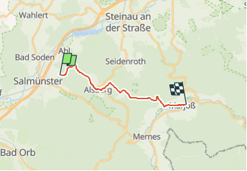
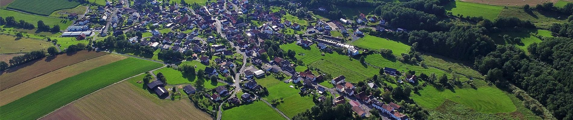
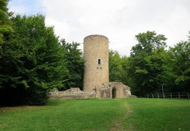
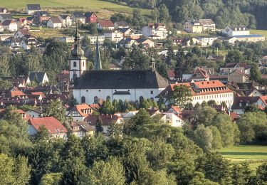
Trail On foot of 12.2 km to be discovered at Hesse, Main-Kinzig-Kreis, Bad Soden-Salmünster. This trail is proposed by SityTrail - itinéraires balisés pédestres.
Description
Trail created by Spessartbund.
Der Wegeverlauf hat sich nach der Unstrukturierung geändert. Muß neu erfasst werden.
Symbol: Rotes X auf weißem Grund
Positioning
Country:
Germany
Region :
Hesse
Department/Province :
Main-Kinzig-Kreis
Municipality :
Bad Soden-Salmünster
Location:
Salmünster
Start:(Dec)
Start:(UTM)
527858 ; 5569531 (32U) N.
Comments
Trails nearby
![Trail On foot Bad Soden-Salmünster - Spessartspuren - Bad Sodener Waldgeflüster - Photo](https://media.geolcdn.com/t/375/260/eab33703-db53-400c-8f5e-a96553cdf665.jpeg&format=jpg&maxdim=2)
![On foot On foot](https://static1.geolcdn.com/sitytour/trail-icons/100.png)
Spessartspuren - Bad Sodener Waldgeflüster
On foot
Easy
Bad Soden-Salmünster,
Hesse,
Main-Kinzig-Kreis,
Germany
![](/images/other/stat-length.png)
4.9 km | 6.6 km-effort
1h 30min
![](https://static1.geolcdn.com/siteimages/upload/files/16400158638029165_repeat_loop_refresh_sync_direction_icon.png)
Yes
![Trail On foot Bad Soden-Salmünster - Stolzenberger Ritterblick ( Spessartfährten ) - Photo](https://media.geolcdn.com/t/375/260/082b6977-d9de-4d85-b235-3038f01e708d.jpeg&format=jpg&maxdim=2)
![On foot On foot](https://static1.geolcdn.com/sitytour/trail-icons/100.png)
Stolzenberger Ritterblick ( Spessartfährten )
On foot
Easy
Bad Soden-Salmünster,
Hesse,
Main-Kinzig-Kreis,
Germany
![](/images/other/stat-length.png)
7 km | 9.8 km-effort
2h 13min
![](https://static1.geolcdn.com/siteimages/upload/files/16400158638029165_repeat_loop_refresh_sync_direction_icon.png)
Yes
![Trail On foot Steinau an der Straße - Steinau a. d. Straße, Wanderweg 3b - Photo](https://media.geolcdn.com/t/375/260/a727d70d-c791-4517-b7dc-042b076b4739.jpeg&format=jpg&maxdim=2)
![On foot On foot](https://static1.geolcdn.com/sitytour/trail-icons/100.png)
Steinau a. d. Straße, Wanderweg 3b
On foot
Easy
Steinau an der Straße,
Hesse,
Main-Kinzig-Kreis,
Germany
![](/images/other/stat-length.png)
7.3 km | 9.9 km-effort
2h 14min
![](https://static1.geolcdn.com/siteimages/upload/files/16400158638029165_repeat_loop_refresh_sync_direction_icon.png)
Yes
![Trail On foot Steinau an der Straße - Steinau a.d. Straße - Wartenweg 1 - Photo](https://media.geolcdn.com/t/375/260/b8e05691-abbb-48d7-8d7c-199ee18beccd.jpeg&format=jpg&maxdim=2)
![On foot On foot](https://static1.geolcdn.com/sitytour/trail-icons/100.png)
Steinau a.d. Straße - Wartenweg 1
On foot
Easy
Steinau an der Straße,
Hesse,
Main-Kinzig-Kreis,
Germany
![](/images/other/stat-length.png)
3.1 km | 4.6 km-effort
1h 2min
![](https://static1.geolcdn.com/siteimages/upload/files/16400158638029165_repeat_loop_refresh_sync_direction_icon.png)
No
![Trail On foot Steinau an der Straße - Steinau a.d. Straße - Wartenweg 4 - Photo](https://media.geolcdn.com/t/375/260/b8e05691-abbb-48d7-8d7c-199ee18beccd.jpeg&format=jpg&maxdim=2)
![On foot On foot](https://static1.geolcdn.com/sitytour/trail-icons/100.png)
Steinau a.d. Straße - Wartenweg 4
On foot
Easy
Steinau an der Straße,
Hesse,
Main-Kinzig-Kreis,
Germany
![](/images/other/stat-length.png)
3.8 km | 5.8 km-effort
1h 18min
![](https://static1.geolcdn.com/siteimages/upload/files/16400158638029165_repeat_loop_refresh_sync_direction_icon.png)
No
![Trail On foot Steinau an der Straße - Steinau a. d. Straße, Wanderweg 5 - Photo](https://media.geolcdn.com/t/375/260/2f75ce78-7455-4a1f-a522-572d5daa3bf8.jpeg&format=jpg&maxdim=2)
![On foot On foot](https://static1.geolcdn.com/sitytour/trail-icons/100.png)
Steinau a. d. Straße, Wanderweg 5
On foot
Easy
Steinau an der Straße,
Hesse,
Main-Kinzig-Kreis,
Germany
![](/images/other/stat-length.png)
4.7 km | 5.9 km-effort
1h 21min
![](https://static1.geolcdn.com/siteimages/upload/files/16400158638029165_repeat_loop_refresh_sync_direction_icon.png)
No
![Trail On foot Steinau an der Straße - Steinau a. d. Straße, Wanderweg 4 - Photo](https://media.geolcdn.com/t/375/260/70e32bfd-28e0-42b4-b181-05d76eecec73.jpeg&format=jpg&maxdim=2)
![On foot On foot](https://static1.geolcdn.com/sitytour/trail-icons/100.png)
Steinau a. d. Straße, Wanderweg 4
On foot
Easy
Steinau an der Straße,
Hesse,
Main-Kinzig-Kreis,
Germany
![](/images/other/stat-length.png)
9.2 km | 10.3 km-effort
2h 19min
![](https://static1.geolcdn.com/siteimages/upload/files/16400158638029165_repeat_loop_refresh_sync_direction_icon.png)
Yes
![Trail On foot Steinau an der Straße - Steinau a. d. Straße, Wanderweg 4a - Photo](https://media.geolcdn.com/t/375/260/70e32bfd-28e0-42b4-b181-05d76eecec73.jpeg&format=jpg&maxdim=2)
![On foot On foot](https://static1.geolcdn.com/sitytour/trail-icons/100.png)
Steinau a. d. Straße, Wanderweg 4a
On foot
Easy
Steinau an der Straße,
Hesse,
Main-Kinzig-Kreis,
Germany
![](/images/other/stat-length.png)
7.9 km | 9.5 km-effort
2h 9min
![](https://static1.geolcdn.com/siteimages/upload/files/16400158638029165_repeat_loop_refresh_sync_direction_icon.png)
No
![Trail On foot Bad Soden-Salmünster - Bad Soden-Salmünster Wanderweg Nr. 25 - Photo](https://media.geolcdn.com/t/375/260/b89c92df-7d0b-4e60-b4f6-ef31cde72362.jpeg&format=jpg&maxdim=2)
![On foot On foot](https://static1.geolcdn.com/sitytour/trail-icons/100.png)
Bad Soden-Salmünster Wanderweg Nr. 25
On foot
Easy
Bad Soden-Salmünster,
Hesse,
Main-Kinzig-Kreis,
Germany
![](/images/other/stat-length.png)
7.4 km | 9.9 km-effort
2h 15min
![](https://static1.geolcdn.com/siteimages/upload/files/16400158638029165_repeat_loop_refresh_sync_direction_icon.png)
No