


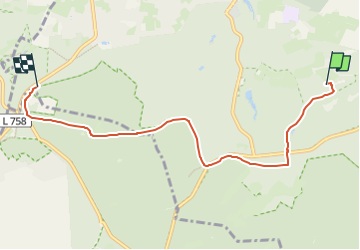

3.7 km | 4.4 km-effort


Tous les sentiers balisés d’Europe GUIDE+


FREE GPS app for hiking
 SityTrail
IGN / Geographical institutes
SityTrail World
The world is yours!
Trail On foot of 5.4 km to be discovered at North Rhine-Westphalia, Kreis Lippe, Detmold. This trail is proposed by SityTrail - itinéraires balisés pédestres.
Symbol: rotes 'K' auf weißem Grund


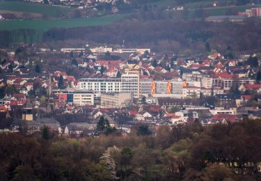
On foot
![Trail On foot Detmold - Rundwanderweg A5 [Berlebeck] - Photo](https://media.geolcdn.com/t/375/260/09e96dc8-2a72-420e-af43-8a0b6d458613.jpeg&format=jpg&maxdim=2)
On foot
On foot
On foot
On foot
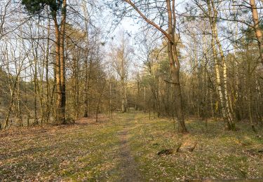
![Trail On foot Detmold - Alter Postweg [Schlangen-Kreuzkrug bis Detmold] - Photo](https://media.geolcdn.com/t/375/260/9624b63f-e63d-4566-afac-fe6174b35d1f.jpeg&format=jpg&maxdim=2)
On foot
On foot
![Trail On foot Detmold - Rundwanderweg A1 [Grotenburg] - Photo](https://media.geolcdn.com/t/375/260/4f1234d5-714f-42ad-8f0b-f8de13961882.jpeg&format=jpg&maxdim=2)
On foot
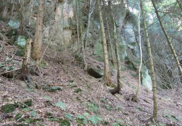
![Trail On foot Detmold - Rundwanderweg [Hangstein / Schling] - Photo](https://media.geolcdn.com/t/375/260/8f496d95-d526-4f86-9abb-749656e744f7.jpeg&format=jpg&maxdim=2)
On foot