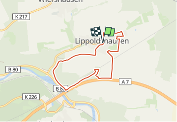
![](/images/other/stat-length.png)
![Trail On foot Hann. Münden - Lippoldshausen - Li1 - Photo](https://media.geolcdn.com/t/1900/400/c48d1a7e-cd9f-4e50-8329-09872f2c5ea8.jpeg&format=pjpeg&maxdim=2)
Lippoldshausen - Li1
SityTrail - itinéraires balisés pédestres
Tous les sentiers balisés d’Europe GUIDE+
![Length](/images/other/stat-length.png)
![Max alt](https://static1.geolcdn.com/siteimages/upload/files/1508320355ic_sort_altitude_max_24dp.png)
![Uphill gradient](https://static1.geolcdn.com/siteimages/upload/files/1508320355ic_sort_den_pos_24dp.png)
![Km-Effort](/images/other/stat-length.png)
![Min alt](https://static1.geolcdn.com/siteimages/upload/files/1508320355ic_sort_altitude_min_24dp.png)
![Downhill gradient](https://static1.geolcdn.com/siteimages/upload/files/1508320355ic_sort_den_neg_24dp.png)
![Boucle](https://static1.geolcdn.com/siteimages/upload/files/16400158638029165_repeat_loop_refresh_sync_direction_icon.png)
![On foot](https://static1.geolcdn.com/sitytour/trail-icons/100.png)
1h42
Difficulty : Easy
![Scan this QR Code to open this trail in the SityTrail application](https://capi.geolives.com/qq0zvz2zws4bq2lad0pu/sitytour/trails/3088678/qr.png?size=200)
FREE GPS app for hiking
About
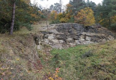
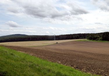
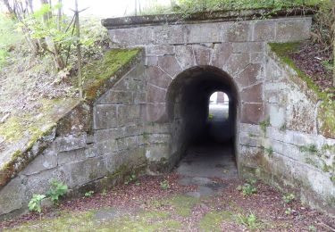
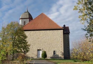
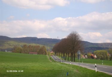
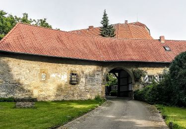
Trail On foot of 6.2 km to be discovered at Lower Saxony, Landkreis Göttingen, Hann. Münden. This trail is proposed by SityTrail - itinéraires balisés pédestres.
Description
Willkommen in der Erlebnisregion Hann. Münden! Hier finden Sie ✓ Unterkünfte ✓ Veranstaltungen ✓ Schiffsfahrten ✓ Wander- und Radangebote ►Jetzt entdecken!
Website: http://www.hann.muenden-tourismus.de/aktiv/tourentipps-wandern/wandern-in-lippoldshausen.html
Positioning
Comments
Trails nearby
![Trail On foot Hann. Münden - Lippoldshausen Li4 - Photo](https://media.geolcdn.com/t/375/260/55fdeccf-dc75-4afa-8020-8d5d089b9c08.jpeg&format=jpg&maxdim=2)
![On foot On foot](https://static1.geolcdn.com/sitytour/trail-icons/100.png)
On foot
![](/images/other/stat-length.png)
![](https://static1.geolcdn.com/siteimages/upload/files/16400158638029165_repeat_loop_refresh_sync_direction_icon.png)
![Trail On foot Hann. Münden - Lippoldshausen Li2 - Photo](https://media.geolcdn.com/t/375/260/55fdeccf-dc75-4afa-8020-8d5d089b9c08.jpeg&format=jpg&maxdim=2)
![On foot On foot](https://static1.geolcdn.com/sitytour/trail-icons/100.png)
On foot
![](/images/other/stat-length.png)
![](https://static1.geolcdn.com/siteimages/upload/files/16400158638029165_repeat_loop_refresh_sync_direction_icon.png)
![Trail On foot Hann. Münden - Blume - B2 - Photo](https://media.geolcdn.com/t/375/260/626e1520-c35a-4bf8-84a1-441aea8bcec2.jpeg&format=jpg&maxdim=2)
![On foot On foot](https://static1.geolcdn.com/sitytour/trail-icons/100.png)
On foot
![](/images/other/stat-length.png)
![](https://static1.geolcdn.com/siteimages/upload/files/16400158638029165_repeat_loop_refresh_sync_direction_icon.png)
![Trail On foot Scheden - Rundwanderweg Scheden 3 - Photo](https://media.geolcdn.com/t/375/260/5262257f-e389-4fa5-81db-15efcab30e54.jpeg&format=jpg&maxdim=2)
![On foot On foot](https://static1.geolcdn.com/sitytour/trail-icons/100.png)
On foot
![](/images/other/stat-length.png)
![](https://static1.geolcdn.com/siteimages/upload/files/16400158638029165_repeat_loop_refresh_sync_direction_icon.png)
![Trail On foot Rosdorf - Rundwanderweg Scheden 9 - Photo](https://media.geolcdn.com/t/375/260/ddff5146-1f35-40b5-9d8e-67658f7324e4.jpeg&format=jpg&maxdim=2)
![On foot On foot](https://static1.geolcdn.com/sitytour/trail-icons/100.png)
On foot
![](/images/other/stat-length.png)
![](https://static1.geolcdn.com/siteimages/upload/files/16400158638029165_repeat_loop_refresh_sync_direction_icon.png)
![Trail On foot Hann. Münden - Rundwanderweg Scheden 1 - Photo](https://media.geolcdn.com/t/375/260/2ac1577f-856c-4cc4-938f-90b58b988c69.jpeg&format=jpg&maxdim=2)
![On foot On foot](https://static1.geolcdn.com/sitytour/trail-icons/100.png)
On foot
![](/images/other/stat-length.png)
![](https://static1.geolcdn.com/siteimages/upload/files/16400158638029165_repeat_loop_refresh_sync_direction_icon.png)
![Trail On foot Scheden - Rundwanderweg Scheden 5 - Photo](https://media.geolcdn.com/t/375/260/e23a2a6e-41e7-4465-ac7f-36da71a695b8.jpeg&format=jpg&maxdim=2)
![On foot On foot](https://static1.geolcdn.com/sitytour/trail-icons/100.png)
On foot
![](/images/other/stat-length.png)
![](https://static1.geolcdn.com/siteimages/upload/files/16400158638029165_repeat_loop_refresh_sync_direction_icon.png)
![Trail On foot Scheden - Rundwanderweg Scheden 4 - Photo](https://media.geolcdn.com/t/375/260/62c37f2a-e9e7-45d9-bbfd-78806fb40325.jpeg&format=jpg&maxdim=2)
![On foot On foot](https://static1.geolcdn.com/sitytour/trail-icons/100.png)
On foot
![](/images/other/stat-length.png)
![](https://static1.geolcdn.com/siteimages/upload/files/16400158638029165_repeat_loop_refresh_sync_direction_icon.png)
![Trail On foot Jühnde - Rundwanderweg Jühnde 3 - Photo](https://media.geolcdn.com/t/375/260/34c194b1-94f6-438d-8031-af90c50e946a.jpeg&format=jpg&maxdim=2)
![On foot On foot](https://static1.geolcdn.com/sitytour/trail-icons/100.png)
On foot
![](/images/other/stat-length.png)
![](https://static1.geolcdn.com/siteimages/upload/files/16400158638029165_repeat_loop_refresh_sync_direction_icon.png)