![](/images/other/stat-length.png)
![Trail On foot Altenahr - Sahrbachweg - Photo](https://media.geolcdn.com/t/1900/400/436e4f06-a858-4c94-b3a9-d0115085abf6.jpeg&format=pjpeg&maxdim=2)
Sahrbachweg
SityTrail - itinéraires balisés pédestres
Tous les sentiers balisés d’Europe GUIDE+
![Length](/images/other/stat-length.png)
Length
8.2 km
![Max alt](https://static1.geolcdn.com/siteimages/upload/files/1508320355ic_sort_altitude_max_24dp.png)
Max alt
300 m
![Uphill gradient](https://static1.geolcdn.com/siteimages/upload/files/1508320355ic_sort_den_pos_24dp.png)
Uphill gradient
244 m
![Km-Effort](/images/other/stat-length.png)
Km-Effort
11.2 km
![Min alt](https://static1.geolcdn.com/siteimages/upload/files/1508320355ic_sort_altitude_min_24dp.png)
Min alt
173 m
![Downhill gradient](https://static1.geolcdn.com/siteimages/upload/files/1508320355ic_sort_den_neg_24dp.png)
Downhill gradient
142 m
![Boucle](https://static1.geolcdn.com/siteimages/upload/files/16400158638029165_repeat_loop_refresh_sync_direction_icon.png)
Boucle
No
Signpost
Creation date :
2022-02-11 12:54:14.234
Updated on :
2022-02-11 12:54:14.234
![On foot](https://static1.geolcdn.com/sitytour/trail-icons/100.png)
2h32
Difficulty : Easy
![Scan this QR Code to open this trail in the SityTrail application](https://capi.geolives.com/qq0zvz2zws4bq2lad0pu/sitytour/trails/3088449/qr.png?size=200)
FREE GPS app for hiking
About
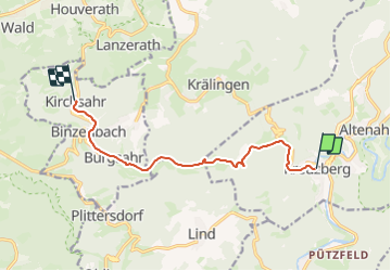
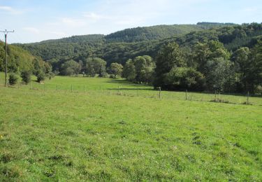
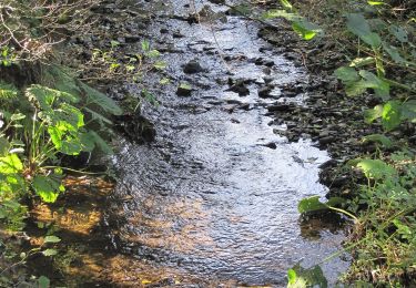
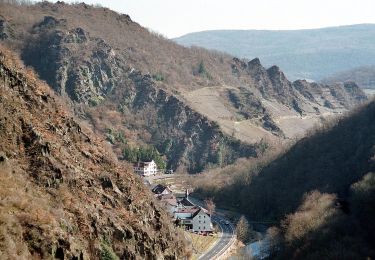
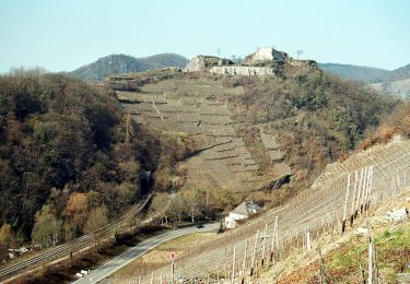
Trail On foot of 8.2 km to be discovered at Rhineland-Palatinate, Landkreis Ahrweiler, Altenahr. This trail is proposed by SityTrail - itinéraires balisés pédestres.
Description
Trail created by Freundeskreis Sahrbachtal.
Symbol: Beschriftung Sahrbachweg über stilisierter blauer Flusschleife in S-Form
Positioning
Country:
Germany
Region :
Rhineland-Palatinate
Department/Province :
Landkreis Ahrweiler
Municipality :
Altenahr
Location:
Unknown
Start:(Dec)
Start:(UTM)
356497 ; 5597180 (32U) N.
Comments
Trails nearby
![Trail On foot Mayschoß - Mayschoß - Rundweg 3 - Photo](https://media.geolcdn.com/t/375/260/16f600b5-0607-441e-b639-8cbd6e404fe6.jpeg&format=jpg&maxdim=2)
![On foot On foot](https://static1.geolcdn.com/sitytour/trail-icons/100.png)
Mayschoß - Rundweg 3
On foot
Easy
Mayschoß,
Rhineland-Palatinate,
Landkreis Ahrweiler,
Germany
![](/images/other/stat-length.png)
7.2 km | 11.9 km-effort
2h 41min
![](https://static1.geolcdn.com/siteimages/upload/files/16400158638029165_repeat_loop_refresh_sync_direction_icon.png)
Yes
![Trail On foot Mayschoß - Mayschoß - Rundweg 2 - Photo](https://media.geolcdn.com/t/375/260/16f600b5-0607-441e-b639-8cbd6e404fe6.jpeg&format=jpg&maxdim=2)
![On foot On foot](https://static1.geolcdn.com/sitytour/trail-icons/100.png)
Mayschoß - Rundweg 2
On foot
Easy
Mayschoß,
Rhineland-Palatinate,
Landkreis Ahrweiler,
Germany
![](/images/other/stat-length.png)
5.8 km | 9.8 km-effort
2h 13min
![](https://static1.geolcdn.com/siteimages/upload/files/16400158638029165_repeat_loop_refresh_sync_direction_icon.png)
Yes
![Trail On foot Mayschoß - Mayschoß - Rundweg 1 - Photo](https://media.geolcdn.com/t/375/260/16f600b5-0607-441e-b639-8cbd6e404fe6.jpeg&format=jpg&maxdim=2)
![On foot On foot](https://static1.geolcdn.com/sitytour/trail-icons/100.png)
Mayschoß - Rundweg 1
On foot
Easy
Mayschoß,
Rhineland-Palatinate,
Landkreis Ahrweiler,
Germany
![](/images/other/stat-length.png)
3.8 km | 6.2 km-effort
1h 24min
![](https://static1.geolcdn.com/siteimages/upload/files/16400158638029165_repeat_loop_refresh_sync_direction_icon.png)
Yes
![Trail On foot Altenahr - Gottfried-Kinkel-Weg - Photo](https://media.geolcdn.com/t/375/260/56366be1-f933-47d3-b229-3722b4a18fdb.jpeg&format=jpg&maxdim=2)
![On foot On foot](https://static1.geolcdn.com/sitytour/trail-icons/100.png)
Gottfried-Kinkel-Weg
On foot
Easy
Altenahr,
Rhineland-Palatinate,
Landkreis Ahrweiler,
Germany
![](/images/other/stat-length.png)
9.7 km | 14.6 km-effort
3h 19min
![](https://static1.geolcdn.com/siteimages/upload/files/16400158638029165_repeat_loop_refresh_sync_direction_icon.png)
No
![Trail On foot Kirchsahr - Milchstraßenweg - Photo](https://media.geolcdn.com/t/375/260/38efb82f-f225-46cb-9f10-4a8e7ede1610.jpeg&format=jpg&maxdim=2)
![On foot On foot](https://static1.geolcdn.com/sitytour/trail-icons/100.png)
Milchstraßenweg
On foot
Easy
Kirchsahr,
Rhineland-Palatinate,
Landkreis Ahrweiler,
Germany
![](/images/other/stat-length.png)
4 km | 5.7 km-effort
1h 17min
![](https://static1.geolcdn.com/siteimages/upload/files/16400158638029165_repeat_loop_refresh_sync_direction_icon.png)
No
![Trail On foot Altenahr - Kotzberger Weg - Photo](https://media.geolcdn.com/t/375/260/fbc56b0b-96d8-4c9b-a866-87396f219721.jpeg&format=jpg&maxdim=2)
![On foot On foot](https://static1.geolcdn.com/sitytour/trail-icons/100.png)
Kotzberger Weg
On foot
Easy
Altenahr,
Rhineland-Palatinate,
Landkreis Ahrweiler,
Germany
![](/images/other/stat-length.png)
3.2 km | 4.9 km-effort
1h 7min
![](https://static1.geolcdn.com/siteimages/upload/files/16400158638029165_repeat_loop_refresh_sync_direction_icon.png)
No
![Trail On foot Altenahr - Altenahr Rundweg 2 - Photo](https://media.geolcdn.com/t/375/260/9471d7e4-5f47-4647-8922-bdef73c6c06b.jpeg&format=jpg&maxdim=2)
![On foot On foot](https://static1.geolcdn.com/sitytour/trail-icons/100.png)
Altenahr Rundweg 2
On foot
Easy
Altenahr,
Rhineland-Palatinate,
Landkreis Ahrweiler,
Germany
![](/images/other/stat-length.png)
3.2 km | 4.5 km-effort
1h 1min
![](https://static1.geolcdn.com/siteimages/upload/files/16400158638029165_repeat_loop_refresh_sync_direction_icon.png)
Yes
![Trail On foot Altenahr - Altenahr Rundweg 3 - Photo](https://media.geolcdn.com/t/375/260/7f317ab8-ece3-4330-9878-22a7250d772e.jpeg&format=jpg&maxdim=2)
![On foot On foot](https://static1.geolcdn.com/sitytour/trail-icons/100.png)
Altenahr Rundweg 3
On foot
Easy
Altenahr,
Rhineland-Palatinate,
Landkreis Ahrweiler,
Germany
![](/images/other/stat-length.png)
4.6 km | 6.8 km-effort
1h 32min
![](https://static1.geolcdn.com/siteimages/upload/files/16400158638029165_repeat_loop_refresh_sync_direction_icon.png)
Yes
![Trail On foot Kesseling - [⑨] Rundweg Kesseling 9 - Photo](https://media.geolcdn.com/t/375/260/4dbbe2ae-b239-4136-9a63-e512e4629c8b.jpeg&format=jpg&maxdim=2)
![On foot On foot](https://static1.geolcdn.com/sitytour/trail-icons/100.png)
[⑨] Rundweg Kesseling 9
On foot
Easy
Kesseling,
Rhineland-Palatinate,
Landkreis Ahrweiler,
Germany
![](/images/other/stat-length.png)
3.3 km | 5.3 km-effort
1h 11min
![](https://static1.geolcdn.com/siteimages/upload/files/16400158638029165_repeat_loop_refresh_sync_direction_icon.png)
No