![](/images/other/stat-length.png)
![Trail On foot Detmold - Residenzweg [Detmold] - Photo](https://media.geolcdn.com/t/1900/400/09e96dc8-2a72-420e-af43-8a0b6d458613.jpeg&format=pjpeg&maxdim=2)
Residenzweg [Detmold]
SityTrail - itinéraires balisés pédestres
Tous les sentiers balisés d’Europe GUIDE+
![Length](/images/other/stat-length.png)
Length
29 km
![Max alt](https://static1.geolcdn.com/siteimages/upload/files/1508320355ic_sort_altitude_max_24dp.png)
Max alt
332 m
![Uphill gradient](https://static1.geolcdn.com/siteimages/upload/files/1508320355ic_sort_den_pos_24dp.png)
Uphill gradient
695 m
![Km-Effort](/images/other/stat-length.png)
Km-Effort
38 km
![Min alt](https://static1.geolcdn.com/siteimages/upload/files/1508320355ic_sort_altitude_min_24dp.png)
Min alt
128 m
![Downhill gradient](https://static1.geolcdn.com/siteimages/upload/files/1508320355ic_sort_den_neg_24dp.png)
Downhill gradient
663 m
![Boucle](https://static1.geolcdn.com/siteimages/upload/files/16400158638029165_repeat_loop_refresh_sync_direction_icon.png)
Boucle
No
Signpost
Creation date :
2022-02-11 12:48:59.473
Updated on :
2022-02-11 12:48:59.473
![On foot](https://static1.geolcdn.com/sitytour/trail-icons/100.png)
8h36
Difficulty : Difficult
![Scan this QR Code to open this trail in the SityTrail application](https://capi.geolives.com/qq0zvz2zws4bq2lad0pu/sitytour/trails/3088015/qr.png?size=200)
FREE GPS app for hiking
About
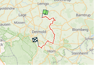
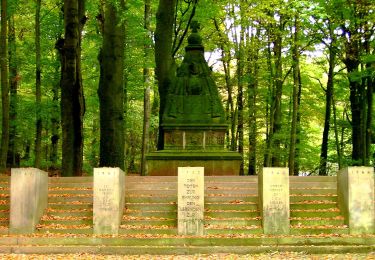
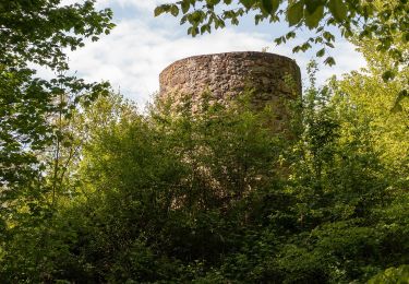
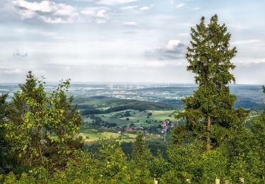
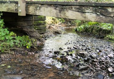
Trail On foot of 29 km to be discovered at North Rhine-Westphalia, Kreis Lippe, Detmold. This trail is proposed by SityTrail - itinéraires balisés pédestres.
Description
Trail created by Teutoburger-Wald-Verein.
Symbol: Weißes 'R', eingekreist, auf schwarzem Grund
Positioning
Country:
Germany
Region :
North Rhine-Westphalia
Department/Province :
Kreis Lippe
Municipality :
Detmold
Location:
Unknown
Start:(Dec)
Start:(UTM)
492751 ; 5758884 (32U) N.
Comments
Trails nearby
![Trail On foot Oerlinghausen - Holzweg - Photo](https://media.geolcdn.com/t/375/260/46fb7f62-dac9-4c53-bef4-31692828a068.jpeg&format=jpg&maxdim=2)
![On foot On foot](https://static1.geolcdn.com/sitytour/trail-icons/100.png)
Holzweg
On foot
Easy
Oerlinghausen,
North Rhine-Westphalia,
Kreis Lippe,
Germany
![](/images/other/stat-length.png)
8.1 km | 10 km-effort
2h 16min
![](https://static1.geolcdn.com/siteimages/upload/files/16400158638029165_repeat_loop_refresh_sync_direction_icon.png)
No
![Trail On foot Schloß Holte-Stukenbrock - Romantisches Furlbachtal - Photo](https://media.geolcdn.com/t/375/260/3b4c90b3-ac39-47a8-a47a-b37ecca07826.jpeg&format=jpg&maxdim=2)
![On foot On foot](https://static1.geolcdn.com/sitytour/trail-icons/100.png)
Romantisches Furlbachtal
On foot
Easy
Schloß Holte-Stukenbrock,
North Rhine-Westphalia,
Kreis Gütersloh,
Germany
![](/images/other/stat-length.png)
5.8 km | 6.4 km-effort
1h 27min
![](https://static1.geolcdn.com/siteimages/upload/files/16400158638029165_repeat_loop_refresh_sync_direction_icon.png)
No
![Trail On foot Bad Salzuflen - Bad Salzuflen Rundweg 4 - Photo](https://media.geolcdn.com/t/375/260/55a2b1c9-3a22-4e3d-9ddb-0635778c833e.jpeg&format=jpg&maxdim=2)
![On foot On foot](https://static1.geolcdn.com/sitytour/trail-icons/100.png)
Bad Salzuflen Rundweg 4
On foot
Easy
Bad Salzuflen,
North Rhine-Westphalia,
Kreis Lippe,
Germany
![](/images/other/stat-length.png)
7.6 km | 9.4 km-effort
2h 7min
![](https://static1.geolcdn.com/siteimages/upload/files/16400158638029165_repeat_loop_refresh_sync_direction_icon.png)
Yes
![Trail On foot Herford - Bad Salzuflen Rundweg 10 - Photo](https://media.geolcdn.com/t/375/260/5067fc69-7ee0-486a-a976-cbc0fbb26700.jpeg&format=jpg&maxdim=2)
![On foot On foot](https://static1.geolcdn.com/sitytour/trail-icons/100.png)
Bad Salzuflen Rundweg 10
On foot
Easy
Herford,
North Rhine-Westphalia,
Kreis Herford,
Germany
![](/images/other/stat-length.png)
5.1 km | 6.8 km-effort
1h 33min
![](https://static1.geolcdn.com/siteimages/upload/files/16400158638029165_repeat_loop_refresh_sync_direction_icon.png)
Yes
![Trail On foot Bad Salzuflen - Bad Salzuflen Rundweg 7 - Photo](https://media.geolcdn.com/t/375/260/d38cd37f-5ca4-44e9-9c5e-2e0035159efc.jpeg&format=jpg&maxdim=2)
![On foot On foot](https://static1.geolcdn.com/sitytour/trail-icons/100.png)
Bad Salzuflen Rundweg 7
On foot
Easy
Bad Salzuflen,
North Rhine-Westphalia,
Kreis Lippe,
Germany
![](/images/other/stat-length.png)
5.4 km | 6.6 km-effort
1h 29min
![](https://static1.geolcdn.com/siteimages/upload/files/16400158638029165_repeat_loop_refresh_sync_direction_icon.png)
Yes
![Trail On foot Bad Salzuflen - Bad Salzuflen Rundweg 1 - Photo](https://media.geolcdn.com/t/375/260/9f73af4e-fdaa-4fc6-9b9b-9ba11044498e.jpeg&format=jpg&maxdim=2)
![On foot On foot](https://static1.geolcdn.com/sitytour/trail-icons/100.png)
Bad Salzuflen Rundweg 1
On foot
Easy
Bad Salzuflen,
North Rhine-Westphalia,
Kreis Lippe,
Germany
![](/images/other/stat-length.png)
13 km | 16.7 km-effort
3h 47min
![](https://static1.geolcdn.com/siteimages/upload/files/16400158638029165_repeat_loop_refresh_sync_direction_icon.png)
Yes
![Trail On foot Horn-Bad Meinberg - Pilgerweg](https://media.geolcdn.com/t/375/260/82208e22-56ad-4715-9507-28234728434e.jpeg&format=jpg&maxdim=2)
![On foot On foot](https://static1.geolcdn.com/sitytour/trail-icons/100.png)
Pilgerweg "Besinn DICH… SEHEN, HÖREN, FÜHLEN - Besinnungsweg Kempen-Feldrom-V...
On foot
Easy
Horn-Bad Meinberg,
North Rhine-Westphalia,
Kreis Lippe,
Germany
![](/images/other/stat-length.png)
3.1 km | 4.3 km-effort
58min
![](https://static1.geolcdn.com/siteimages/upload/files/16400158638029165_repeat_loop_refresh_sync_direction_icon.png)
Yes
![Trail On foot Horn-Bad Meinberg - Besinnungsweg (Kempen-Feldrom-Veldrom) - Photo](https://media.geolcdn.com/t/375/260/82208e22-56ad-4715-9507-28234728434e.jpeg&format=jpg&maxdim=2)
![On foot On foot](https://static1.geolcdn.com/sitytour/trail-icons/100.png)
Besinnungsweg (Kempen-Feldrom-Veldrom)
On foot
Easy
Horn-Bad Meinberg,
North Rhine-Westphalia,
Kreis Lippe,
Germany
![](/images/other/stat-length.png)
4.5 km | 5.9 km-effort
1h 20min
![](https://static1.geolcdn.com/siteimages/upload/files/16400158638029165_repeat_loop_refresh_sync_direction_icon.png)
No
![Trail On foot Bad Salzuflen - Bad Salzuflen Rundweg 3 - Photo](https://media.geolcdn.com/t/375/260/14714b46-9977-4f9a-96cd-896adf6a708e.jpeg&format=jpg&maxdim=2)
![On foot On foot](https://static1.geolcdn.com/sitytour/trail-icons/100.png)
Bad Salzuflen Rundweg 3
On foot
Easy
Bad Salzuflen,
North Rhine-Westphalia,
Kreis Lippe,
Germany
![](/images/other/stat-length.png)
5 km | 5.7 km-effort
1h 17min
![](https://static1.geolcdn.com/siteimages/upload/files/16400158638029165_repeat_loop_refresh_sync_direction_icon.png)
Yes