![](/images/other/stat-length.png)
![Trail On foot Losheim am See - Der Bergener - Photo](https://media.geolcdn.com/t/1900/400/ext.pjpeg?maxdim=2&url=https%3A%2F%2Fmedia.geolcdn.com%2Ff%2F8ef22c85-1d94-40b0-95aa-29761b54f676.jpeg)
Der Bergener
SityTrail - itinéraires balisés pédestres
Tous les sentiers balisés d’Europe PRO
![Length](/images/other/stat-length.png)
Length
11.1 km
![Max alt](https://static1.geolcdn.com/siteimages/upload/files/1508320355ic_sort_altitude_max_24dp.png)
Max alt
504 m
![Uphill gradient](https://static1.geolcdn.com/siteimages/upload/files/1508320355ic_sort_den_pos_24dp.png)
Uphill gradient
270 m
![Km-Effort](/images/other/stat-length.png)
Km-Effort
14.7 km
![Min alt](https://static1.geolcdn.com/siteimages/upload/files/1508320355ic_sort_altitude_min_24dp.png)
Min alt
332 m
![Downhill gradient](https://static1.geolcdn.com/siteimages/upload/files/1508320355ic_sort_den_neg_24dp.png)
Downhill gradient
271 m
![Boucle](https://static1.geolcdn.com/siteimages/upload/files/16400158638029165_repeat_loop_refresh_sync_direction_icon.png)
Boucle
Yes
Signpost
Creation date :
2022-02-11 12:43:52.672
Updated on :
2022-02-11 12:43:52.672
![On foot](https://static1.geolcdn.com/sitytour/trail-icons/100.png)
3h19
Difficulty : Easy
![Scan this QR Code to open this trail in the SityTrail application](https://capi.geolives.com/qq0zvz2zws4bq2lad0pu/sitytour/trails/3087710/qr.png?size=200)
FREE GPS app for hiking
About
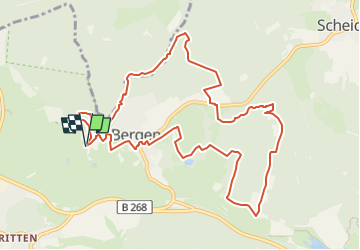
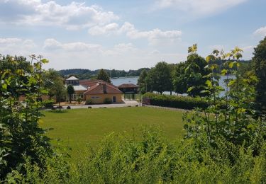
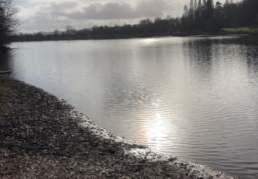
Trail On foot of 11.1 km to be discovered at Saarland, Landkreis Merzig-Wadern, Losheim am See. This trail is proposed by SityTrail - itinéraires balisés pédestres.
Description
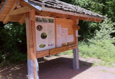
Trail created by Gemeinde Losheim.
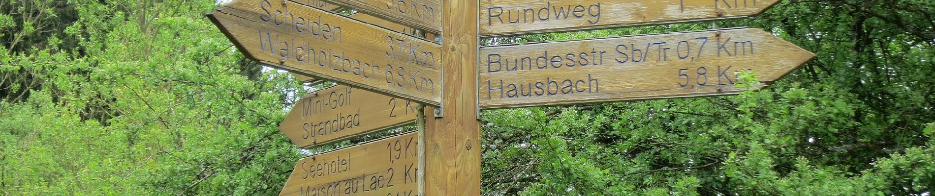
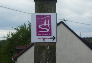
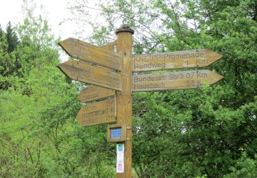
Symbol: rotes Quadrat mit Fotohintergrund (Sitzbank) und weißer Aufschrift "Der Bergener"
Positioning
Country:
Germany
Region :
Saarland
Department/Province :
Landkreis Merzig-Wadern
Municipality :
Losheim am See
Location:
Britten
Start:(Dec)
Start:(UTM)
332636 ; 5489183 (32U) N.
Comments
Trails nearby
![Trail On foot Losheim am See - Greimerather Höhenweg - Photo](https://media.geolcdn.com/t/375/260/ext.jpg?maxdim=2&url=https%3A%2F%2Fmedia.geolcdn.com%2Ff%2F1618392c-19e8-4f3f-8467-e12887d06a5a.jpeg)
![On foot On foot](https://static1.geolcdn.com/sitytour/trail-icons/100.png)
Greimerather Höhenweg
On foot
Easy
Losheim am See,
Saarland,
Landkreis Merzig-Wadern,
Germany
![](/images/other/stat-length.png)
13.2 km | 18.4 km-effort
4h 10min
![](https://static1.geolcdn.com/siteimages/upload/files/16400158638029165_repeat_loop_refresh_sync_direction_icon.png)
Yes
![Trail On foot Losheim am See - Waldsaumweg - Photo](https://media.geolcdn.com/t/375/260/ext.jpg?maxdim=2&url=https%3A%2F%2Fmedia.geolcdn.com%2Ff%2F619ba0cc-99dc-401f-9234-9f002ae39ed3.jpeg)
![On foot On foot](https://static1.geolcdn.com/sitytour/trail-icons/100.png)
Waldsaumweg
On foot
Easy
Losheim am See,
Saarland,
Landkreis Merzig-Wadern,
Germany
![](/images/other/stat-length.png)
10 km | 13.6 km-effort
3h 4min
![](https://static1.geolcdn.com/siteimages/upload/files/16400158638029165_repeat_loop_refresh_sync_direction_icon.png)
Yes
![Trail On foot Losheim am See - Tafeltour - Photo](https://media.geolcdn.com/t/375/260/ext.jpg?maxdim=2&url=https%3A%2F%2Fmedia.geolcdn.com%2Ff%2F8ef22c85-1d94-40b0-95aa-29761b54f676.jpeg)
![On foot On foot](https://static1.geolcdn.com/sitytour/trail-icons/100.png)
Tafeltour
On foot
Easy
Losheim am See,
Saarland,
Landkreis Merzig-Wadern,
Germany
![](/images/other/stat-length.png)
9.7 km | 12.9 km-effort
2h 55min
![](https://static1.geolcdn.com/siteimages/upload/files/16400158638029165_repeat_loop_refresh_sync_direction_icon.png)
No
![Trail On foot Losheim am See - Steinhauerweg - Photo](https://media.geolcdn.com/t/375/260/ext.jpg?maxdim=2&url=https%3A%2F%2Fmedia.geolcdn.com%2Ff%2Fc399055f-d88a-4132-9ad1-7de1082fe034.jpeg)
![On foot On foot](https://static1.geolcdn.com/sitytour/trail-icons/100.png)
Steinhauerweg
On foot
Easy
Losheim am See,
Saarland,
Landkreis Merzig-Wadern,
Germany
![](/images/other/stat-length.png)
10.1 km | 13.2 km-effort
3h 0min
![](https://static1.geolcdn.com/siteimages/upload/files/16400158638029165_repeat_loop_refresh_sync_direction_icon.png)
Yes
![Trail On foot Greimerath - RuT3 - Photo](https://media.geolcdn.com/t/375/260/ext.jpg?maxdim=2&url=https%3A%2F%2Fmedia.geolcdn.com%2Ff%2F0e82cc95-177f-4476-840a-9e9b6d408716.jpeg)
![On foot On foot](https://static1.geolcdn.com/sitytour/trail-icons/100.png)
RuT3
On foot
Easy
Greimerath,
Rhineland-Palatinate,
Landkreis Trier-Saarburg,
Germany
![](/images/other/stat-length.png)
6.7 km | 8.6 km-effort
1h 57min
![](https://static1.geolcdn.com/siteimages/upload/files/16400158638029165_repeat_loop_refresh_sync_direction_icon.png)
Yes
![Trail On foot Losheim am See - Stauseerundweg - Photo](https://media.geolcdn.com/t/375/260/ext.jpg?maxdim=2&url=https%3A%2F%2Fmedia.geolcdn.com%2Ff%2F6c88a7bf-e1ab-4c12-bb6b-23ceeb490663.jpeg)
![On foot On foot](https://static1.geolcdn.com/sitytour/trail-icons/100.png)
Stauseerundweg
On foot
Easy
Losheim am See,
Saarland,
Landkreis Merzig-Wadern,
Germany
![](/images/other/stat-length.png)
3.8 km | 4.7 km-effort
1h 4min
![](https://static1.geolcdn.com/siteimages/upload/files/16400158638029165_repeat_loop_refresh_sync_direction_icon.png)
Yes
![Trail On foot Losheim am See - Britten tour - Photo](https://media.geolcdn.com/t/375/260/ext.jpg?maxdim=2&url=https%3A%2F%2Fservices.sitytrail.com%2FGeolivesWS%2FDownloadMedia.ashx%3FTrailID%3D1055044%26Media%3Dfix__20181011103359.jpg)
![On foot On foot](https://static1.geolcdn.com/sitytour/trail-icons/100.png)
Britten tour
On foot
Medium
Losheim am See,
Saarland,
Landkreis Merzig-Wadern,
Germany
![](/images/other/stat-length.png)
17.6 km | 23 km-effort
5h 6min
![](https://static1.geolcdn.com/siteimages/upload/files/16400158638029165_repeat_loop_refresh_sync_direction_icon.png)
Yes
![Trail Walking Losheim am See - losheim cooll - Photo](https://media.geolcdn.com/t/375/260/ext.jpg?maxdim=2&url=https%3A%2F%2Fservices.sitytrail.com%2FGeolivesWS%2FDownloadMedia.ashx%3FTrailID%3D995313%26Media%3Dfix__20180628143609.jpg)
![Walking Walking](https://static1.geolcdn.com/sitytour/trail-icons/101.png)
losheim cooll
Walking
Very easy
Losheim am See,
Saarland,
Landkreis Merzig-Wadern,
Germany
![](/images/other/stat-length.png)
3.7 km | 4.6 km-effort
50min
![](https://static1.geolcdn.com/siteimages/upload/files/16400158638029165_repeat_loop_refresh_sync_direction_icon.png)
Yes
![Trail Walking Losheim am See - Losheim 2 - Photo](https://media.geolcdn.com/t/375/260/ext.jpg?maxdim=2&url=https%3A%2F%2Fmedia.geolcdn.com%2Ff%2F01a06262-95c9-4cb7-b0c5-9f6cd83b7ccc.jpg)
![Walking Walking](https://static1.geolcdn.com/sitytour/trail-icons/101.png)
Losheim 2
Walking
Medium
Losheim am See,
Saarland,
Landkreis Merzig-Wadern,
Germany
![](/images/other/stat-length.png)
6.7 km | 8.4 km-effort
1h 54min
![](https://static1.geolcdn.com/siteimages/upload/files/16400158638029165_repeat_loop_refresh_sync_direction_icon.png)
Yes