5.2 km | 6.2 km-effort
Bornscheid Rundweg A1
SityTrail - itinéraires balisés pédestres
Tous les sentiers balisés d’Europe GUIDE+
Length
4 km
Max alt
290 m
Uphill gradient
82 m
Km-Effort
5.1 km
Min alt
209 m
Downhill gradient
81 m
Boucle
Yes
Signpost
Creation date :
2022-02-11 12:41:53.584
Updated on :
2022-02-11 12:41:53.584
1h09
Difficulty : Easy
FREE GPS app for hiking
About
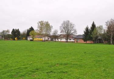
Trail On foot of 4 km to be discovered at North Rhine-Westphalia, Rhein-Sieg-Kreis, Ruppichteroth. This trail is proposed by SityTrail - itinéraires balisés pédestres.
Positioning
Country:
Germany
Region :
North Rhine-Westphalia
Department/Province :
Rhein-Sieg-Kreis
Municipality :
Ruppichteroth
Location:
Unknown
Start:(Dec)
Start:(UTM)
390128 ; 5630196 (32U) N.
Comments
Trails nearby
Schönenberg Rundweg "■" (Quadrat)
On foot
Easy
Ruppichteroth,
North Rhine-Westphalia,
Rhein-Sieg-Kreis,
Germany
1h 24min
No
Ruppichteroth Rundweg "●" (Vollkreis)
On foot
Easy
Ruppichteroth,
North Rhine-Westphalia,
Rhein-Sieg-Kreis,
Germany
4.2 km | 5.4 km-effort
1h 13min
No
Ruppichteroth Rundweg Rechteck
On foot
Easy
Ruppichteroth,
North Rhine-Westphalia,
Rhein-Sieg-Kreis,
Germany
10.8 km | 13.7 km-effort
3h 6min
Yes
Ruppichteroth Rundweg
On foot
Easy
Ruppichteroth,
North Rhine-Westphalia,
Rhein-Sieg-Kreis,
Germany
8.1 km | 10 km-effort
2h 16min
Yes
Ruppichteroth Rundweg "V"
On foot
Easy
Ruppichteroth,
North Rhine-Westphalia,
Rhein-Sieg-Kreis,
Germany
10.8 km | 13.7 km-effort
3h 7min
Yes
Ruppichteroth Rundweg
On foot
Easy
Ruppichteroth,
North Rhine-Westphalia,
Rhein-Sieg-Kreis,
Germany
4.6 km | 5.8 km-effort
1h 19min
Yes
Ruppichteroth Rundweg ⟂ Lot
On foot
Easy
Ruppichteroth,
North Rhine-Westphalia,
Rhein-Sieg-Kreis,
Germany
9.4 km | 12.4 km-effort
2h 49min
Yes
Ruppichteroth Rundweg Hohlquadrat
On foot
Easy
Ruppichteroth,
North Rhine-Westphalia,
Rhein-Sieg-Kreis,
Germany
5.1 km | 6.7 km-effort
1h 31min
Yes
Fachwerkweg
On foot
Easy
Ruppichteroth,
North Rhine-Westphalia,
Rhein-Sieg-Kreis,
Germany
11.6 km | 15.3 km-effort
3h 28min
Yes