![](/images/other/stat-length.png)
![Trail On foot Unknown - [Volldreieck] Eller - Volksgarten - Photo](https://media.geolcdn.com/t/1900/400/ext.pjpeg?maxdim=2&url=https%3A%2F%2Fmedia.geolcdn.com%2Ff%2F8a72960d-3a14-4e60-95e0-99357e2467ee.jpeg)
[Volldreieck] Eller - Volksgarten
SityTrail - itinéraires balisés pédestres
Tous les sentiers balisés d’Europe PRO
![Length](/images/other/stat-length.png)
Length
6 km
![Max alt](https://static1.geolcdn.com/siteimages/upload/files/1508320355ic_sort_altitude_max_24dp.png)
Max alt
48 m
![Uphill gradient](https://static1.geolcdn.com/siteimages/upload/files/1508320355ic_sort_den_pos_24dp.png)
Uphill gradient
38 m
![Km-Effort](/images/other/stat-length.png)
Km-Effort
6.5 km
![Min alt](https://static1.geolcdn.com/siteimages/upload/files/1508320355ic_sort_altitude_min_24dp.png)
Min alt
33 m
![Downhill gradient](https://static1.geolcdn.com/siteimages/upload/files/1508320355ic_sort_den_neg_24dp.png)
Downhill gradient
40 m
![Boucle](https://static1.geolcdn.com/siteimages/upload/files/16400158638029165_repeat_loop_refresh_sync_direction_icon.png)
Boucle
No
Signpost
Creation date :
2022-02-11 12:41:26.524
Updated on :
2022-02-11 12:41:26.524
![On foot](https://static1.geolcdn.com/sitytour/trail-icons/100.png)
1h28
Difficulty : Easy
![Scan this QR Code to open this trail in the SityTrail application](https://capi.geolives.com/qq0zvz2zws4bq2lad0pu/sitytour/trails/3087578/qr.png?size=200)
FREE GPS app for hiking
About
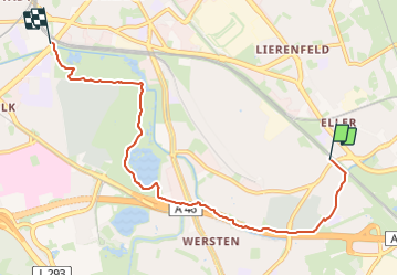
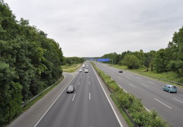
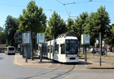
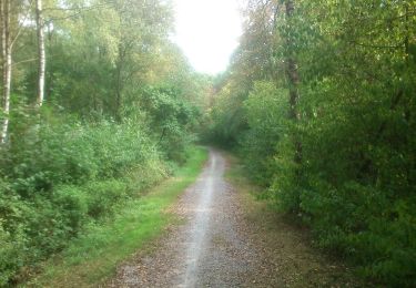
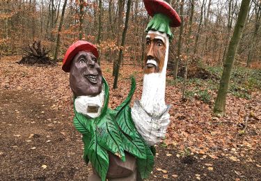
Trail On foot of 6 km to be discovered at North Rhine-Westphalia, Dusseldorf, Unknown. This trail is proposed by SityTrail - itinéraires balisés pédestres.
Description
Trail created by Sauerländischer Gebirgsverein.
Symbol: weißes Dreieck (gefüllt) auf schwarzem Grund
Website: https://sgv-duesseldorf.de/
Positioning
Country:
Germany
Region :
North Rhine-Westphalia
Department/Province :
Dusseldorf
Municipality :
Unknown
Location:
Stadtbezirk 8
Start:(Dec)
Start:(UTM)
348823 ; 5674036 (32U) N.
Comments
Trails nearby
![Trail On foot Erkrath - Neanderlandsteig Entdeckerschleife](https://media.geolcdn.com/t/375/260/ext.jpg?maxdim=2&url=https%3A%2F%2Fmedia.geolcdn.com%2Ff%2Ff0a4c676-b45d-44ca-9d2f-c9554313404f.jpeg)
![On foot On foot](https://static1.geolcdn.com/sitytour/trail-icons/100.png)
Neanderlandsteig Entdeckerschleife "Denkmalroute Alt-Erkrath"
On foot
Easy
Erkrath,
North Rhine-Westphalia,
Kreis Mettmann,
Germany
![](/images/other/stat-length.png)
12.4 km | 15.7 km-effort
3h 34min
![](https://static1.geolcdn.com/siteimages/upload/files/16400158638029165_repeat_loop_refresh_sync_direction_icon.png)
No
![Trail On foot Unknown - Rechteck Gerresheim-Unterbach - Photo](https://media.geolcdn.com/t/375/260/ext.jpg?maxdim=2&url=https%3A%2F%2Fmedia.geolcdn.com%2Ff%2F533e878e-0bfb-411b-a976-bd0edf99eb3a.jpeg)
![On foot On foot](https://static1.geolcdn.com/sitytour/trail-icons/100.png)
Rechteck Gerresheim-Unterbach
On foot
Easy
Unknown,
North Rhine-Westphalia,
Dusseldorf,
Germany
![](/images/other/stat-length.png)
3.3 km | 4.4 km-effort
1h 0min
![](https://static1.geolcdn.com/siteimages/upload/files/16400158638029165_repeat_loop_refresh_sync_direction_icon.png)
No
![Trail On foot Unknown - Unterbacher See Rundweg A3 - Photo](https://media.geolcdn.com/t/375/260/ext.jpg?maxdim=2&url=https%3A%2F%2Fmedia.geolcdn.com%2Ff%2Fc913dfa4-e9b0-439a-9a38-a119d4e18ce9.jpeg)
![On foot On foot](https://static1.geolcdn.com/sitytour/trail-icons/100.png)
Unterbacher See Rundweg A3
On foot
Easy
Unknown,
North Rhine-Westphalia,
Dusseldorf,
Germany
![](/images/other/stat-length.png)
3.5 km | 4 km-effort
53min
![](https://static1.geolcdn.com/siteimages/upload/files/16400158638029165_repeat_loop_refresh_sync_direction_icon.png)
No
![Trail On foot Unknown - Hassels Rundweg A7 - Photo](https://media.geolcdn.com/t/375/260/ext.jpg?maxdim=2&url=https%3A%2F%2Fmedia.geolcdn.com%2Ff%2Ffda4dd72-3028-45ee-af0c-115df55dd9bd.jpeg)
![On foot On foot](https://static1.geolcdn.com/sitytour/trail-icons/100.png)
Hassels Rundweg A7
On foot
Easy
Unknown,
North Rhine-Westphalia,
Dusseldorf,
Germany
![](/images/other/stat-length.png)
6.4 km | 6.9 km-effort
1h 34min
![](https://static1.geolcdn.com/siteimages/upload/files/16400158638029165_repeat_loop_refresh_sync_direction_icon.png)
Yes
![Trail On foot Erkrath - Rechteck Erkrath-Eller - Photo](https://media.geolcdn.com/t/375/260/ext.jpg?maxdim=2&url=https%3A%2F%2Fmedia.geolcdn.com%2Ff%2F869ed9d6-13d5-459e-9f12-6811fc83e378.jpeg)
![On foot On foot](https://static1.geolcdn.com/sitytour/trail-icons/100.png)
Rechteck Erkrath-Eller
On foot
Easy
Erkrath,
North Rhine-Westphalia,
Kreis Mettmann,
Germany
![](/images/other/stat-length.png)
5.7 km | 6.7 km-effort
1h 31min
![](https://static1.geolcdn.com/siteimages/upload/files/16400158638029165_repeat_loop_refresh_sync_direction_icon.png)
No
![Trail On foot Unknown - Unterbacher See Rundweg A2 - Photo](https://media.geolcdn.com/t/375/260/ext.jpg?maxdim=2&url=https%3A%2F%2Fmedia.geolcdn.com%2Ff%2Ffb0b4672-6d1f-40e5-9bcf-36e3e3992b8e.jpeg)
![On foot On foot](https://static1.geolcdn.com/sitytour/trail-icons/100.png)
Unterbacher See Rundweg A2
On foot
Easy
Unknown,
North Rhine-Westphalia,
Dusseldorf,
Germany
![](/images/other/stat-length.png)
5.5 km | 6.1 km-effort
1h 23min
![](https://static1.geolcdn.com/siteimages/upload/files/16400158638029165_repeat_loop_refresh_sync_direction_icon.png)
Yes
![Trail On foot Unknown - Hassels Rundweg A6 - Photo](https://media.geolcdn.com/t/375/260/ext.jpg?maxdim=2&url=https%3A%2F%2Fmedia.geolcdn.com%2Ff%2F2cd0a983-0c91-4362-93ae-94f2cab1c564.jpeg)
![On foot On foot](https://static1.geolcdn.com/sitytour/trail-icons/100.png)
Hassels Rundweg A6
On foot
Easy
Unknown,
North Rhine-Westphalia,
Dusseldorf,
Germany
![](/images/other/stat-length.png)
3.6 km | 3.9 km-effort
52min
![](https://static1.geolcdn.com/siteimages/upload/files/16400158638029165_repeat_loop_refresh_sync_direction_icon.png)
Yes
![Trail On foot Unknown - [Dreieck] Benrath-Eller - Photo](https://media.geolcdn.com/t/375/260/ext.jpg?maxdim=2&url=https%3A%2F%2Fmedia.geolcdn.com%2Ff%2F266731a8-fd1a-456f-89bb-c5c7ffea0328.jpeg)
![On foot On foot](https://static1.geolcdn.com/sitytour/trail-icons/100.png)
[Dreieck] Benrath-Eller
On foot
Easy
Unknown,
North Rhine-Westphalia,
Dusseldorf,
Germany
![](/images/other/stat-length.png)
10.3 km | 11.3 km-effort
2h 33min
![](https://static1.geolcdn.com/siteimages/upload/files/16400158638029165_repeat_loop_refresh_sync_direction_icon.png)
No
![Trail Walking Unknown - dusse2 - Photo](https://media.geolcdn.com/t/375/260/ext.jpg?maxdim=2&url=https%3A%2F%2Fstatic1.geolcdn.com%2Fsiteimages%2Fupload%2Ffiles%2F1553511878bg_sport_marche.png)
![Walking Walking](https://static1.geolcdn.com/sitytour/trail-icons/101.png)
dusse2
Walking
Very easy
Unknown,
North Rhine-Westphalia,
Dusseldorf,
Germany
![](/images/other/stat-length.png)
4.5 km | 5 km-effort
2h 26min
![](https://static1.geolcdn.com/siteimages/upload/files/16400158638029165_repeat_loop_refresh_sync_direction_icon.png)
Yes