![](/images/other/stat-length.png)
![Trail On foot Jodoigne - Promenade du Stoquoy - Photo](https://media.geolcdn.com/t/1900/400/ext.pjpeg?maxdim=2&url=https%3A%2F%2Fmedia.geolcdn.com%2Ff%2F5456fa28-e84d-48b6-b4dc-fd93afeb52db.jpeg)
Promenade du Stoquoy
SityTrail - itinéraires balisés pédestres
Tous les sentiers balisés d’Europe PRO
![Length](/images/other/stat-length.png)
Length
10.5 km
![Max alt](https://static1.geolcdn.com/siteimages/upload/files/1508320355ic_sort_altitude_max_24dp.png)
Max alt
124 m
![Uphill gradient](https://static1.geolcdn.com/siteimages/upload/files/1508320355ic_sort_den_pos_24dp.png)
Uphill gradient
138 m
![Km-Effort](/images/other/stat-length.png)
Km-Effort
12.3 km
![Min alt](https://static1.geolcdn.com/siteimages/upload/files/1508320355ic_sort_altitude_min_24dp.png)
Min alt
70 m
![Downhill gradient](https://static1.geolcdn.com/siteimages/upload/files/1508320355ic_sort_den_neg_24dp.png)
Downhill gradient
138 m
![Boucle](https://static1.geolcdn.com/siteimages/upload/files/16400158638029165_repeat_loop_refresh_sync_direction_icon.png)
Boucle
Yes
Signpost
Creation date :
2022-02-09 19:05:09.729
Updated on :
2022-02-09 19:05:09.729
![On foot](https://static1.geolcdn.com/sitytour/trail-icons/100.png)
2h47
Difficulty : Easy
![Scan this QR Code to open this trail in the SityTrail application](https://capi.geolives.com/qq0zvz2zws4bq2lad0pu/sitytour/trails/3085094/qr.png?size=200)
FREE GPS app for hiking
About
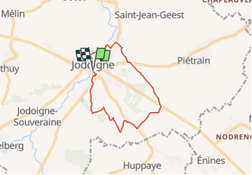
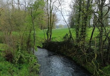
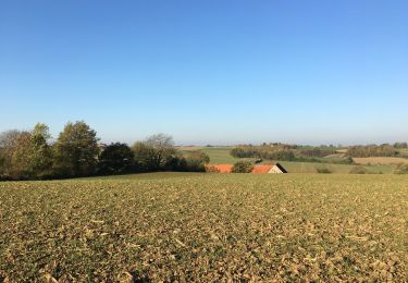
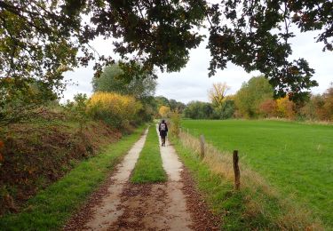
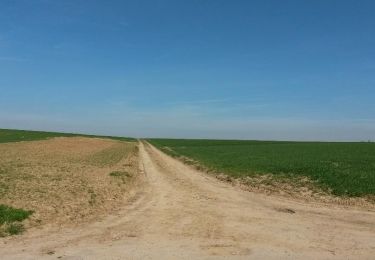
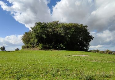
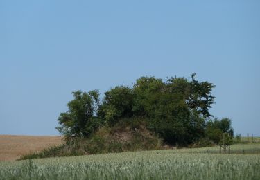
Trail On foot of 10.5 km to be discovered at Wallonia, Walloon Brabant, Jodoigne. This trail is proposed by SityTrail - itinéraires balisés pédestres.
Description
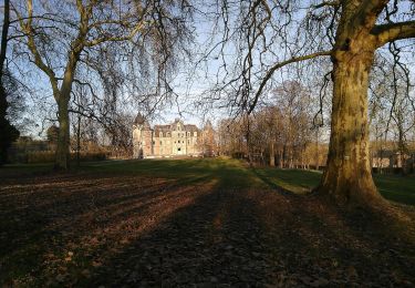
Trail created by Maison du Tourisme Hesbaye Brabançonne.
Symbol: A yellow stripe on a white background
Positioning
Country:
Belgium
Region :
Wallonia
Department/Province :
Walloon Brabant
Municipality :
Jodoigne
Location:
Unknown
Start:(Dec)
Start:(UTM)
631872 ; 5620595 (31U) N.
Comments
Trails nearby
![Trail Walking Jodoigne - RB-BW-03 -raccourci 2 - - Les beaux villages de pierre blanche - Photo](https://media.geolcdn.com/t/375/260/ext.jpg?maxdim=2&url=https%3A%2F%2Fservices.sitytrail.com%2FGeolivesWS%2FDownloadMedia.ashx%3FTrailID%3D218915%26Media%3D61181c27-8958-4ec4-942a-661689b8a15d.jpg)
![Walking Walking](https://static1.geolcdn.com/sitytour/trail-icons/101.png)
RB-BW-03 -raccourci 2 - - Les beaux villages de pierre blanche
Walking
Easy
(5)
Jodoigne,
Wallonia,
Walloon Brabant,
Belgium
![](/images/other/stat-length.png)
12.9 km | 15.2 km-effort
4h 1min
![](https://static1.geolcdn.com/siteimages/upload/files/16400158638029165_repeat_loop_refresh_sync_direction_icon.png)
Yes
![Trail Walking Jodoigne - RB-BW-03 -raccourci 1 - - Les beaux villages de pierre blanche - Photo](https://media.geolcdn.com/t/375/260/ext.jpg?maxdim=2&url=https%3A%2F%2Fservices.sitytrail.com%2FGeolivesWS%2FDownloadMedia.ashx%3FTrailID%3D218903%26Media%3Deebd04ea-0d50-4c1d-9663-7aab1908c590.jpg)
![Walking Walking](https://static1.geolcdn.com/sitytour/trail-icons/101.png)
RB-BW-03 -raccourci 1 - - Les beaux villages de pierre blanche
Walking
Easy
(6)
Jodoigne,
Wallonia,
Walloon Brabant,
Belgium
![](/images/other/stat-length.png)
20 km | 24 km-effort
5h 17min
![](https://static1.geolcdn.com/siteimages/upload/files/16400158638029165_repeat_loop_refresh_sync_direction_icon.png)
Yes
![Trail On foot Jodoigne - #230424 - Dongelberg, Souveraine et Tienne Strichaux - Photo](https://media.geolcdn.com/t/375/260/ext.jpg?maxdim=2&url=https%3A%2F%2Fmedia.geolcdn.com%2Ff%2Fd9ce38b9-c44e-46c8-b2cf-c1e7283cad2c.JPG)
![On foot On foot](https://static1.geolcdn.com/sitytour/trail-icons/100.png)
#230424 - Dongelberg, Souveraine et Tienne Strichaux
On foot
Easy
(1)
Jodoigne,
Wallonia,
Walloon Brabant,
Belgium
![](/images/other/stat-length.png)
8.1 km | 9.3 km-effort
2h 6min
![](https://static1.geolcdn.com/siteimages/upload/files/16400158638029165_repeat_loop_refresh_sync_direction_icon.png)
Yes
![Trail Walking Jodoigne - 221114b - Jodoigne, Gobertange, St Remy-Geest, GRP127 (court) - Photo](https://media.geolcdn.com/t/375/260/ext.jpg?maxdim=2&url=https%3A%2F%2Fmedia.geolcdn.com%2Ff%2F2b3117fb-cd20-4669-94a7-0dc953126513.JPG)
![Walking Walking](https://static1.geolcdn.com/sitytour/trail-icons/101.png)
221114b - Jodoigne, Gobertange, St Remy-Geest, GRP127 (court)
Walking
Medium
(2)
Jodoigne,
Wallonia,
Walloon Brabant,
Belgium
![](/images/other/stat-length.png)
5.8 km | 6.8 km-effort
1h 32min
![](https://static1.geolcdn.com/siteimages/upload/files/16400158638029165_repeat_loop_refresh_sync_direction_icon.png)
Yes
![Trail Walking Orp-Jauche - #201026 - Entre Énines, Jauche et Folx-les-Caves - Photo](https://media.geolcdn.com/t/375/260/ext.jpg?maxdim=2&url=https%3A%2F%2Fmedia.geolcdn.com%2Ff%2F74a90765-c947-46e6-9d81-7225ace6010a.JPG)
![Walking Walking](https://static1.geolcdn.com/sitytour/trail-icons/101.png)
#201026 - Entre Énines, Jauche et Folx-les-Caves
Walking
Medium
(2)
Orp-Jauche,
Wallonia,
Walloon Brabant,
Belgium
![](/images/other/stat-length.png)
8.2 km | 9.6 km-effort
2h 5min
![](https://static1.geolcdn.com/siteimages/upload/files/16400158638029165_repeat_loop_refresh_sync_direction_icon.png)
Yes
![Trail Walking Incourt - Ballade au soleil - Photo](https://media.geolcdn.com/t/375/260/ext.jpg?maxdim=2&url=https%3A%2F%2Fservices.sitytrail.com%2FGeolivesWS%2FDownloadMedia.ashx%3FTrailID%3D407894%26Media%3D3656b3ca-7464-489a-8f3d-1e57b2f10ace.jpg)
![Walking Walking](https://static1.geolcdn.com/sitytour/trail-icons/101.png)
Ballade au soleil
Walking
Easy
(1)
Incourt,
Wallonia,
Walloon Brabant,
Belgium
![](/images/other/stat-length.png)
18.9 km | 21 km-effort
3h 41min
![](https://static1.geolcdn.com/siteimages/upload/files/16400158638029165_repeat_loop_refresh_sync_direction_icon.png)
Yes
![Trail Walking Incourt - Promenade du Tumulus (6,1km) - Photo](https://media.geolcdn.com/t/375/260/ext.jpg?maxdim=2&url=https%3A%2F%2Fmedia.geolcdn.com%2Ff%2F42b094d1-405f-40a3-978f-996b68225655.jpg)
![Walking Walking](https://static1.geolcdn.com/sitytour/trail-icons/101.png)
Promenade du Tumulus (6,1km)
Walking
Medium
Incourt,
Wallonia,
Walloon Brabant,
Belgium
![](/images/other/stat-length.png)
6.1 km | 7 km-effort
1h 34min
![](https://static1.geolcdn.com/siteimages/upload/files/16400158638029165_repeat_loop_refresh_sync_direction_icon.png)
Yes
![Trail On foot Jodoigne - Promenade de la Ramée - Photo](https://media.geolcdn.com/t/375/260/ext.jpg?maxdim=2&url=https%3A%2F%2Fmedia.geolcdn.com%2Ff%2F2884b106-ded9-4c41-90fb-2fb633d6b660.jpeg)
![On foot On foot](https://static1.geolcdn.com/sitytour/trail-icons/100.png)
Promenade de la Ramée
On foot
Easy
Jodoigne,
Wallonia,
Walloon Brabant,
Belgium
![](/images/other/stat-length.png)
10.6 km | 12.4 km-effort
2h 49min
![](https://static1.geolcdn.com/siteimages/upload/files/16400158638029165_repeat_loop_refresh_sync_direction_icon.png)
Yes
![Trail On foot Jodoigne - Promenade de la chapelle d'Herbais - Photo](https://media.geolcdn.com/t/375/260/ext.jpg?maxdim=2&url=https%3A%2F%2Fmedia.geolcdn.com%2Ff%2F9aa9d8fc-8d5f-4ab8-a073-3c93152fc20d.jpeg)
![On foot On foot](https://static1.geolcdn.com/sitytour/trail-icons/100.png)
Promenade de la chapelle d'Herbais
On foot
Easy
Jodoigne,
Wallonia,
Walloon Brabant,
Belgium
![](/images/other/stat-length.png)
8.5 km | 9.6 km-effort
2h 10min
![](https://static1.geolcdn.com/siteimages/upload/files/16400158638029165_repeat_loop_refresh_sync_direction_icon.png)
Yes