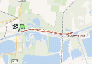
![](/images/other/stat-length.png)
![Trail On foot Mol - Den Diel - Photo](https://media.geolcdn.com/t/1900/400/c27b7662-6e94-4e29-b3cf-5c4fe5dc9647.jpeg&format=pjpeg&maxdim=2)
Den Diel
SityTrail - itinéraires balisés pédestres
Tous les sentiers balisés d’Europe GUIDE+
![Length](/images/other/stat-length.png)
Length
5.2 km
![Max alt](https://static1.geolcdn.com/siteimages/upload/files/1508320355ic_sort_altitude_max_24dp.png)
Max alt
47 m
![Uphill gradient](https://static1.geolcdn.com/siteimages/upload/files/1508320355ic_sort_den_pos_24dp.png)
Uphill gradient
33 m
![Km-Effort](/images/other/stat-length.png)
Km-Effort
5.7 km
![Min alt](https://static1.geolcdn.com/siteimages/upload/files/1508320355ic_sort_altitude_min_24dp.png)
Min alt
32 m
![Downhill gradient](https://static1.geolcdn.com/siteimages/upload/files/1508320355ic_sort_den_neg_24dp.png)
Downhill gradient
33 m
![Boucle](https://static1.geolcdn.com/siteimages/upload/files/16400158638029165_repeat_loop_refresh_sync_direction_icon.png)
Boucle
Yes
Signpost
Creation date :
2022-02-09 18:47:34.057
Updated on :
2022-02-09 18:47:34.057
![On foot](https://static1.geolcdn.com/sitytour/trail-icons/100.png)
1h17
Difficulty : Easy
![Scan this QR Code to open this trail in the SityTrail application](https://capi.geolives.com/qq0zvz2zws4bq2lad0pu/sitytour/trails/3084749/qr.png?size=200)
FREE GPS app for hiking
About
Trail On foot of 5.2 km to be discovered at Flanders, Antwerp, Mol. This trail is proposed by SityTrail - itinéraires balisés pédestres.
Description
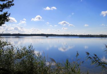
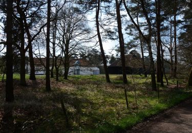
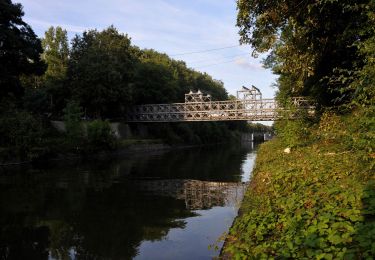
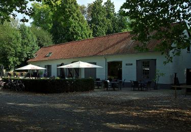
Ongelooflijke natuur! Dat zal je slotconclusie zijn na een wandeling op het unieke natuurreservaat ‘Den Diel’.
Website: https://toerisme.gemeentemol.be/aanbod/679/wandeling-den-diel
Positioning
Country:
Belgium
Region :
Flanders
Department/Province :
Antwerp
Municipality :
Mol
Location:
Unknown
Start:(Dec)
Start:(UTM)
652624 ; 5678672 (31U) N.
Comments
Trails nearby
![Trail On foot Mol - Merenpad 7km - Photo](https://media.geolcdn.com/t/375/260/4f059d46-9351-4bfb-b85c-d0034645b3fe.jpeg&format=jpg&maxdim=2)
![On foot On foot](https://static1.geolcdn.com/sitytour/trail-icons/100.png)
![Trail On foot Mol - De Ronde Put - Photo](https://media.geolcdn.com/t/375/260/efbeaa32-cb17-4c5e-8778-848d9e20f27f.jpeg&format=jpg&maxdim=2)
![On foot On foot](https://static1.geolcdn.com/sitytour/trail-icons/100.png)
![Trail On foot Mol - Galbergenpad - Photo](https://media.geolcdn.com/t/375/260/ac6c45ad-0a3f-46f0-8730-3bf99148b3e6.jpeg&format=jpg&maxdim=2)
![On foot On foot](https://static1.geolcdn.com/sitytour/trail-icons/100.png)
![Trail On foot Mol - Merenpad - Photo](https://media.geolcdn.com/t/375/260/03f8c97e-ed17-4356-a72b-3f3c82846f0d.jpeg&format=jpg&maxdim=2)
![On foot On foot](https://static1.geolcdn.com/sitytour/trail-icons/100.png)
![Trail On foot Lommel - Blauwe Kei Rode driehoek - Photo](https://media.geolcdn.com/t/375/260/9bca7f32-27e0-4e61-aadd-7c6bcb57fbd7.jpeg&format=jpg&maxdim=2)
![On foot On foot](https://static1.geolcdn.com/sitytour/trail-icons/100.png)
Blauwe Kei Rode driehoek
On foot
Easy
Lommel,
Flanders,
Limburg,
Belgium
![](/images/other/stat-length.png)
11.4 km | 12.2 km-effort
2h 47min
![](https://static1.geolcdn.com/siteimages/upload/files/16400158638029165_repeat_loop_refresh_sync_direction_icon.png)
Yes
![Trail On foot Lommel - Blauwe Kei Groene rechthoek - Photo](https://media.geolcdn.com/t/375/260/9bca7f32-27e0-4e61-aadd-7c6bcb57fbd7.jpeg&format=jpg&maxdim=2)
![On foot On foot](https://static1.geolcdn.com/sitytour/trail-icons/100.png)
Blauwe Kei Groene rechthoek
On foot
Easy
Lommel,
Flanders,
Limburg,
Belgium
![](/images/other/stat-length.png)
4.9 km | 5.3 km-effort
1h 11min
![](https://static1.geolcdn.com/siteimages/upload/files/16400158638029165_repeat_loop_refresh_sync_direction_icon.png)
Yes
![Trail On foot Lommel - Blauwe Kei Gele zeshoek - Photo](https://media.geolcdn.com/t/375/260/c27b7662-6e94-4e29-b3cf-5c4fe5dc9647.jpeg&format=jpg&maxdim=2)
![On foot On foot](https://static1.geolcdn.com/sitytour/trail-icons/100.png)
Blauwe Kei Gele zeshoek
On foot
Easy
Lommel,
Flanders,
Limburg,
Belgium
![](/images/other/stat-length.png)
8.8 km | 9.6 km-effort
2h 10min
![](https://static1.geolcdn.com/siteimages/upload/files/16400158638029165_repeat_loop_refresh_sync_direction_icon.png)
Yes
![Trail On foot Lommel - De Maat blauwe vlam - Photo](https://media.geolcdn.com/t/375/260/feb75399-7b57-4327-8c6f-945ea77a910c.jpeg&format=jpg&maxdim=2)
![On foot On foot](https://static1.geolcdn.com/sitytour/trail-icons/100.png)
De Maat blauwe vlam
On foot
Easy
Lommel,
Flanders,
Limburg,
Belgium
![](/images/other/stat-length.png)
5.7 km | 6.1 km-effort
1h 23min
![](https://static1.geolcdn.com/siteimages/upload/files/16400158638029165_repeat_loop_refresh_sync_direction_icon.png)
Yes
![Trail On foot Mol - De Maat oranje - Photo](https://media.geolcdn.com/t/375/260/9907868f-6967-4473-bfc3-0d3aa316b5fc.jpeg&format=jpg&maxdim=2)
![On foot On foot](https://static1.geolcdn.com/sitytour/trail-icons/100.png)