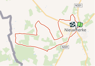
![](/images/other/stat-length.png)
![Trail On foot Heuvelland - Geuzen wandelroute - Photo](https://media.geolcdn.com/t/1900/400/a748d58f-6dfe-4ad8-b887-8505015b63cc.jpeg&format=pjpeg&maxdim=2)
Geuzen wandelroute
SityTrail - itinéraires balisés pédestres
Tous les sentiers balisés d’Europe GUIDE+
![Length](/images/other/stat-length.png)
![Max alt](https://static1.geolcdn.com/siteimages/upload/files/1508320355ic_sort_altitude_max_24dp.png)
![Uphill gradient](https://static1.geolcdn.com/siteimages/upload/files/1508320355ic_sort_den_pos_24dp.png)
![Km-Effort](/images/other/stat-length.png)
![Min alt](https://static1.geolcdn.com/siteimages/upload/files/1508320355ic_sort_altitude_min_24dp.png)
![Downhill gradient](https://static1.geolcdn.com/siteimages/upload/files/1508320355ic_sort_den_neg_24dp.png)
![Boucle](https://static1.geolcdn.com/siteimages/upload/files/16400158638029165_repeat_loop_refresh_sync_direction_icon.png)
![On foot](https://static1.geolcdn.com/sitytour/trail-icons/100.png)
2h35
Difficulty : Easy
![Scan this QR Code to open this trail in the SityTrail application](https://capi.geolives.com/qq0zvz2zws4bq2lad0pu/sitytour/trails/3083379/qr.png?size=200)
FREE GPS app for hiking
About
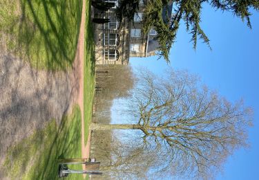
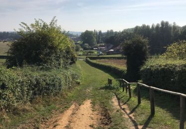
Trail On foot of 9.7 km to be discovered at Flanders, West Flanders, Heuvelland. This trail is proposed by SityTrail - itinéraires balisés pédestres.
Description
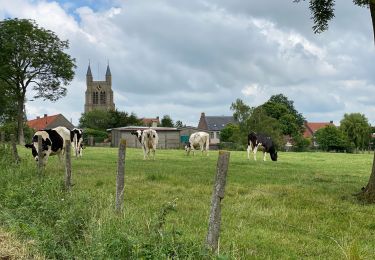
Deze wandelroute verkent de glooiende omgeving ten westen van Nieuwkerke. Ze biedt weidse panorama’s op de Leievallei en op de heuvels van de Katsberg tot de Kemmelberg. De naam verwijst naar de opstand van de bosgeuzen tegen de katholieke kerk in de 16e eeuw.
Positioning
Comments
Trails nearby
![Trail Walking Comines-Warneton - Ploegsteert2 - Photo](https://media.geolcdn.com/t/375/260/a18aaf3b-b0bc-4f4e-b927-dc13a3158e1c.jpg&format=jpg&maxdim=2)
![Walking Walking](https://static1.geolcdn.com/sitytour/trail-icons/101.png)
Walking
![](/images/other/stat-length.png)
![](https://static1.geolcdn.com/siteimages/upload/files/16400158638029165_repeat_loop_refresh_sync_direction_icon.png)
![Trail Walking Heuvelland - Loker - Le Mont Rouge - Photo](https://media.geolcdn.com/t/375/260/ext.jpg?maxdim=2&url=https%3A%2F%2Fservices.sitytrail.com%2FGeolivesWS%2FDownloadMedia.ashx%3FTrailID%3D106138%26Media%3D10379_6.jpg)
![Walking Walking](https://static1.geolcdn.com/sitytour/trail-icons/101.png)
Walking
![](/images/other/stat-length.png)
![](https://static1.geolcdn.com/siteimages/upload/files/16400158638029165_repeat_loop_refresh_sync_direction_icon.png)
![Trail On foot Heuvelland - Kraters en Mijnen - Photo](https://media.geolcdn.com/t/375/260/aaf8f233-f3c6-4670-9899-0548e3a6df10.jpeg&format=jpg&maxdim=2)
![On foot On foot](https://static1.geolcdn.com/sitytour/trail-icons/100.png)
On foot
![](/images/other/stat-length.png)
![](https://static1.geolcdn.com/siteimages/upload/files/16400158638029165_repeat_loop_refresh_sync_direction_icon.png)
![Trail On foot Heuvelland - Kemmelberg wandelroute - Photo](https://media.geolcdn.com/t/375/260/e1bcc212-763f-4467-b0b8-b765654be94a.jpeg&format=jpg&maxdim=2)
![On foot On foot](https://static1.geolcdn.com/sitytour/trail-icons/100.png)
On foot
![](/images/other/stat-length.png)
![](https://static1.geolcdn.com/siteimages/upload/files/16400158638029165_repeat_loop_refresh_sync_direction_icon.png)
![Trail Walking Heuvelland - Dranouter 12,3 km - Photo](https://media.geolcdn.com/t/375/260/ab62849d-d2cc-4c63-a20f-7ad369b5fc0f.jpg&format=jpg&maxdim=2)
![Walking Walking](https://static1.geolcdn.com/sitytour/trail-icons/101.png)
Walking
![](/images/other/stat-length.png)
![](https://static1.geolcdn.com/siteimages/upload/files/16400158638029165_repeat_loop_refresh_sync_direction_icon.png)
![Trail Walking Heuvelland - Kemmel 16,8 km - Photo](https://media.geolcdn.com/t/375/260/35efd325-6d2d-445a-be71-1af85c252386.jpg&format=jpg&maxdim=2)
![Walking Walking](https://static1.geolcdn.com/sitytour/trail-icons/101.png)
Walking
![](/images/other/stat-length.png)
![](https://static1.geolcdn.com/siteimages/upload/files/16400158638029165_repeat_loop_refresh_sync_direction_icon.png)
![Trail Walking Heuvelland - Loker 18,2 km - Photo](https://media.geolcdn.com/t/375/260/95fcaf9d-4059-4e0a-91b3-686074f6c894.jpg&format=jpg&maxdim=2)
![Walking Walking](https://static1.geolcdn.com/sitytour/trail-icons/101.png)
Walking
![](/images/other/stat-length.png)
![](https://static1.geolcdn.com/siteimages/upload/files/16400158638029165_repeat_loop_refresh_sync_direction_icon.png)
![Trail Walking Heuvelland - Nieuwekerke Bailleul 17,5 km - Photo](https://media.geolcdn.com/t/375/260/9e8e5b67-08f2-434d-8359-01cf5462426a.jpg&format=jpg&maxdim=2)
![Walking Walking](https://static1.geolcdn.com/sitytour/trail-icons/101.png)
Walking
![](/images/other/stat-length.png)
![](https://static1.geolcdn.com/siteimages/upload/files/16400158638029165_repeat_loop_refresh_sync_direction_icon.png)
![Trail Walking Heuvelland - Kemmel Dranouter 21 km - Photo](https://media.geolcdn.com/t/375/260/dc67270b-3bd6-42f0-9f11-f5a0fb775182.jpg&format=jpg&maxdim=2)
![Walking Walking](https://static1.geolcdn.com/sitytour/trail-icons/101.png)
Walking
![](/images/other/stat-length.png)
![](https://static1.geolcdn.com/siteimages/upload/files/16400158638029165_repeat_loop_refresh_sync_direction_icon.png)