![](/images/other/stat-length.png)
![Trail On foot Tervuren - Warandewandeling - Photo](https://media.geolcdn.com/t/1900/400/87c065a8-2320-4622-bcf3-9c4a54024d3f.jpeg&format=pjpeg&maxdim=2)
Warandewandeling
SityTrail - itinéraires balisés pédestres
Tous les sentiers balisés d’Europe GUIDE+
![Length](/images/other/stat-length.png)
Length
4.9 km
![Max alt](https://static1.geolcdn.com/siteimages/upload/files/1508320355ic_sort_altitude_max_24dp.png)
Max alt
101 m
![Uphill gradient](https://static1.geolcdn.com/siteimages/upload/files/1508320355ic_sort_den_pos_24dp.png)
Uphill gradient
86 m
![Km-Effort](/images/other/stat-length.png)
Km-Effort
6 km
![Min alt](https://static1.geolcdn.com/siteimages/upload/files/1508320355ic_sort_altitude_min_24dp.png)
Min alt
61 m
![Downhill gradient](https://static1.geolcdn.com/siteimages/upload/files/1508320355ic_sort_den_neg_24dp.png)
Downhill gradient
73 m
![Boucle](https://static1.geolcdn.com/siteimages/upload/files/16400158638029165_repeat_loop_refresh_sync_direction_icon.png)
Boucle
No
Signpost
Creation date :
2022-02-09 15:00:49.893
Updated on :
2022-02-09 17:53:16.485
![On foot](https://static1.geolcdn.com/sitytour/trail-icons/100.png)
1h21
Difficulty : Easy
![Scan this QR Code to open this trail in the SityTrail application](https://capi.geolives.com/qq0zvz2zws4bq2lad0pu/sitytour/trails/3083253/qr.png?size=200)
FREE GPS app for hiking
About
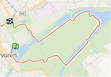
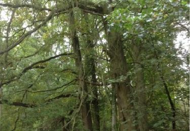
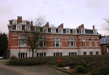
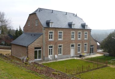
Trail On foot of 4.9 km to be discovered at Flanders, Flemish Brabant, Tervuren. This trail is proposed by SityTrail - itinéraires balisés pédestres.
Description
Trail created by vzw Toerisme Vlaams-Brabant..
Symbol: Blauwe paaltjes met schuine kop
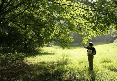
Positioning
Country:
Belgium
Region :
Flanders
Department/Province :
Flemish Brabant
Municipality :
Tervuren
Location:
Unknown
Start:(Dec)
Start:(UTM)
606767 ; 5631409 (31U) N.
Comments
Trails nearby
![Trail Walking Tervuren - #221017 - Duisburg, Wolfkensberg, Raffelberg - Photo](https://media.geolcdn.com/t/375/260/eb11e242-b355-4cb6-a158-313432558930.jpg&format=jpg&maxdim=2)
![Walking Walking](https://static1.geolcdn.com/sitytour/trail-icons/101.png)
#221017 - Duisburg, Wolfkensberg, Raffelberg
Walking
Medium
(2)
Tervuren,
Flanders,
Flemish Brabant,
Belgium
![](/images/other/stat-length.png)
8.3 km | 9.5 km-effort
2h 10min
![](https://static1.geolcdn.com/siteimages/upload/files/16400158638029165_repeat_loop_refresh_sync_direction_icon.png)
Yes
![Trail Walking Tervuren - Tervuren Leefdaal 22 km - Photo](https://media.geolcdn.com/t/375/260/ext.jpg?maxdim=2&url=https%3A%2F%2Fservices.sitytrail.com%2FGeolivesWS%2FDownloadMedia.ashx%3FTrailID%3D1084200%26Media%3D20181213150951.jpg)
![Walking Walking](https://static1.geolcdn.com/sitytour/trail-icons/101.png)
Tervuren Leefdaal 22 km
Walking
Easy
(1)
Tervuren,
Flanders,
Flemish Brabant,
Belgium
![](/images/other/stat-length.png)
23 km | 27 km-effort
5h 24min
![](https://static1.geolcdn.com/siteimages/upload/files/16400158638029165_repeat_loop_refresh_sync_direction_icon.png)
Yes
![Trail Walking Tervuren - Arboretum - Kapucijnenbos - Photo](https://media.geolcdn.com/t/375/260/b9913596-de24-4332-b79b-b09410acdfbd.jpg&format=jpg&maxdim=2)
![Walking Walking](https://static1.geolcdn.com/sitytour/trail-icons/101.png)
Arboretum - Kapucijnenbos
Walking
Difficult
(1)
Tervuren,
Flanders,
Flemish Brabant,
Belgium
![](/images/other/stat-length.png)
13.7 km | 16.3 km-effort
3h 41min
![](https://static1.geolcdn.com/siteimages/upload/files/16400158638029165_repeat_loop_refresh_sync_direction_icon.png)
Yes
![Trail Walking Tervuren - arboretum - Photo](https://media.geolcdn.com/t/375/260/ext.jpg?maxdim=2&url=https%3A%2F%2Fservices.sitytrail.com%2FGeolivesWS%2FDownloadMedia.ashx%3FTrailID%3D226959%26Media%3D20131013134220.jpg)
![Walking Walking](https://static1.geolcdn.com/sitytour/trail-icons/101.png)
arboretum
Walking
Very easy
(1)
Tervuren,
Flanders,
Flemish Brabant,
Belgium
![](/images/other/stat-length.png)
8 km | 9.2 km-effort
2h 51min
![](https://static1.geolcdn.com/siteimages/upload/files/16400158638029165_repeat_loop_refresh_sync_direction_icon.png)
Yes
![Trail Cycle Wezembeek-Oppem - ox2 - Photo](https://media.geolcdn.com/t/375/260/ext.jpg?maxdim=2&url=https%3A%2F%2Fservices.sitytrail.com%2FGeolivesWS%2FDownloadMedia.ashx%3FTrailID%3D151603%26Media%3D20120904141505.jpg)
![Cycle Cycle](https://static1.geolcdn.com/sitytour/trail-icons/200.png)
ox2
Cycle
Easy
(1)
Wezembeek-Oppem,
Flanders,
Flemish Brabant,
Belgium
![](/images/other/stat-length.png)
13.7 km | 15.2 km-effort
48min
![](https://static1.geolcdn.com/siteimages/upload/files/16400158638029165_repeat_loop_refresh_sync_direction_icon.png)
Yes
![Trail On foot Zaventem - Meester Crapswandeling - Photo](https://media.geolcdn.com/t/375/260/3dfabf4c-91ef-4e01-b655-1f27a780941d.jpeg&format=jpg&maxdim=2)
![On foot On foot](https://static1.geolcdn.com/sitytour/trail-icons/100.png)
Meester Crapswandeling
On foot
Easy
Zaventem,
Flanders,
Flemish Brabant,
Belgium
![](/images/other/stat-length.png)
8.5 km | 9.4 km-effort
2h 7min
![](https://static1.geolcdn.com/siteimages/upload/files/16400158638029165_repeat_loop_refresh_sync_direction_icon.png)
Yes
![Trail On foot Huldenberg - Vossekouterwandeling - Photo](https://media.geolcdn.com/t/375/260/f9edc4ad-a3ef-4882-9a56-b4ff71f9dcfa.jpeg&format=jpg&maxdim=2)
![On foot On foot](https://static1.geolcdn.com/sitytour/trail-icons/100.png)
Vossekouterwandeling
On foot
Easy
Huldenberg,
Flanders,
Flemish Brabant,
Belgium
![](/images/other/stat-length.png)
7.1 km | 8.7 km-effort
1h 58min
![](https://static1.geolcdn.com/siteimages/upload/files/16400158638029165_repeat_loop_refresh_sync_direction_icon.png)
Yes
![Trail On foot Tervuren - Kap(ucijnen)bos van Duisburgwandeling - Photo](https://media.geolcdn.com/t/375/260/716ca0df-5263-43cf-b6ba-7d16b36dfeb0.jpeg&format=jpg&maxdim=2)
![On foot On foot](https://static1.geolcdn.com/sitytour/trail-icons/100.png)
Kap(ucijnen)bos van Duisburgwandeling
On foot
Easy
Tervuren,
Flanders,
Flemish Brabant,
Belgium
![](/images/other/stat-length.png)
6.2 km | 7.6 km-effort
1h 43min
![](https://static1.geolcdn.com/siteimages/upload/files/16400158638029165_repeat_loop_refresh_sync_direction_icon.png)
No
![Trail On foot Tervuren - Arboretumwandeling - Photo](https://media.geolcdn.com/t/375/260/deef483e-a724-4529-a3ed-af2727caf4be.jpeg&format=jpg&maxdim=2)
![On foot On foot](https://static1.geolcdn.com/sitytour/trail-icons/100.png)
Arboretumwandeling
On foot
Easy
(1)
Tervuren,
Flanders,
Flemish Brabant,
Belgium
![](/images/other/stat-length.png)
7.1 km | 8.5 km-effort
1h 55min
![](https://static1.geolcdn.com/siteimages/upload/files/16400158638029165_repeat_loop_refresh_sync_direction_icon.png)
Yes